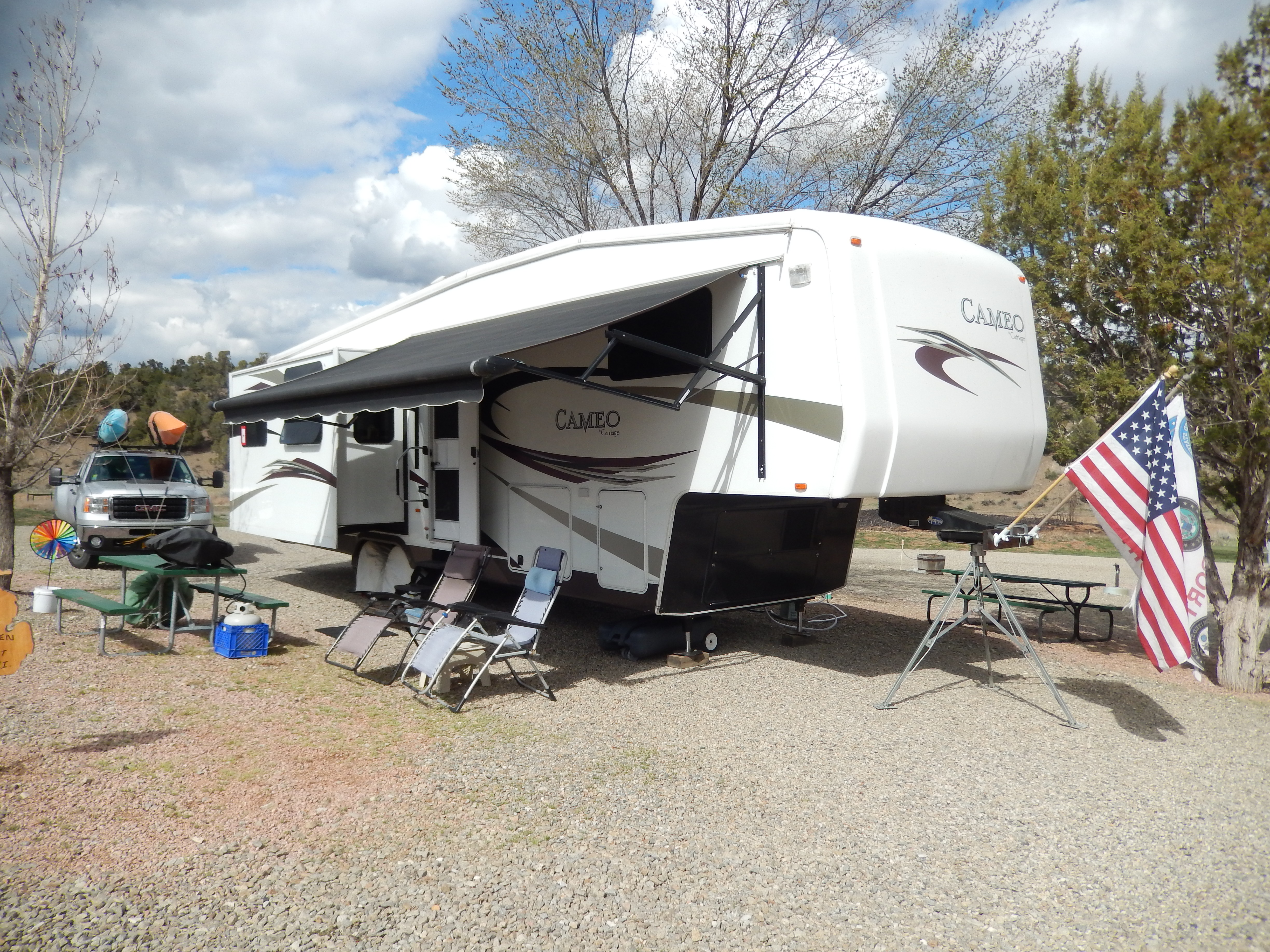
Alaska Journal – 2014, Chapter Five

Thursday, 7/24/14

We headed to Valdez, but it would take us a couple of days to get there. On our way from Palmer we stopped at an overlook for the Matanuska Glacier. You would think, “ya seen one glacier, ya seen ’em all,” but I continue to be amazed at these things. This one was huge, twenty-four miles long and four miles wade, descending twelve thousand feet from its summit to the bottom. As it retreated a section of the glacier separated from the main part and became dormant. It is slowly melting and has been overgrown with a layer of topsoil and vegetation.

DSCN2774DSCN2786

We spent the night in a small campground near Glennallen, AK. After dinner we gathered around a campfire for S’mores and singing. One of our new friends, Norman and I entertained the group with a mix of folk songs and country western. Aside from the man-eating mosquitoes, it was a fun night.

Friday, 7/25/14

Today we drove 135 miles to Valdez. Enroute we stopped at the Wrangell-St. Elias National Park and Preserve. This park covers 13.2 million acres. Most of the park is designated as wilderness and most visitors will see little of the park up close and personal. This doesn’t mean you can’t go there. There are campgrounds and lodges and opportunities for camping, hiking, paddling, fishing, and hunting. However, because of the wilderness designation, no motorized vehicles are allowed in most of the park. Native Alaskans are allowed to do subsistence hunting throughout the park.

DSCN2788
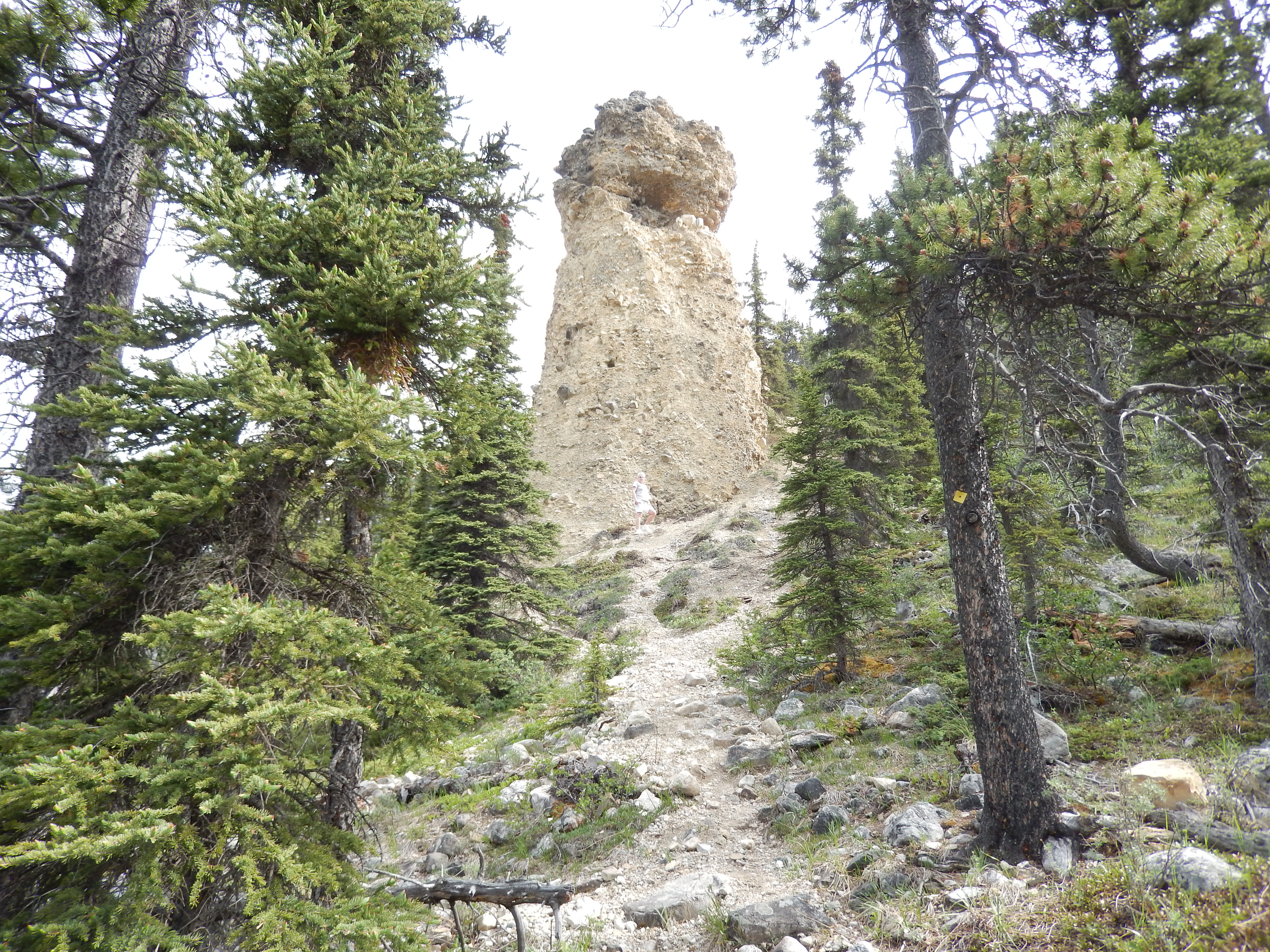
We traveled over the Thompson Pass, along the route that the goldrush miners traveled to get to the Yukon gold territory. In 1953 Thompson Pass had a snow accumulation of 974 inches! There was a long (7.5 miles) of downgrade from here, thank goodness for the exhaust brake! On the way down we stopped to see where a river had eroded a cave in a glacier and the “Old Railroad Tunnel.” The tunnel is all that remains of a failed attempt by nine companies to make a short route from the coast to the gold fields.

DSCN2797

Saturday, 7/26/14

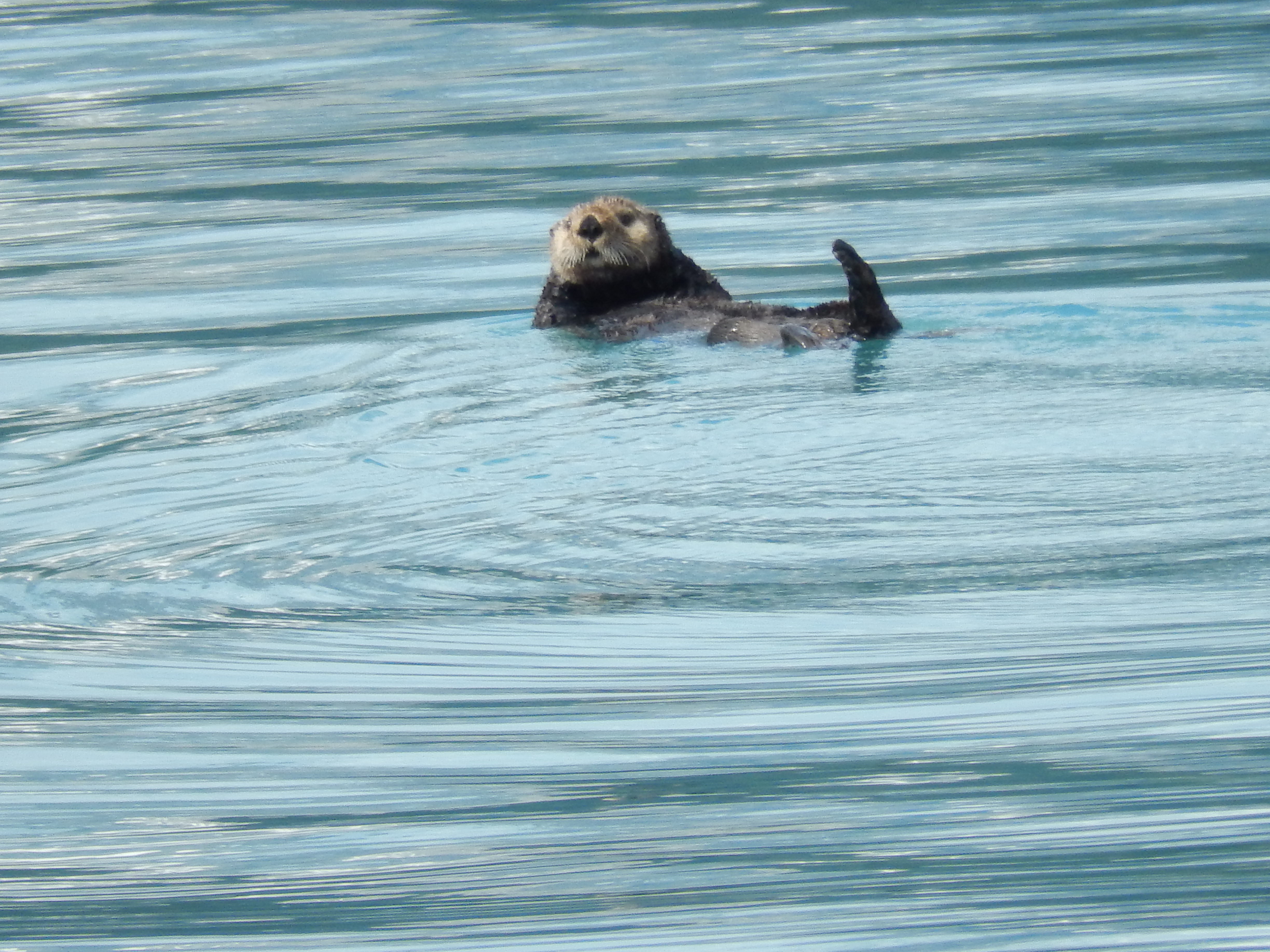
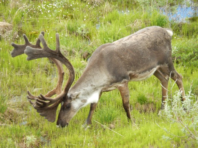
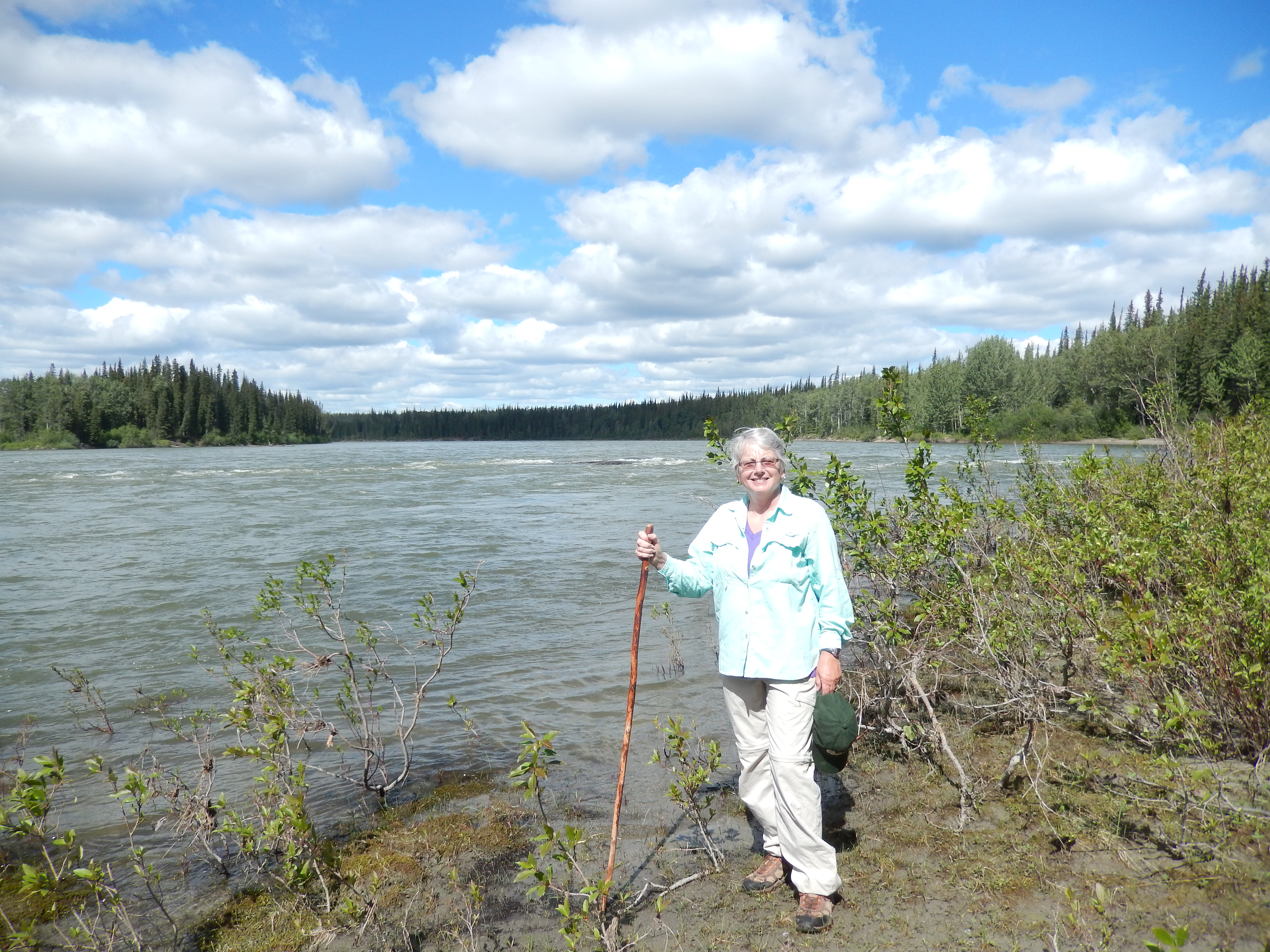
We gathered to take a boat tour in Port Valdez and Prince William Sound. Captain Fred of the LuLu Belle kept up a running commentary describing the history of Valdez, Prince William Sound, the 1964 earthquake and the Exxon Valdez oil spill. We didn’t see as much wildlife as we hoped, but Captain Fred did his best. He pulled his boat into cracks in the rock cliffs to let us observe birds and sea lions.

DSCN2857DSCN2815

DSCN2829DSCN2842

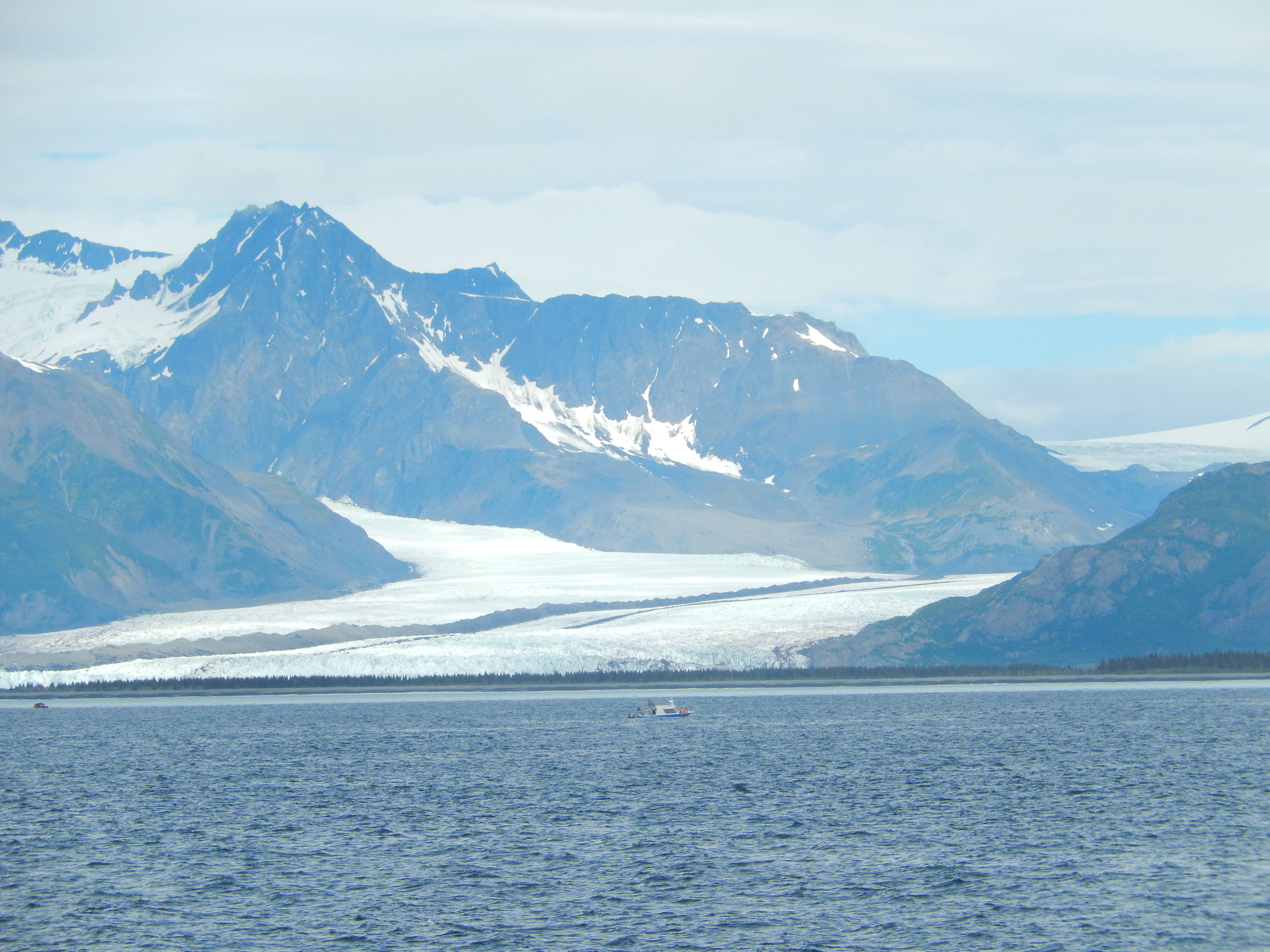
The biggest part of the tour was the Columbia Glacier. The floating ice from the glacier was all over the Sound as we approached the glacier. As we traveled up to the glacier, the temperature started to drop dramatically. The water was so thick with floating ice that the captain had to pick his way through it to get to the glacier. You could hear and feel the ice banging against the hull as we got closer.DSCN2917

DSCN2897The Columbia Glacier is huge. We were a quarter of a mile from it and the face of it was so tall that you could not see the mountains behind it. You could hear the glacier calving. Much of it seemed to be happening in the crevasses behind the face, we could hear it, but not see it – very disappointing.

Sunday, 7/27/14

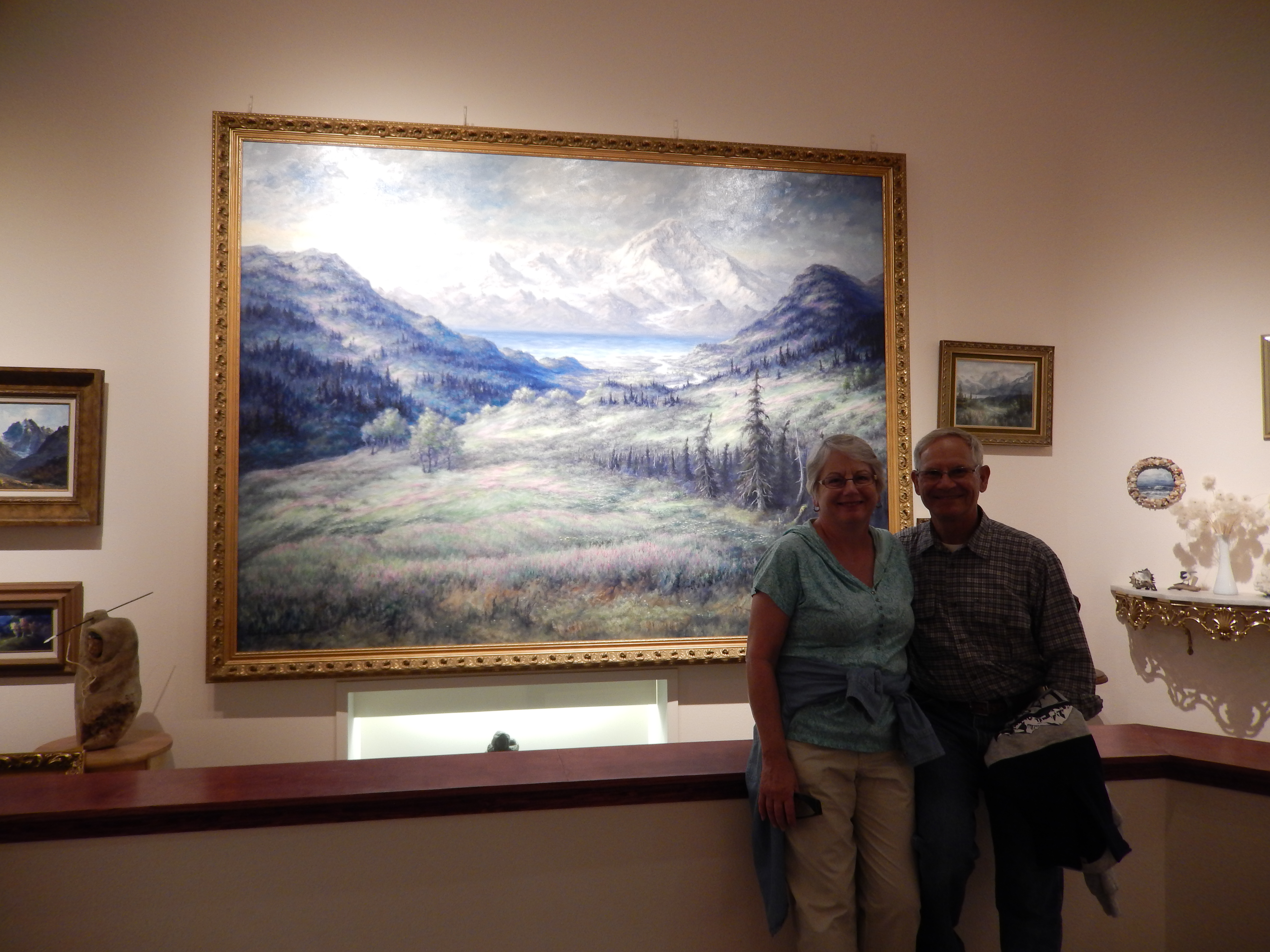
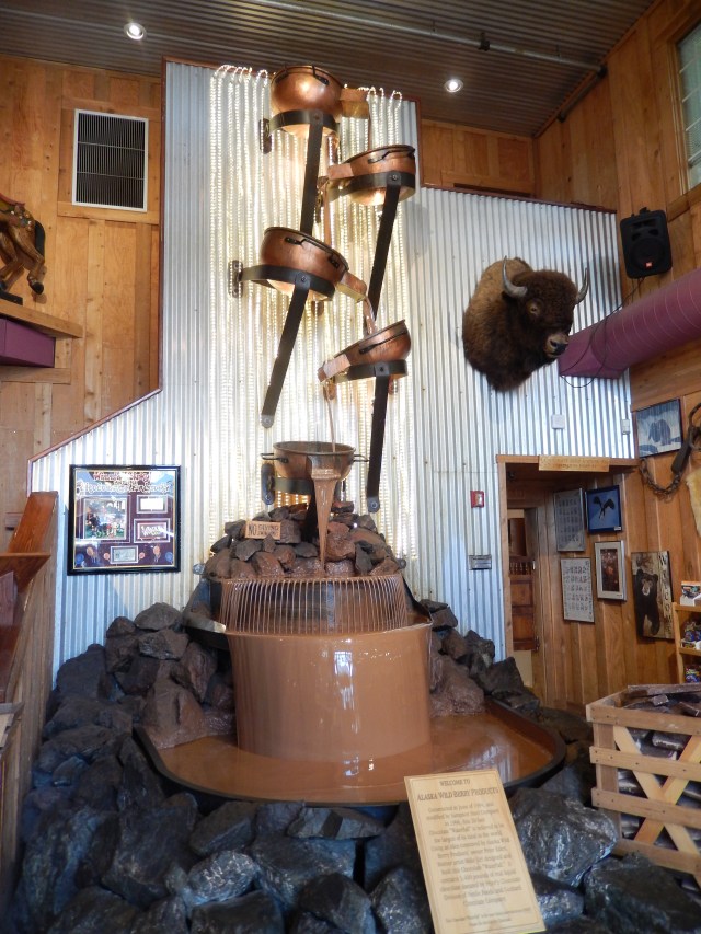
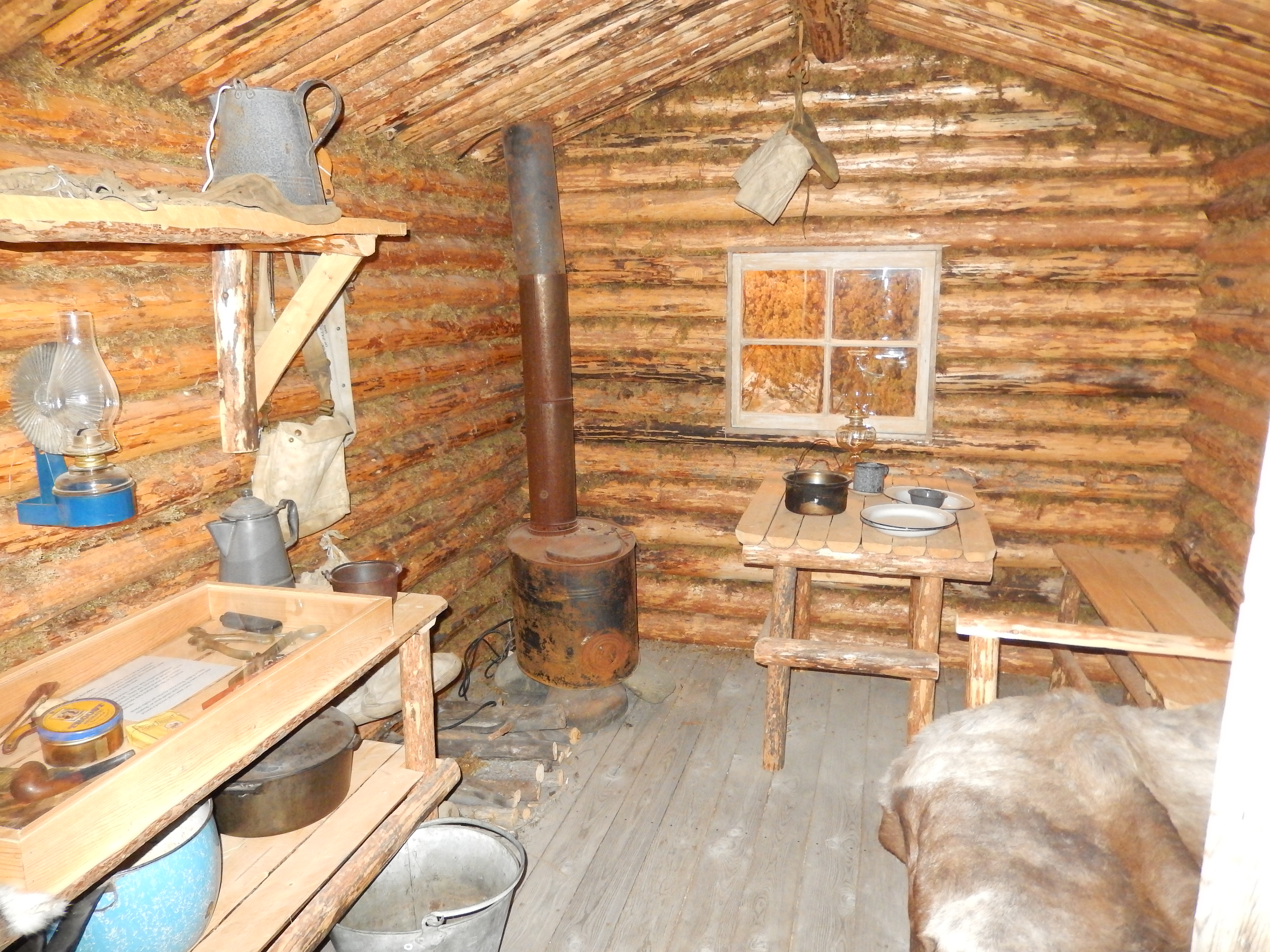
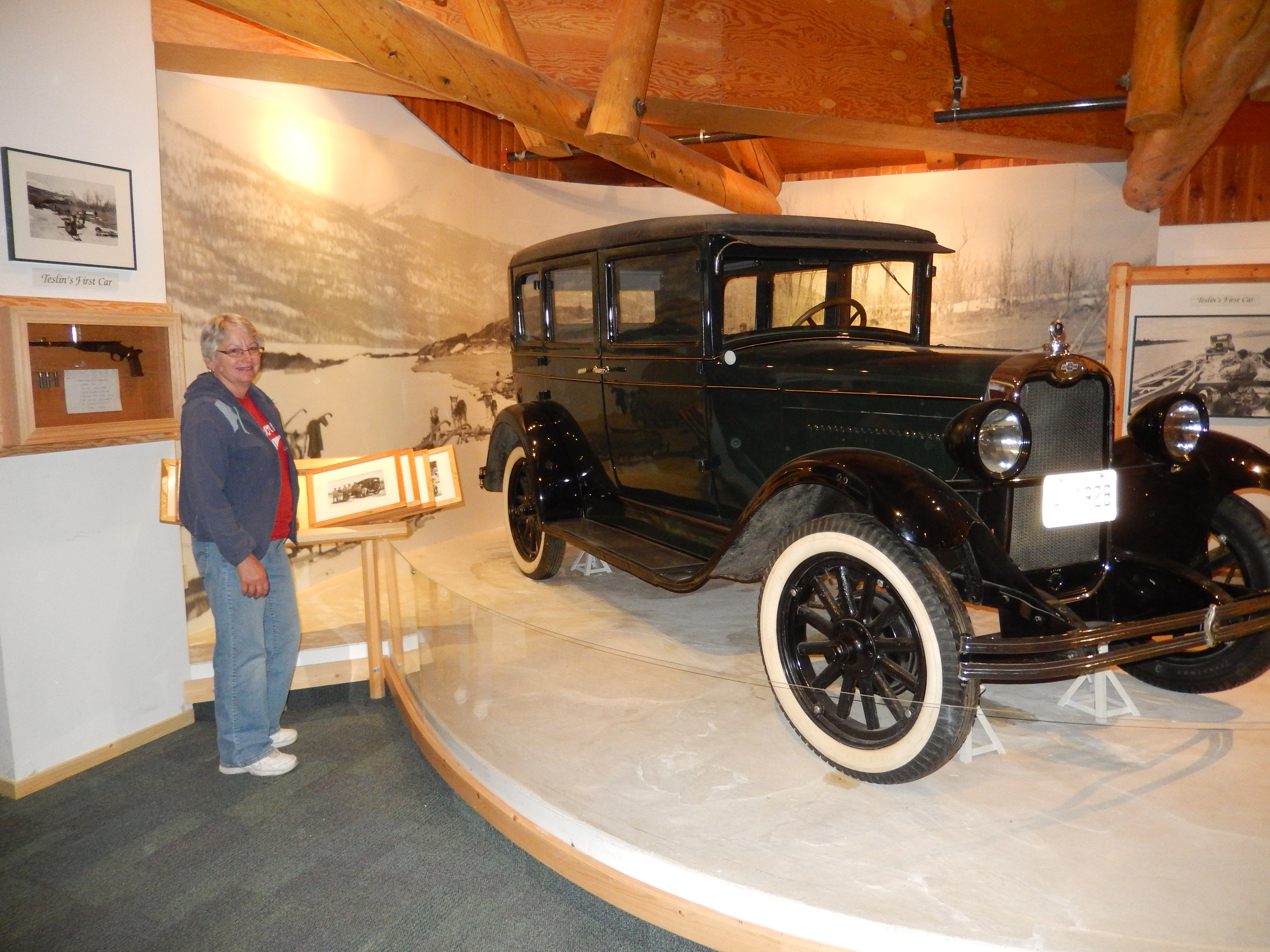
We car pooled to the Valdez Museum where we saw displays about life in Valdez, from the Gold Rush days to the present. You could imagine the disappointment the Gold Rush stampeders must have felt when they took the “All American Route,” sailing from Seattle to Valdez. They thought they would land in a city that would be able to provide them with provisions and support for their journey to the Yukon. Instead they found a small town of a couple of hundred settlers, struggling to provide for themselves – no docks, ferry and wagon companies; nothing but snow, ice and a long trip ahead of them. It was interesting to see how the town grew over the years. I was particularly interested in the Exxon Valdez spill. I learned some facts that I was unaware of before. You know you are getting old when the things you lived through are displayed in a museum!

DSCN2925

From there we drove to the Museum Annex that is focused on the 1964 earthquake and tsunami. It destroyed the harbor area and much of the commercial area. After that the City Council determined it was unsafe to rebuild on the same land. Two local residents donated land for a new town site and three years later the new location of Valdez was complete. It is really quite a story.

Monday, 7/28/14

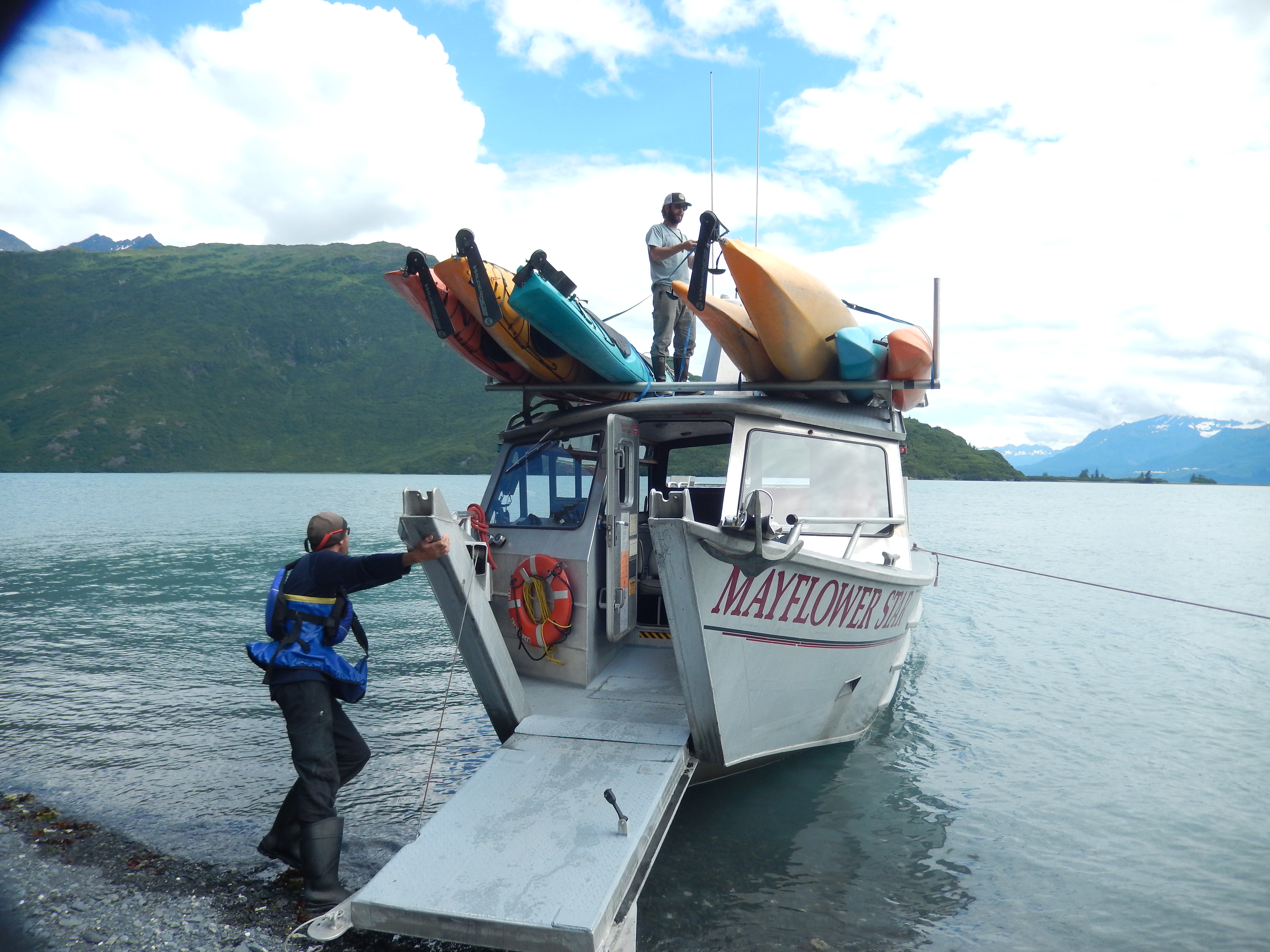
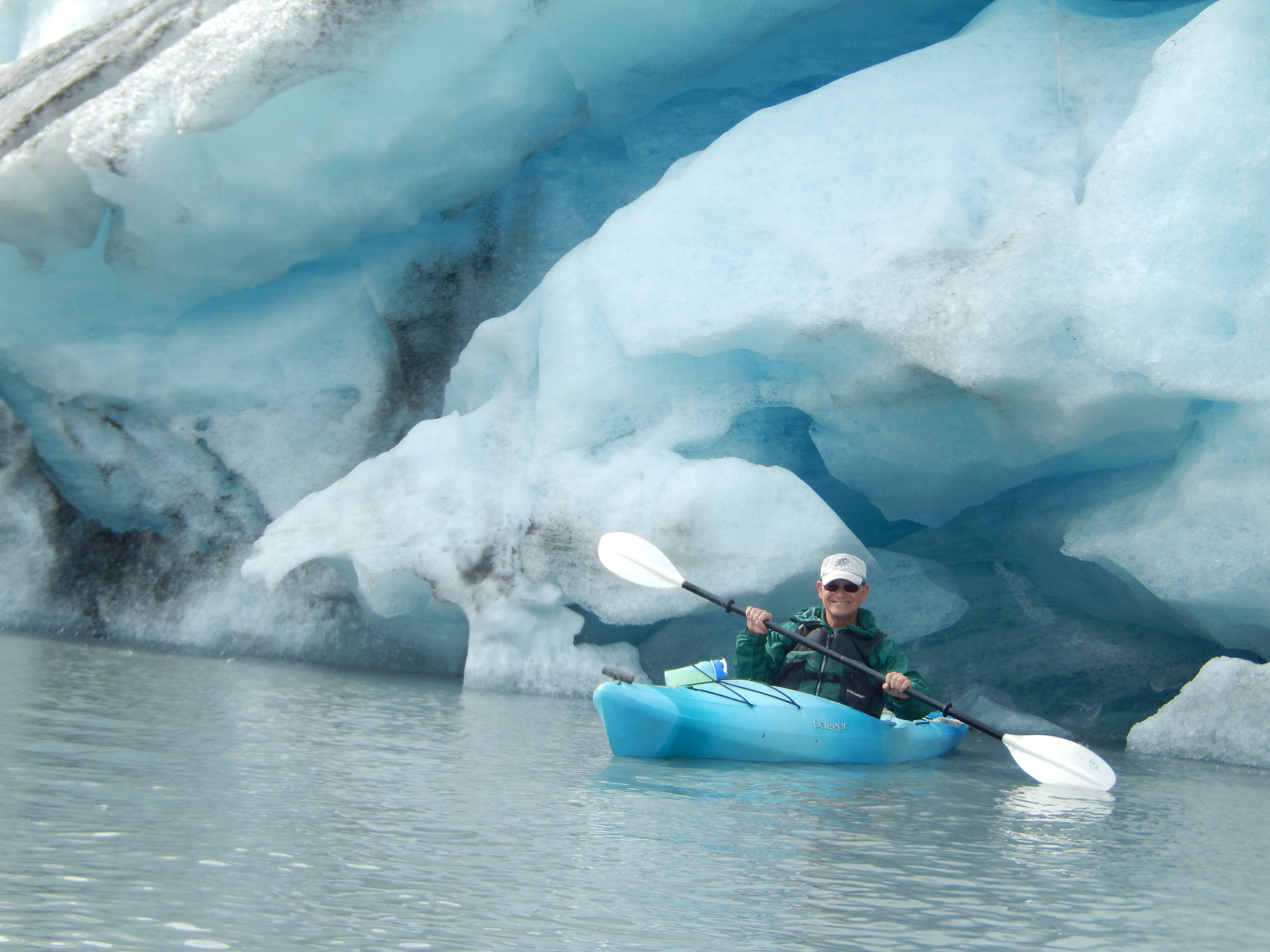
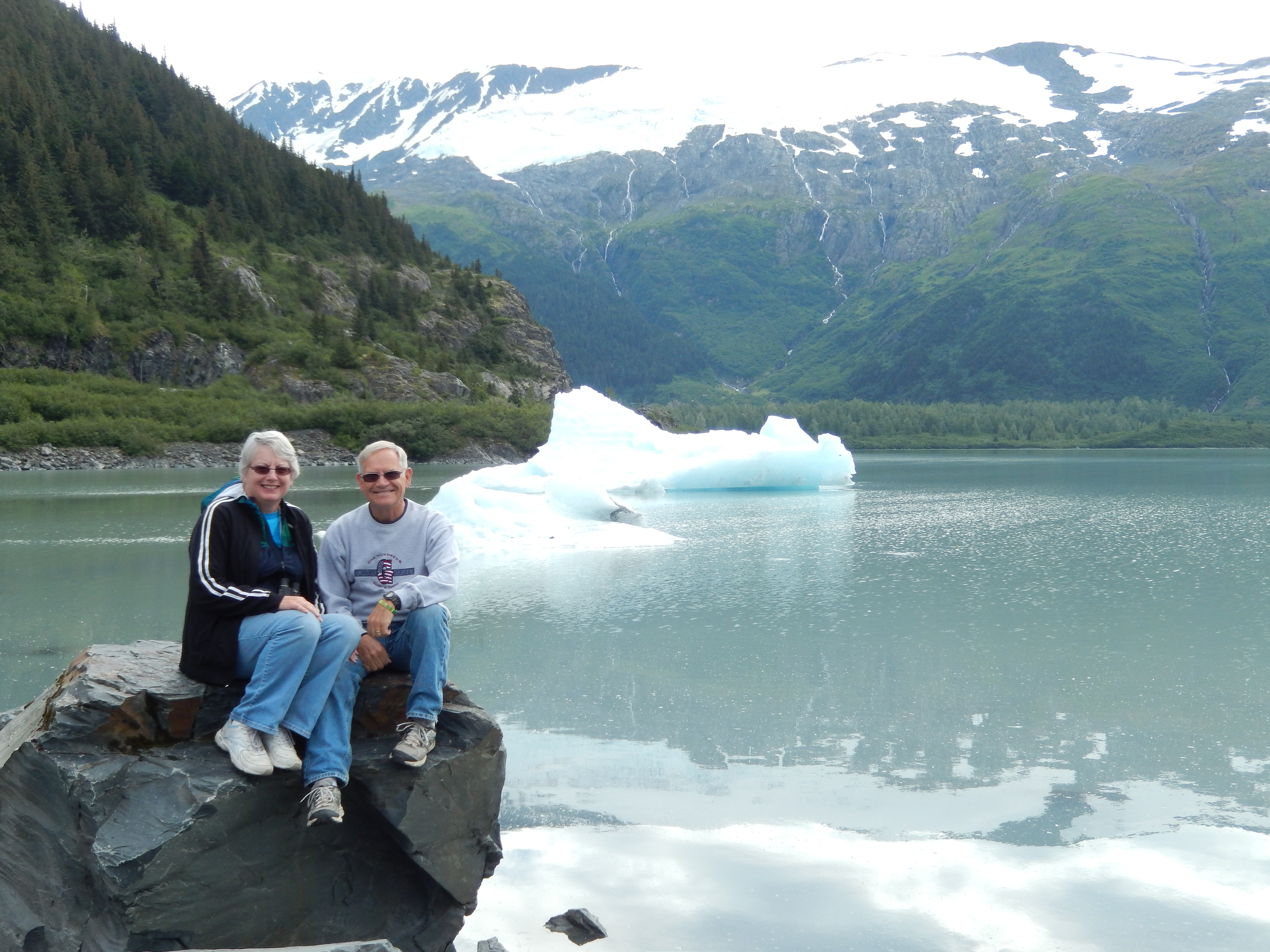
Early in our planning I asked the folks at Adventure Treks if there would be opportunities for kayaking or if we should leave the kayaks behind for this trip. They said there were kayaking tours to the glaciers and sent me a picture of kayakers near the Columbia Glacier. At that point I knew we had to try to do this.

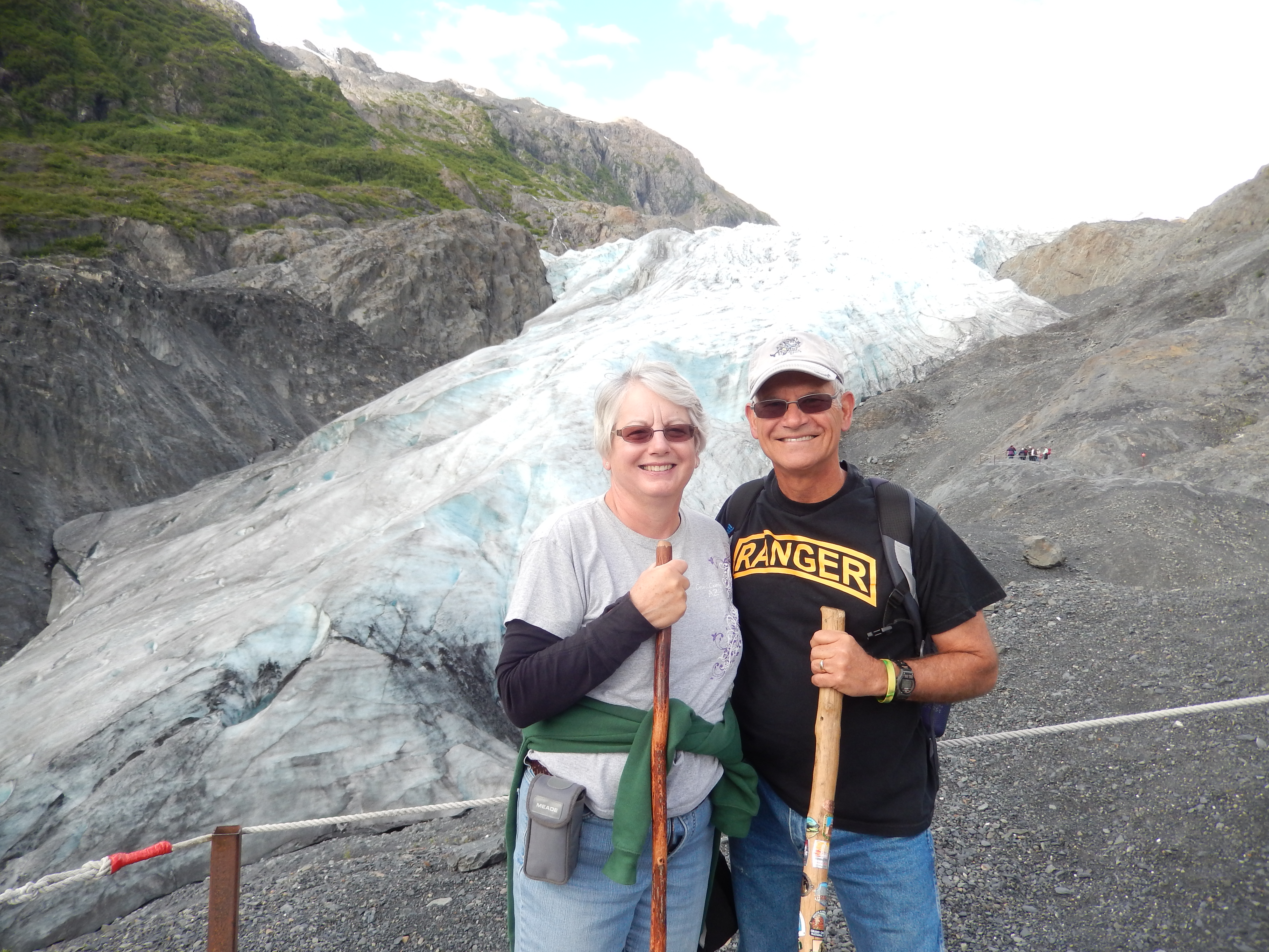
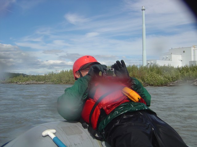
After some research we discovered we could hitch a ride with a tour from Pangaea Adventures to the Shoup Glacier. We traveled to the bay below the glacier in a water taxi. The paddle across the lower bay was a bit challenging with the rising tide and a fresh wind coming off Prince William Sound. We paddled up a short channel into the upper bay and we on calm water with almost calm winds. There is a Kittiwake rookery on a small island in the upper bay. It was interesting to see how they would make their nests on small rock outcroppings. They were certainly a noisy bunch of birds!

DSCN2957DSCN2969

As we approached the glacier, we started paddling through chunks of ice floating in the bay and the air got cooler from the katabatic wind coming off the surface of the glacier. There was a huge cave in the face of the glacier formed by melting water flowing on the surface under the glacier. It was flowing so fast that I wasn’t able to paddle against it for more than a couple of minutes. We took a break for lunch with the tour group and chatted with them before we hiked up the side of the glacier. It didn’t look much like ice because it was thoroughly covered in wind-blown dirt, and looked more like a hill than a mountain of ice.

DSCN2973DSCN2980DSCN3005

Back in the water we paddled around the face of the glacier, getting close enough so we could reach out from our kayaks and touch it. This was everything that I hoped it would be. We paddled back with the outgoing tide to the lower bay and we picked up by our water taxi for the trip back.

DSCN3023

Tuesday, 7/29/14

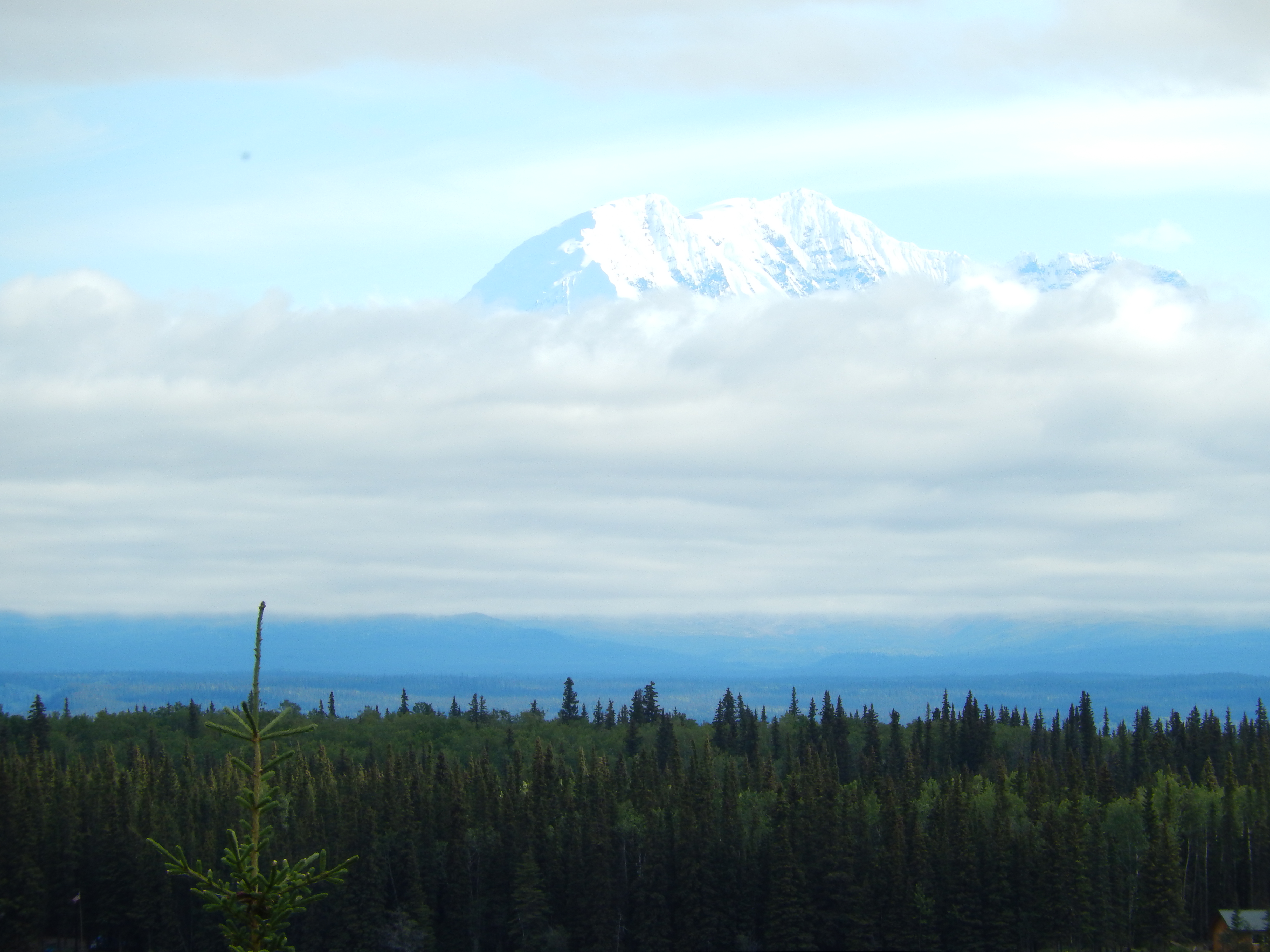
We were on our way to Tok. On our way through the Thompson Pass we were able to see Mount Wrangell, with its peak above the clouds. Mount Wrangell is the centerpiece of the Wrangell-St. Elias National Park and Preserve. If we make another trip to Alaska, this is a park where I would want to spend some time.

DSCN3045

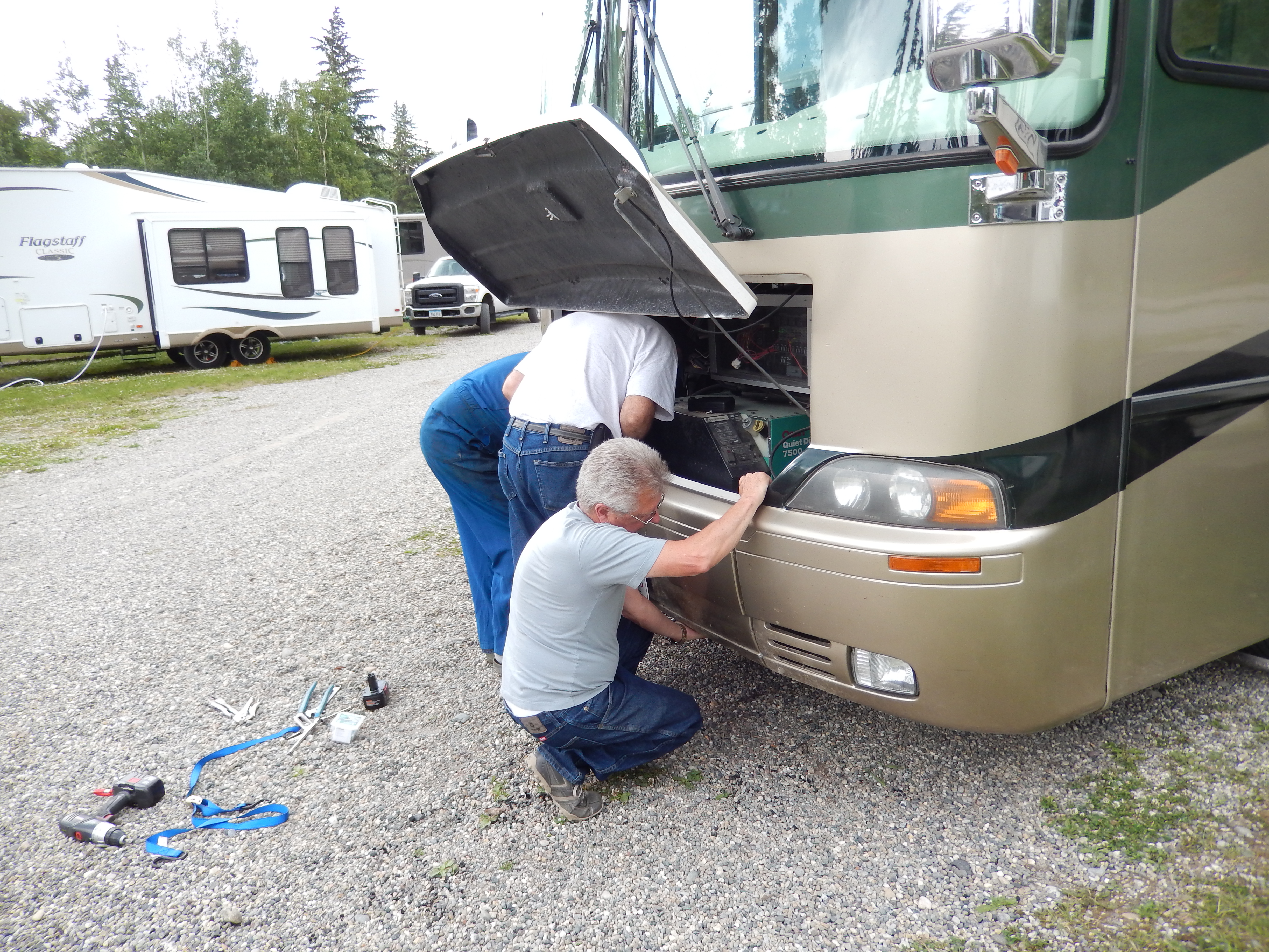
It was an easy drive, although we arrived in a drizzling rain, I think it always rains in Tok. When we got to Tok, we heard that one of our group from Iowa had broke a leaf spring shortly after leaving Valdez. Everett, our tail gunner, had helped them to connect with a repair shop in Glennallen and the thought they would be able to catch up with us in Chicken or Whitehorse. Between Denali and Talkeetna, another one of our group had broken a spring and wrecked his axle. He got it fixed enough that he was able to get to Anchorage where he would get a more permanent repair made. This started getting me worried about having a major problem with our rig.

I took a walk to the Visitor Center to watch a video on the building of the Alaska Highway in 1942. I had seen part of the video before, but this was an opportunity to see the entire thing. It was interesting to hear about how unprepared the Army was to build a 1,500 mile road in arctic conditions. I could understand how they hadn’t planned on dealing with the muskeg (a peak moss type layer of decomposing vegetation that was like a sponge) and permafrost (frozen ground that never thaws, until you scrape away the insulating vegetation above it causing it to thaw into a soupy mud). What really surprised me was that many of the soldiers were not trained on the heavy equipment (bulldozers, scrapers, and cranes) that they had to operate and maintain. However, I was very impressed with the flexibility and ingenuity they showed in dealing with these problems, and the logistical effort it took to support six battalions of engineers with food, fuel, and everything else they needed.

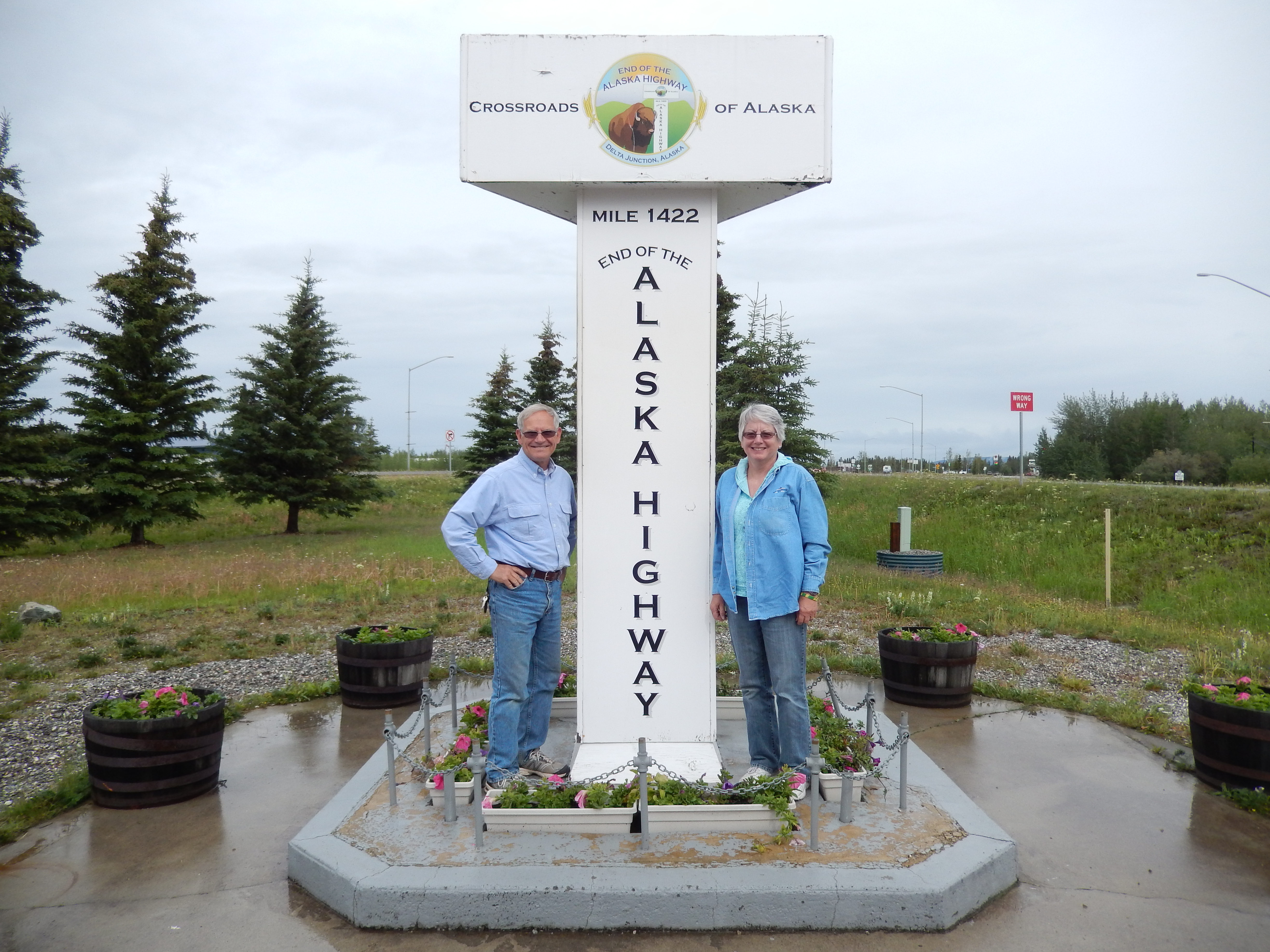
The Alaska Highway, 1,422 miles of pioneer road, completed in eight months – quite an accomplishment!

Wednesday, 7/30/14

A short drive today, only 79 miles to Chicken. To say Chicken is a small town is an understatement. It is a small mining town that has a winter population of three people, maybe forty in the summer. It has no government, no police or fire department. “Downtown” Chicken consists of three storefronts; a mercantile, a saloon/liquor store , and a cafe – that’s it! Chicken was named by a bunch of miners who wanted to name it after a bird they saw a lot, but they didn’t know how to spell Ptarmigan, so they decided to just call it Chicken.

DSCN3078

DSCN3053
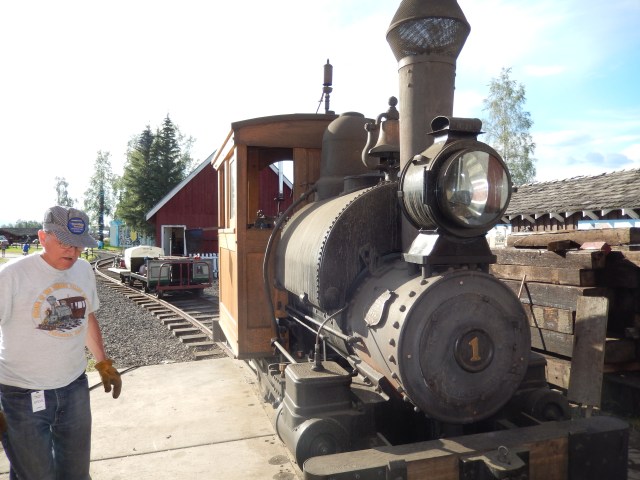
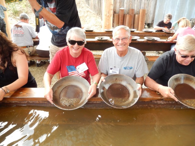
We stayed at the Chicken Gold Camp. Here were able to take a tour of the Pedro Creek gold dredge and pan for gold. At first I thought, “we did all of this in Fairbanks, why did we come here?” The tour of the dredge (which was almost a double to the Dredge #8 in Fairbanks) was more instructive than Dredge 8. In Fairbanks, they gave us a bag of gravel and we panned that for the gold dust, but if you wanted more, the price was $10. Here we shoveled our own gravel out of a pile and panned it. We could do this all day if we wanted. This is known as “recreational gold mining.” Some people will stay here for weeks, panning for gold. It’s like paying for an admission to a theme park or green fees for playing golf. I think we panned for a couple of hours over the course of the day. I thought it was a lot of fun as I enjoyed the challenge of trying to find gold in this pile of gravel, just like the Gold Rush miners.

DSCN3058

Thursday, 7/31/14.

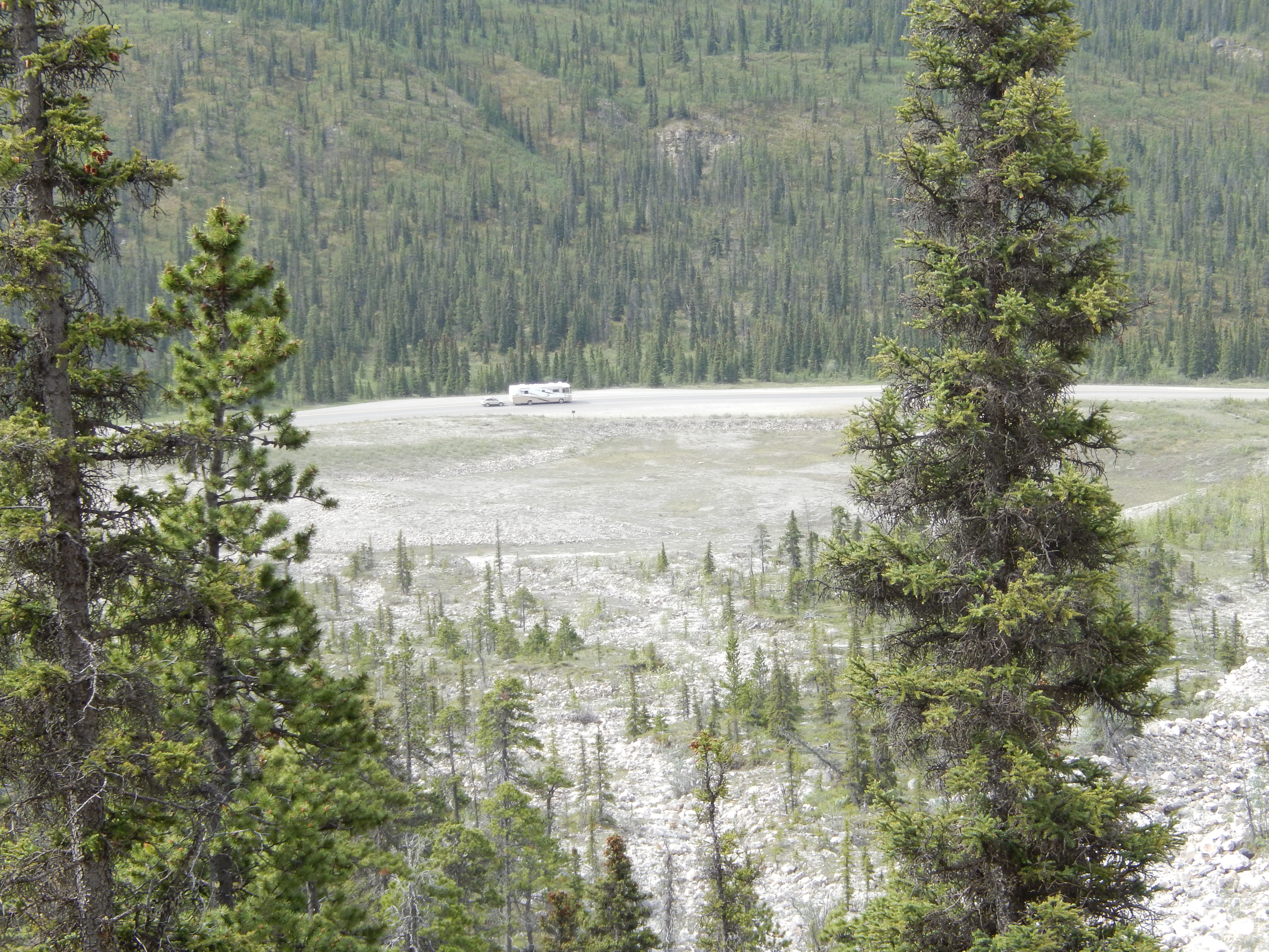
We all got an early start. Some of our caravan decided they wanted to drive to Dawson City in the Yukon via the “Over the Top Road,” and the rest of us headed straight for Whitehorse. Either way it was going to be a long drive over some of the worst roads on the trip.

I was definitely taking it easy over this rough road. I was now paranoid about driving too fast over a pothole and breaking a spring or axle! However, we had no problems, had some great scenery. We arrived at the White River Campground, which was supposed to have a military vehicle collection. It was more like a military vehicle junkyard. Just a bunch of wreaks from the construction of the Alaska Highway that were abandoned when the highway was complete and dragged into this park – a bit disappointing. After dinner I was sitting by the campfire when a traveler from Germany stopped by to talk. It was interesting; between my poor German and his poor English we had an enjoyable conversation!

Friday, 8/1/14

After Chicken we were essentially headed back to the “Lower 48.” Today we traveled to Whitehorse. A pretty long drive as it is 250 miles to the RV park, and plenty of construction zones to go through. People up here joke about the weather like we do in Michigan, such as “we have four seasons too, fall, winter, spring, and construction.” It wasn’t too bad. We didn’t plan to be the first ones on the road, but we beat everyone else out of the campground and were the first into Pioneer RV Park in Whitehorse. This was the place where we were packed in like sardines, and we wanted to get there while there was room to maneuver. Later that day, the brothers from Iowa rolled in, having their repairs completed. The rigs that went through Dawson showed up the next day.

Saturday, 8/2/14

In the morning we visited the Beringia Interpretive Centre. This center describes the land bridge that existed between Russia and Alaska during the Ice Age. We have heard people talk about the migration over the ice bridge between Russia and Alaska, but that bridge is a myth. The glaciers and ice fields consumed so much of the precipitation in ice and snow that the ocean levels dropped creating a huge land mass between Russia and Alaska. Large mammals such as the woolly mammoth and scimitar cats, as well as native tribes migrated across this land mass. Some continued through a break in the ice fields in western Canada into the Continental United States. The description was very fascinating and we were able to use some of the tools, like the atlatl used to throw spears.

DSCN3090DSCN3093

After the Beringia Centre, I went on my own to the Transportation Museum. Here there were many displays of transportation in frontier Yukon. Of course, it covered the Gold Rush and the Alaska Highway. What appealed to me were the displays about the bush pilots, the aircraft they flew, and the risks they took. After this I wandered through Whitehorse doing some geocaching – my first geocaching in Canada.

Sunday, 8/3/14

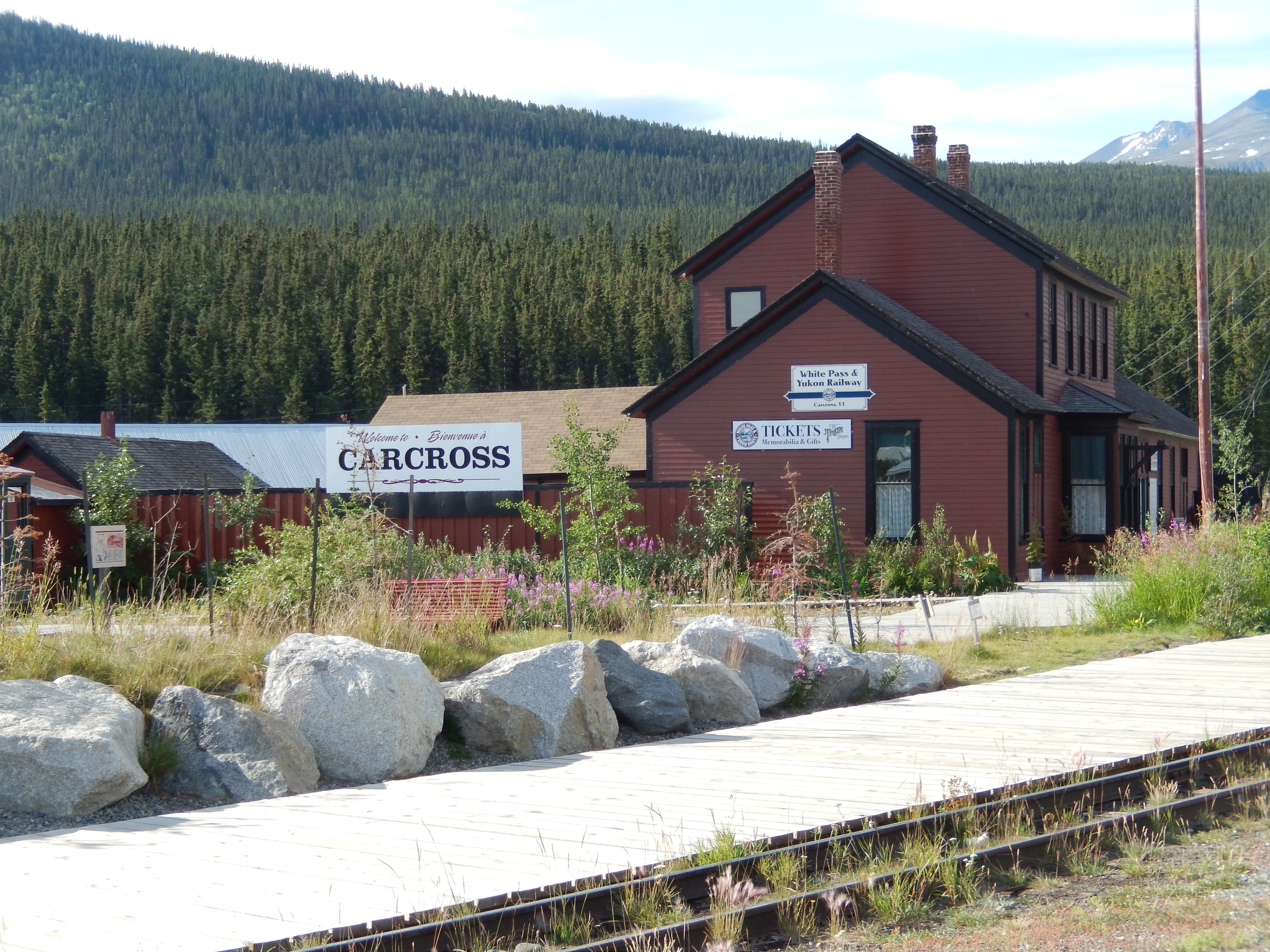
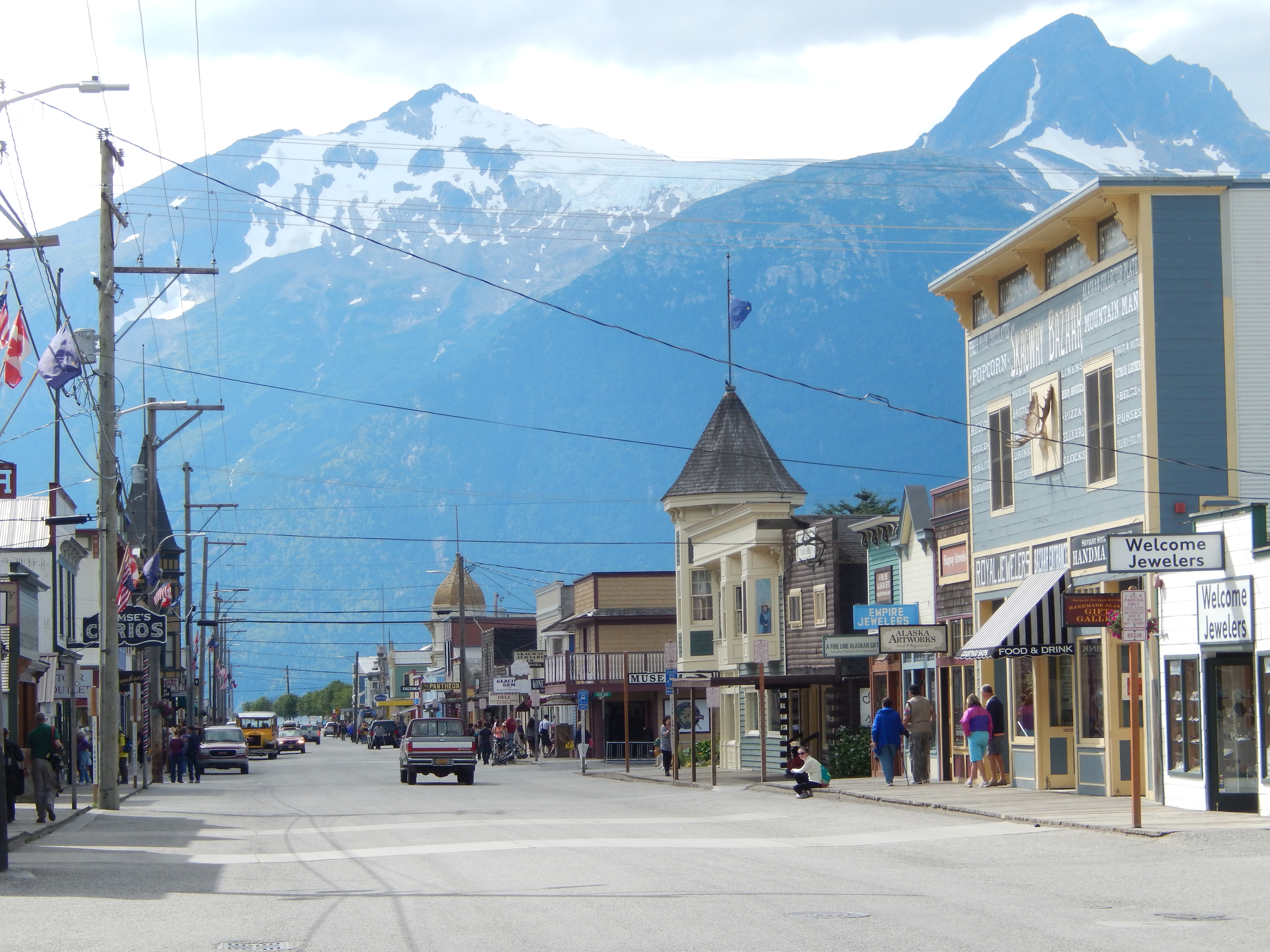
Skagway, AK, was the beginning of the trail to the gold fields for miners coming by sea from the lower 48. With a combination of tour bus and narrow gauge train, we traveled over the White Pass. Along the route we stopped at Carcross for coffee and cinnamon buns on the way down and ice cream on the way back up.

DSCN3124DSCN3133

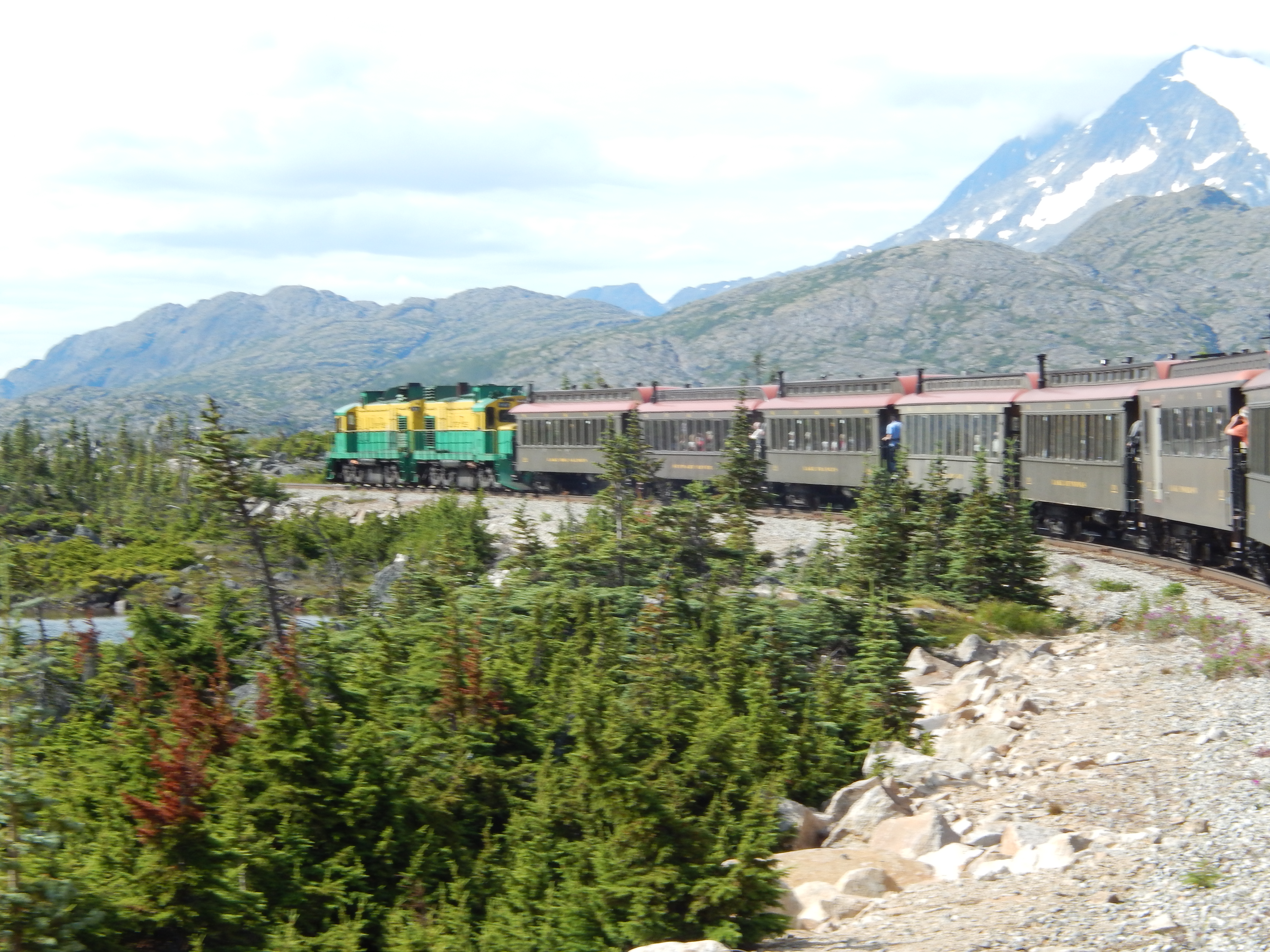
The White Pass & Yukon Railway was the best way to get into the interior until the Yukon Highway was completed in 1979. As we traveled to Skagway we were given a narration about some of the sights we would pass. We were able to stand on the railcar platforms and get some excellent pictures.DSCN3184

Skagway was a lawless, gold rush town for years. “Soapy” Smith and his gang pretty much ran the place until local citizens finally had enough. “Soapy” Smith was killed in a shoot out and peace slowly became the norm as more and more families followed the gold rush “stampeders,” and settled in town. Physically the town has not changed too much over the years, although tourism is now the leading industry.

DSCN3196

After we returned to Whitehorse someone suggested we should get pizza for dinner.  Before you knew it, almost everyone said that was a great idea, and 27 of us showed up in this small pizza place.  The owner said he hadn’t had that much business in one night in a month!

DSCN3110

Monday, 8/4/14

This morning really started the trip back home. From this point forward we have mostly travel days and only a few organized events.

Posted in Adventure Treks, Alaska, Canada, Fulltime RV, Michigan Traveler, U.S. Army Corps of Engineers | Tagged , , , , , , , , , , , , , , | Leave a comment

Alaska Journal – 2014, Chapter Four

Tuesday, 7/15/14

Today we traveled to Homer. Our first stop along the route was the Potter Point State Game Refuge. This site has an extensive boardwalk for viewing nesting waterfowl. The best thing about this stop was that we had an unobscured view of Mount McKinley. Even though it was 200 miles away, we finally had a chance to see it. Surprisingly most visitors don’t have the opportunity to see it because it is often obscured by clouds.

DSCN2178

We also stopped at the Begich-Boggs Visitor Center at the Portage Glacier. The glacier must have shed some of its ice because there were several ice flows in the lake by the Visitor Center.DSCN2200

The closer we got to Homer, the more we traveled along the coastline of the Cook Inlet. We stopped at the Mount Iliamna Viewpoint. This was interesting as we had to walk across a meadow to get to the cliff to look across the Inlet. Homer sits at the mainland end of the Aleutian chain. The Aleutians are part of the Pacific Ring of Fire, chains of volcanoes that circle the Pacific. Active volcanoes Mount Redoubt, Mount Douglas, Mount Augustine, and Mount Iliamna are part of that chain in the Homer area.

Wednesday, 7/16/14

This was our “free day” with no scheduled activities. We thought we would do some kayaking, but had not been able to do much research ahead of time. We drove out onto the “Spit” and checked with Mako Water Taxi. They said they could taxi us across Kachemak Bay to the Kachemak Bay State Park, if we could leave right away. We jumped at the opportunity and loaded our kayaks aboard. Kachemak Bay State Park is only accessible by water and is too far and too hazardous to paddle across the busy Kachemak Bay. We landed at Kayak Beach at the mouth of Tutka Bay.

DSCN2221

We unloaded our kayaks and, after a short hike up the Grace Ridge Trail to check out the view, we started to paddle up the bay. The tide was coming in and it was like paddling on a river with the wind and tidal current behind us. The scenery was amazing, with cliffs and mountains high above us. Once again we were blessed with glorious weather, sunny skies and light winds. We pulled our kayaks up a beach for lunch and enjoyed the sunny day. The tide rises as much as 28 feet in the bay and it wasn’t long before we saw our nice beach disappearing, so we interrupted our lunch and were back in the water.

DSCN2251DSCN2238

At one point we saw some bald eagles perched in the trees above us. We paddled close than I thought we would ever get and the eagles didn’t seem to be bothered by us at all. We thought we saw some whales blowing on the far side of the bay, but didn’t see any other indication of whales, so it was probably fish jumping.

DSCN2293

About 5:00 we arrived at the other trailhead for the Grace Ridge Trail, where we had made arrangements for the water taxi to pick us up. There were a trio of ladies camping in a State Park Yurt doing landscape painting and we had a nice chat with them. A couple of hikers were there and glad to hear we had a water taxi coming, because they had not arranged for one. The taxi arrived about 6:30 and we made a quick return to the small boat harbor on the “Spit.” Although we didn’t see any sea otters in Tutka Bay, we did see one playing in the harbor.DSCN2263

DSCN2311

Thursday, 7/17/14

Our group had a bus tour of Homer. Our first stop was the art gallery of Norman Lowell. This artist came to Alaska as a homesteader, then began painting. He is widely recognized as a leading landscape artist. We were able to see his original homestead cabin and their vegetable garden. His lifestyle has definitely improved! His gallery was amazing, some of the landscapes just took my breath away. There were also works from other artists in the area. I was particularly impressed by the carvings from moose antlers.DSCN2324DSCN2330

We also had a walking tour of the harbor. There was everything from commercial fishing vessels to small water taxis. We saw the cribs that are used to raise boats out of the water with the rising tide so work can be done on the bottom of the boat at low tide. The entire dock system floats so it can go up and down with the tide.DSCN2341

Friday, 7/18/14

Another travel day, on our way to Seward. We did some backtracking and took advantage of it to visit some stops that we bypassed on our way to Homer. In Seward we stayed at a city-owned RV park that was built after the 1964 earthquake and tsunami that destroyed the entire waterfront. The RV park is right on the water, but can be easily evacuated whereas permanent buildings would be destroyed. The view is amazing!

Saturday, 7/19/14

Our first full day in Seward we took an all day cruise through Resurrection Bay. DSCN2361

Once again we lucked out on the weather. The forecast was for showers turning into steady rain, but we ended up with sunny skies and temperatures in the high 60s. As we traveled to the mouth of the bay, the captain began an ongoing commentary on the history and the environment of Seward and Resurrection Bay. He kept a watch for wildlife as we traveled, and we were able to see Bald Eagles, mountain goats, sea otters, harbor seals, porpoise, humpback and Orca whales. When he spotted one of these he would carefully steer the ship as close as possible so we could get close looks and great pictures.DSCN2577DSCN2380DSCN2408

As we passed Callisto Head we saw Bear Glacier and the small bay created by the terminal moraine (the piled up earth left at the end of the glacier as it started to retreat).

DSCN2383

Past Callisto Head we were in the Gulf of Alaska and the sea became pretty rough. It wasn’t long before we rounded Aialik Cape and headed up the Holgate Arm to Aialik Glacier. Aialik Glacier is a tidewater glacier, meaning that the toe of the glacier is in the water, not dry land.

DSCN2419

Here the waves and currents erode the glacier. This erosion and the softening and melting of the glacier where it rests on the rock base causes the glacier to “calve.” Calving is when slabs of the glacier break off and slide into the water. On this trip we were entertained as Aialik Glacier calved at least half a dozen times, sometimes in a very spectacular fashion. As we floated a quarter mile from the face of the glacier, we could feel the katabatic wind rolling the cold air from the surface of the glacier down to displace the warm air in front of it, and the chunks of ice floating in the water clanging against the hull of our ship. It was like nothing I had even experienced before!DSCN2458

From Aialik Glacier we headed back out towards the Gulf of Alaska to the Chiswell Islands. These islands are a nesting ground for all kinds of birds. We saw seagulls, bald eagles, cormorants, and puffins. We also saw a rookery for sea lions. What a pleasure to see so much and have the captain’s commentary to explain what we were observing.

DSCN2547DSCN2532

We turned back toward Resurrection Bay and landed at Fox Island for a buffet dinner at the National Park Service day lodge. Another excellent meal and, by far, the best salmon I have ever eaten! Some people complained there wasn’t any desert, but after we boarded our ship the captain announced that the crew would be serving fresh chocolate chip cookies, still warm from the oven – the complaints about desert quickly stopped.

DSCN2593Our last point on the cruise was to circle Fox Island and see how the 1964 earthquake had dropped the spit created by the glacier’s terminal moraine. The flood of salt water from the tsunami following the earthquake had killed many evergreen trees, creating a “ghost forest.” All-in-all it was just a great trip and a great day!

Sunday, 7/20/14

Our big event of the day was a trip to the toe of the Exit Glacier. Our group made a short hike to the toe of the glacier, were able to see how the glacier had receded over the years, and what factors cause the glacier to advance or retreat.DSCN2610DSCN2612


Six of us took the opportunity to stay when the group left and continue up the 4.1 mile trail to the top of the glacier and the Harding Icefield. This was no easy hike! We started some serious uphill climbing right away. Part way up two of our party decided this was more than they were capable of doing and turned back. The remaining four of us continued. We stopped for lunch just above the tree line and took shelter from the wind behind a low mound for a trail lunch. As we continued our climb, we were more exposed to the wind and the steepness of the climb increased.DSCN2622DSCN2627


We knew we were getting closer to the ice field as we started crossing patches of ice and snow. We paused at an emergency hut just short of the top. The views were already amazing and I know my pictures will do a poor job of describing what we saw. When we finished the last .3 miles to the top we were rewarded with the most awesome sight I have ever seen. I felt like I was on the top of the world. The icefield seemed to go on forever. The Arctic katabatic wind coming off the surface of the glacier was a huge change from the warm air we left 3,000 feet below us. The trip down went quicker than the climb up but was no less demanding as we had to climb down over the rocks we had scrambled over on our way up.DSCN2670DSCN2661DSCN2655

Monday, 7/21/14

After the exertions of the day before, we took it easy. We walked into town to see the Alaska Sea Life Center. This aquarium was very well done. We were able to view fish, aquatic birds, and other sea life from above and below with huge underwater viewing windows. It was also interesting to learn about how sea life is often rescued, rehabilitated and returned to the wild. Later we wandered through the town of Seward, imagining what it must be like to live here year round.

DSCN2711

That evening the four of us that made the climb to the top of the Exit Glacier had dinner at a harbor side restaurant to celebrate. Both the food and the views were delicious.

Tuesday, 7/22/14

Another travel day and we headed back through Anchorage to the town of Palmer. We stopped at Elmendorf AFB for groceries and fuel enroute. After setting up we were treated to a meal prepared by the caravan staff. A great way to end a day of travel.

Wednesday, 7/23/14

An easy day today. We took a trip to a Musk Ox Farm. This was really unique in that Musk Ox only exist in Norway, Greenland, and Alaska. What made this farm special is that it was created from an original homestead by John Teal. He developed the farm to domesticate these wild animals and create a cash business for outlaying indigenous tribes. At the farm they raise the Musk Ox and comb the wool from the animals coat. Musk Ox qiviut (pronounced KIV-ee- oot) is thicker, softer, more warm and durable than wool. They then ship the qiviut to native tribes who then weave hats and scarves, and send the finished product back to the farm for sale. The tribes are paid as soon as they return the finished product and this gives them a cash revenue they can use to purchase goods and services they can’t provide for themselves. It was a fascinating visit and a great story of a selfless man with a vision.

DSCN2745

We are having a wonderful time in America’s Last Frontier!DSCN2306

Posted in Adventure Treks, Alaska, Alaska RV Caravan, Fulltime RV, Michigan Traveler, National Parks | Tagged , , , , , , , , , , | Leave a comment

Alaska Journal – 2014, Chapter Three

Thursday, 7/3/14

This was our free day in the Fairbanks area. We traveled to the Large Animal Research Station, but found it closed for the holiday weekend. However, we were able to see some of the animals in the distance. This was my first view of Muskox and caribou. Next stop was the Fountainhead Antique Auto Museum. I enjoyed this more than I expected. All but four of the automobiles are operational and are driven in parades and for other special events. For me, the highlight of the museum was the audioplayers that everyone gets with their admission. On this device we were able to listen to a curator describe the history of each car, its features, and how it was restored. There was even a car an Alaskan built to impress a potential girl friend! She loved the car, but still wasn’t interested in him.

DSCN1690

We visited the Fairbanks Visitor Center and biked along the Chena River. You could tell they had a lot of rain recently as the river was flowing over the bike path in spots.

DSCN1692

After doing some research we decided we could kayak on the Chena River. The next morning we paddled from a bridge upstream from the campground to a spot in Fort Wainwright. Fort Wainwright was just downstream from the campground and there was a nice spot where the river had overflowed its bank, giving us the perfect spot to take our kayaks out of the river. It was interesting to paddle past backyards in one stretch and feel like you were in the middle of the wilderness in the next.

DSCN1697

Later that afternoon our group took a bus to the University of Alaska Museum of the North. I found the Museum particularly interesting as it displayed Alaska by region, highlighting significant events and resources of each region. Every place we stop we learn more about the “last frontier.”

DSCN1717

The big event of the day was the Alaska Pioneer Park Salmon Bake Dinner. This was a huge outdoor buffet and we all enjoyed it. There was grilled salmon, Alaskan cod, roast beef, crab legs, and more. Some of the best salmon and cod I have had in a long time!

DSCN1740DSCN1741

Pioneer Park is a 44-acre park in downtown Fairbanks and is the site of the Salmon Bank, Air Museum, Pioneer Museum, Tanana Valley Railroad Museum, and Palace Theater. At the Railroad Museum I was shown Engine #1, the original engine used on the Tanana Valley Railroad. The men that have restored it have done an outstanding job!

DSCN1749

We attended the “Golden Heart Review” at the Palace Theater. As opposed to the “Frantic Follies” that we attended in Whitehorse, this show focused on Alaskan history, primarily in the Fairbanks area. It was an excellent performance with plenty of laughs.

DSCN1770

Saturday, 7/5/14

The big event today was a trip on the Riverboat Discovery. This was the best thing we did in the Fairbanks area. At the beginning of the trip, we were treated to watching the takeoff and landing of a float plane and listened as the pilot described, over the radio, his takeoff and landing, and how bush pilots supported Alaskans living in the back country.

DSCN1776

We had a running commentary during the entire trip. The commentator gave us history on some of the homes along the river, and the captain described how the ship was driven by the paddlewheel and how they navigated the river that had sand bars that appeared and disappeared overnight. A special treat was the free blueberry donuts and coffee offered to all onboard. This was a tradition that has lasted since the first river cruise.

Along the route we were treated to speakers from the shore. Our first stop was Susan Butcher’s cabin and dog kennel. Susan Butcher was a four-time winner of the Iditarod and started breeding and raising sled dogs. Her family continues this tradition and her daughter described the breeding and training of the dogs. We saw a team hitched to a four wheeled and raced around a short route in front of the boat. It was amazing to see the strength of these dogs and how much they actually enjoyed pulling the “sled.”

DSCN1790

Our next stop was an Athabascan Fish Camp. A native Athabascan described the salmon wheel and how it was used to harvest the salmon.   She also demonstrated how salmon were filleted and smoked.

DSCN1808

We then stopped at a rebuilt Athabascan Village and were given demonstrations of how they lived and hunted; types of homes and shelters; and how they prepared and used animal hide for clothing as well as other uses. Some of the staff of Susan Butcher’s kennel were there with the dogs to give us more information on how dogs are breed and trained for dog sledding. I can’t say enough good things about this tour, it was much more than a boat ride!

DSCN1799DSCN1831

On the way back from the river trip, we stopped at the Alaska Wooden Bowl Company, where they make wooden bowls from native trees and berls. It was interesting to see how they use a lathe with a curved blade to cut concentric bowls, sand, and apply a finish.

DSCN1851

Sunday, 7/6/14

Gold Dredge 8 is a restored gold dredge. They used to use high pressure water to blow away the top levels of soil to expose the lower layers that held the gold. With core drilling they mapped out where veins of gold lay underground. They would then dig a pit, flood it, and put the dredging barge in the resulting pond. The dredge would scoop up soil like a chain saw cuts into wood, bringing the soil to the surface and dump it into the dredge where it was sifted through screens to eliminate the large rocks. The remaining soil would be washed (or panned) to bring the lighter soil to the surface and wash it away, leaving the heavier gold behind. It was a big, impressive piece of machinery.

DSCN1869

We had a chance to pan for gold. We were given a small bag of soil and taught how to use a pan to wash away the lighter soils. Pat ended up with nine grams of gold and I got seven – women are always better gold diggers! When Dredge 8 was taken out of service, it wasn’t because they ran out of gold, but because they ran out of profit. Gold prices had been set at a fixed level by the government, but production and transportation costs continued to rise. Eventually it was no longer profitable to continue and it was closed down. Now with safety and environmental restrictions, this form of mining is no longer feasible.

DSCN1864

The Alaska Pipeline was out next stop. The ingenuity that went into the design was amazing. Much of the pipeline is above ground to avoid thawing the permafrost and the vertical supports are engineered to protect the pipeline from even an 8.5 earthquake! At times the pipeline runs underground to allow for animal migration. Periodically they run “pigs” through the pipeline to inspect and clean the sides and prevent a build up of wax and other contaminants. One of our group was an engineer who had worked on the pipeline and his additional knowledge was a plus for the trip.

DSCN1892DSCN1855

Our campground was located in North Pole, AK. Of course we had to go to the Santa Claus House. It was a typical Christmas shop, although a nice one. You could get your picture taken with Santa and they had reindeer outside. We did buy a few ornaments while we were there.

DSCN1904

Monday, 7/7/14

We had a relatively easy drive, although it rained for most of it. We made a quick stop in Nenana. This is the city where the annual Ice Classic, the oldest tradition in Alaska, is held. People have been guessing when the ice will break up on the Tanana River since the early 1900’s. This time is determined by a huge black and white tripod. When the breaking ice tips the tripod an attached line to the Ice Classic office stops a clock and the winning time is recorded.

DSCN1910

We arrived at Denali in mid-afternoon, wandered around the shops that lined the main road, and made arrangements to go white water rafting on Wednesday. That night we went to dinner at Cabin Nite. Cabin Nite replicates an Alaskan roadhouse experience, with a family style dinner. Following dinner was a show that focused on Denali history. Even though this was the third show we had seen as a group it was unique and we all had a great time.

DSCN1929

Tuesday, 7/8/14

DSCN2045We took the bus tour through Denali National Park. It is not advertised as a narrated tour, but our driver did a good job of describing the park, its history, and the wildlife as we drove the 66 miles from the Wilderness Access Center to the Eielson Visitor Center. We saw Dall sheep on the rocky cliffs above the tree line, grizzly bear, moose, and caribou in the valleys. We even saw a red fox running down the road right next to our bus.

DSCN2001

We did some hiking near the Eielson Visitor Center and caught a different bus back. DSCN1992DSCN1985

On our way back, we stopped at the Park Sled Dog Kennel to see a demonstration of a dog sled team and how they are used by Rangers in the park. All day I was in awe of just how huge Denali is. The park seemed to have a raw power projected from the mountains and glaciers. We spend the entire day in the park and we saw a mere thimble full of the six million acres of wilderness.

Wednesday, 7/9/14

We went rafting on the Nenana River with eight other members of our caravan. This is a glacier fed river, 48 hours earlier the water was ice! Everyone wore dry suits, the kind of suit divers wear for SCUBA diving under the ice. The area had more than normal rainfall in the past weeks and the river was high and fast. It was a great ride and I took more than one wave right in the face – great fun! An hour and a half later we pulled into the take out point, way too soon!

DSC05204DSC05220

After we changed clothes, Pat and I headed back into the park. We went to the visitor center. The displays were some of the best I have seen, showing the history of the park and the wildlife that inhabit it. From the visitor center we hiked some of the local trails. One of them led to a lookout about 1,700 feet above the valley floor. We made it about 1/3 of the way to the top, enjoyed the view and headed back to the visitor center.

DSCN2041

We have been so fortunate with the weather. The forecast was for cloudy skies with a 60% chance of thunderstorms. The days started out cool, but were sunny with temperatures in the high 60’s the rest of the day.

Thursday, 7/10/14

Another travel day, but we had an easy day in front of us and only one stop for sightseeing, so we were in no rush to get going. The weather was pretty bad, rainy and cold. We stopped at the Veterans Memorial and Medal of Honor Loop. This memorial honors veterans of all services, traces the history of the military in Alaska, and describes the actions of those brave Alaskans who were awarded the Medal of Honor. It was a very well done and touching memorial.

DSCN2053

That afternoon we drove into Talkeetna. This is a small village that essentially supports the climbing on Mt McKinley. We visited the local cemetery to see the memorial to those who died attempting to climb Mt. McKinley. The Talkeetna Historical Society Museum had some unique displays, including “artifacts” from the local school. I say “artifacts” because Pat and I recognized text books that we had used in elementary school – what does that say about our age?

DSCN2058

Other displays exhibited bush pilots and their exploits, one pilot would hunt wolves with rifles attached to his plane’s wings. At the Ranger Station we saw where climbers would check in, obtain their approvals and permits, and prepare for the for the climb. We saw a video of how climbers will take three to four weeks to travel the 14 mile trail to the summit – at least half of the climbers fail to reach the summit. Our final stop in town was to stop by the Fairview Inn to see where many of the mountaineers would have their last drink before departing for their climb.

DSCN2069

Friday, 7/11/14

We only had a 90 mile drive and were asked not to arrive in the next campground until after noon. Consequently, everyone took their time and we left about 9:30. Along the way we stopped at the Museum of Alaska Transportation and Industry. Parts of this museum were interesting and well done, other parts looked like a junkyard. I found the restored train the most interesting. The pictures inside showed how the railroad supported industry and the general population. There was a Model T Ford on display that showed how it was modified to be a snowmobile, as well as two motorized toboggans. You know you are in an Alaskan Museum when there is a 20 foot row of outboard motors and an equal amount of chainsaws on display.

DSCN2076DSCN2073

Our next stop was the Iditarod Trail Headquarters and Museum. The parking was real tight for RV’s and several of our group drove through the parking lot and just kept on going. There was good information about the race and a video about how the mushers train and take care of their dogs. Outside you could take a short ride on a dog sled. We went out to see the dogs. They were laying in the trail waiting for the next ride and they looked mighty hot!

DSCN2085

We arrived at the Golden Nugget RV Park in mid-afternoon. This was the first time we were in a real built up area. There was a Costco right across the street and most of us took advantage of it to stock up on groceries.

Saturday, 7/12/14

We had enough time before our first activity for Pat and I to get some exercise. There is a nice trail network in the area and we were able to get in a good walk and run. It felt good to get in a good run for a change.

We went downtown to take a trolley tour of Anchorage. This was very interesting. Jody, our driver and guide did a great job of describing Anchorage and its history. We drove past the float plane base and Jody told us that one out of every 56 Alaskans is a licensed pilot, some are licensed to fly before they are old even to be licensed to drive! Also, one out of every 85 Alaskans own their own plane. Her combination of real-life examples (she is a fourth generation Alaskan) and humor made it an enjoyable experience.

DSCN2102

After the tour we had some lunch at the local famers’ market and went to the Anchorage Museum of History and Art. While some of the group are suffering from an overdose of museums, I thought this was a very good one. I particularly enjoyed the floor that was devoted to the indigenous Alaskan natives and their culture and the exhibit that showcased Alaska’s history in a chronological series of displays. While we had heard a lot of this already, this exhibit gave it more life and texture.

DSCN2110

The Ulu knife is a very popular tool in Alaska.  The Ulu Knife Factory is in Anchorage.  During business hours you can see the knives being made.

DSCN2117

Sunday, 7/13/14

The first item on the agenda was the Alaska Native Heritage Center. This center was created to help native Alaskans to learn about their own culture. Because the history of native Alaskans has been passed down through oral history from tribal elders, public school education has caused many of the tribal young to lose their cultural roots.

Young native Alaskans act as docents to guide visitors through the center. They demonstrated a lot of pride in their cultural knowledge and were excited to be a part of its preservation. We saw demonstrations of native games and dance. One exhibit described the traditional values and how they impact on the lives of native Alaskans. I found the description of the values easy to relate to and how they would apply to anyone.

DSCN2121

Later one of the docents guided us through a display of how each of the groups of native Alaskans lived. It was interesting to see how the availability of wood from trees affected how they lived. On the Arctic coast with few trees, the homes were underground, supports were constructed from drift wood and the sod walls were supported with mats woven from grass. Heat for warmth and cooking came from sea oil lamps. Often food was eaten raw. On the coast in southern Alaska, the environment is like a rain forest and trees are abundant and huge. Here the homes are framed with logs and closed in with lumber. This is the area with totem poles made from the largest trees. The totem poles tell a story. Today tribal craftsman continue this tradition.

DSCN2145

I felt this was one of the best museums of the trip. It was stirring to learn about the native customs and how they could apply to anyone. The commitment of the young docents, striving to continue their tribal customs and tradition, was inspiring.

After this Pat and I rode our bikes to Earthquake Park. Anchorage has a great bicycle trail network that allows you to ride almost anywhere in the city. One minute you are in a busy commercial area and the next you are surrounded by trees and streams. We rode along the coast of the Cook Inlet and saw how much of the land was exposed by the low tide. Anchorage has the second most radical change in tide fluctuation in the world of 39 feet! Earthquake Park is at the end of a huge area that literally dropped into the sea during the 1964 earthquake (9.2 on the Richter Scale). We rode all the way to Woronzof Point hoping to get a look at Mount McKinley. Unfortunately McKinley was still obscured by clouds, but we did see aircraft passing directly overhead as they landed at the Anchorage Airport.

DSCN2155

Monday, 7/14/14

This was our free day. We took care of laundry and some shopping and rode our bikes along the bike path with some friends from the caravan. They continued on to Woronzof Point and we rode into town to check out the downtown area.

DSCN2158

That night we took a bus to see the World’s Largest Chocolate Waterfall at Alaska Wild Berry Products and had a family style dinner at the Sourdough Mining Company. Everyone made sure they had their fill at the ice cream machine!

DSCN2169DSCN2171

Posted in Adventure Treks, Alaska, Alaska RV Caravan, Fulltime RV, Michigan Traveler, National Parks | Tagged , , , , , , , , , , , | Leave a comment

Alaska Journal – 2014, Chapter Two

Thursday, 6/26/14

We had a nice, easy drive to Teslin, the only problem was a long construction zone that left all of our vehicles covered with dust and dirt. When we stopped along the way at Rancheria Falls, it seemed like most of the caravan pulled in at the same time. It was quite a feat to get all of our big rigs into the small parking area, but we pulled it off. The falls were really something to see!

Once we arrived in Teslin, Pat and I took a short walk down the road from the RV park to see the George Johnston Museum. George was a First Nation (what we call American Indians) and got into photography at an early age. His collection of photos tells the story of his tribe, the Tlingit Indians, from 1910 to 1940. George also bought a car and had it shipped to Teslin, even though there were no roads! He used to drive on the 78 mile lake and on the three mile road they constructed just for his car! It was a fascinating museum and gave us a new perspective on life in the Yukon and the impact of the construction of the Alaska Highway and on the indigenous people of the area.

DSCN1446DSCN1442

That night we had a wine and cheese party with the caravan and had a chance to get to know many of our traveling companions on a more personal level.

Friday, 6/27/14

We had a short drive (105 miles) to Whitehorse. One of the first things we did at the RV park was run our trailer through the RV wash rack. We teamed up with two other couples and with six of us washing together we had them done in no time. It was a relief to get that dirt off, even though we know we will get it all back again at the next construction zone.  I don’t want to say the Canadian RV parks pack RVs in a little tight, but…..DSCN1513

That night we attended a performance of the Frantic Follies, a turn of the century vaudeville revue. It was just hilarious! This is one of the advantages of the caravan as I don’t think we would have attended the show if we had been traveling on our own.

DSCN1465

Saturday, 6/28/14

The caravan had several activities scheduled for the day. Our first stop was the SS Klondike, the biggest sternwheeler on the Yukon. During the gold rush there were over 150 sternwheelers hauling people and supplies from Whitehorse to Dawson City. The Klondike is now a Canadian National Historic Site.

DSCN1481

We made a short stop for a video presentation at the Visitor Centre, then we traveled to the Whitehorse Rapids Fishway. After the construction of the hydro-electric dam, the government built what is now the world’s largest fish ladder to allow the Chinook salmon to swim upstream to spawn. The staff showed us how the fish navigated the ladder and how the government monitored the number, size, and species of fish traveling up the ladder to the spawning grounds.

DSCN1498

The activity I found most interesting was our hike with the Yukon Conservation Society to Canyon City. In the early days of the Gold Rush, miners would arrive at the head of the Miles Canyon rapids in all kinds of boats and makeshift rafts on their way to Whitehorse. Hundreds of these miners and their families lost their lives and all their possessions when they crashed on the rocks of the rapids. The Northwest Mounted Police (NWMP) set a policy that anyone going through the rapids had to have a licensed guide to take the boat or raft downstream. A small town (Canyon City) grew at the head of the rapids to support this. A tram railroad was built with logs as rails to haul miners and their possession overland to Whitehorse from Canyon City. Completion of the White Pass & Yukon Railroad made this dangerous passage unnecessary and the city was abandoned. It’s ruins are now protected as an archeological site.

DSCN1502

Sunday, 6/29/14

This was a free day (no caravan-planned activities). We made plans to kayak on the Yukon River, but when we woke up to rainy weather we decided to tour the McBride Museum of Yukon History. This is a great museum with the original Engine 51 of the White Pass & Yukon Railway, a recreated NWMP patrol cabin, and Sam McGee’s (the focus of Robert Service’s poem, the Cremation of Sam McGee) original cabin. The display of Gold to Government is a great depiction of the evolution of the Yukon and Whitehorse from pre-Gold Rush to the present.

DSCN1520

About mid-afternoon we determined the weather was going to stay clear and decided to try to kayak. We found a friend to help me spot our truck at the take-out point downstream, launched from downtown Whitehorse, and were on the water by 4:00 PM. The weather was wonderful and the scenery even better. At one point we must have seen a couple of dozen bald eagles in the trees above the river. With a strong current we had a relatively quick paddle down the river. This was good because it started to rain a couple hundred yards from the take-out point. Several of our traveling companions had been asking us when we were going to go kayaking and now we had an answer for them.

DSCN1538DSCN1545

Monday, 6/30/14

It was certainly easier to leave Pioneer RV Park then it was getting into it as more and more RVs headed out. Along the Alaska Highway we stopped at the Kluane National Park and Reserve Visitor Centre. This was one of the best stops we have made to date. This center has a terrific display about the glaciers and wildlife in the icefields of the National Park. One exhibit displayed the movements of a female grizzly bear, tagged with a GPS, for a year as she came out of hibernation, gave birth to a cub, lost the cub (we don’t know how), built a new den, and returned to hibernation. Another exhibit described how a glacier had surged forward, covered a river, forming a temporary lake. Later the glacier receded and the rush of water from the lake wiped out complete native villages downstream.

DSCN1595

We arrived at the Cottonwood Campground, south of Destruction Bay (named for a storm that swept through, destroying the buildings and material in the town). Later that afternoon we met for a campfire and one of our new friends, Norman, and I entertained the group with our guitars. It was a nice conclusion to the day of travel.

DSCN1598

Tuesday, 7/1/14

We had a long trip of 243 miles, adding in the factor of having to go through customs at the U.S. border, we decided to get an early start. We were on the road a little after 7:00AM. We hadn’t gone more than a couple of miles when we saw a grizzly bear eating along the lakeshore – our first grizzly sighting of the trip!

We didn’t plan on making too many stops along the way and knew we would run into some construction on the highway. This is supposed to be the worst part of the Alaska Highway. The problem is the permafrost beneath the roadbed. The construction of the road took away the insulating vegetation and the ground thawed, turning it into a soupy mud. This is not a good base on which to build a road. The biggest problem is what is called “frost heaves.” The ground thaws and then when it freezes again, it expands and pushes the pavement upward causing cracks and humps. The soft sub base creates an undulating wave-type surface that will really get your vehicle bouncing, especially at high speeds. Consequently, the rule of thumb is “slow down and take your time.” We had heard all kinds of horror stories about the condition of the Alaska Highway and how much damage is done to motor homes and trailers, like broken axles, kitchen appliance doors falling off, and dust clogged radiators. This leg of the trip was when we got a good taste of it, but came through it with no problems.

Crossing the border was a piece of cake. The Customs Officer asked for our passports and if we had any fresh fruit onboard, and that was it! Of course, he may have been looking at the line of RVs behind us and decided to get us out of the way quickly.

We arrived at the Sourdough Campground in Tok, AK. Shortly after arrival we visited the Burnt Paw Gift Shop and were treated to a talk on dogsledding. The gentleman giving the presentation had run a sled in the first Iditarod in Alaska. He described how dog sledding was not used by native Indians, but was developed by white men during the Good Rush. He also described how dogs are bred for pulling sleds, how the sleds were constructed and how they are driven. He had four Alaskan Husky pups that we could hold. Pat wanted me to buy one. While they were cute, I wasn’t ready to have any pet traveling with us.

DSCN1616DSCN1614

Next we visited the Jack Wade Gold Company, named for Jack Anderson and Wade Nelson. The company still has active mines for precious metals and makes their own jewelry at a bench right in the store. The big treat was being able to hold the 14th largest gold nugget in the world. It was discovered in six inches of gravel in a stream that was being worked for gold and weighs approximately five pounds. At today’s prices, I wonder just how much money was being passed around the group.

DSCN1633

We had homemade chili in a bread bowl in the campground that night and tossed sourdough pancakes into a bucket to try to win a free sourdough pancake breakfast the next morning. Good entertainment.

DSCN1639

Wednesday, 7/2/14

This was our last day on the Alaska Highway. At the Delta Junction Visitor Centre we picked up our certificate for completing the 1422 mile drive from Mile Zero in Dawson Creek. Our journey was much easier than the journey of the U.S. Army Engineers that built the original highway in 1942.

DSCN1654

Shortly before we arrived in North Pole, AK we stopped to see where the Alaska Pipeline crosses the Tanana River. The pipeline bridge is 1,200 feet long.

DSCN1667

Posted in Adventure Treks, Alaska, Alaska RV Caravan, Fulltime RV, Michigan Traveler | Tagged , , , , , , , | Leave a comment

Alaska Journal – 2014, Chapter One

We started our journey in Dawson Creek, BC and we will end in Prince George, BC before we return to the “Lower 48.” We are traveling frequently from point to point. This map will show our major stops along the way. You can click on the map to see it in a larger view. Please be advised that we will stop at some locations twice as we return from Alaska. Alaska Caravan Map

Saturday, 6/21/14

We arrived at the Mile Zero RV Park in Dawson Creek. Members of the caravan were out and about in the park to meet each other and compare stories. Sounds like we should have a great group. The park does not allow trailer washing, but they did say I could at least wash the bugs off the front of the trailer. I haven’t seen so many bugs on there since we went fulltime three years ago!DSCN1321DSCN1319

Sunday, 6/22/14

The official start of the caravan. It was like a bunch of race car drivers getting ready for the big event, checking their rigs, cleaning windows, checking maps, etc. We all met for the opening dinner at the George Dawson Inn. The local tourism office gave a very informative presentation on the construction of the Alaska Highway, a joint venture of Canada and the USA. The 16,000 soldiers deployed from the Continental US and 18,000 Canadian workers built this 1500 mile highway in eight months!

Our Trek Master and Tail Gunner briefed us on procedures and what to expect on the trip. The “Tour Guide” from Adventure Treks seems to cover everything and what it doesn’t cover, our copy of “Mileposts” should. The real adventure starts tomorrow!

Monday, 6/23/14

Our longest drive (281 miles) was today so we got an early start. Our Trek Masters, Guy and Vicki, were on the road at 6:30 to get things set up at our destination. We checked out with our Tail Gunners, Everett and Jeanette, who had fresh coffee for anyone who wanted it, before we leave and follow us to make sure no one is left on the road. At one point we drove across the original curved bridge over the Kiskatinaw River. Built as a part of the original Alaska Highway in 1942, it is the only wooden bridge still in use today.DSCN1324

This stretch of the road is in very good shape and we moved right along. We arrived at the Triple G Campground in Fort Nelson around 2:00. We toured the Fort Nelson Heritage Museum which contains what the Yukon News calls “one of the most impressive collection of antique cars in British Columbia.” It has artifacts of wildlife, pioneers dwellings and lifestyle, and of the construction of the Alaska Highway. We also received a presentation from the Fort Nelson Visitor Centre about the area and discovered Fort Nelson was named after Admiral Horatio Nelson, hero of the Battle of Trafalgar. Why an inland town in Canada is named for an admiral in the British Navy is a mystery to me.DSCN1344

Tuesday, 6/24/14

Another early start we were the third rig out of the campground. Our goal was not to beat everyone else, but we woke up early and decided to get moving. The benefit is that we had the road to ourselves most of the time. We could actually stop in the middle of the road to take pictures and not bother other drivers. We weren’t too far down the road when we saw two black bears along the roadside. They were so used to people and traffic that even honking the horn didn’t disturb them! DSCN1358The landscape and terrain we drove through is amazing, and the best is yet to come. We crossed Summit Pass, the highest summit on the highway, then stopped to climb to some “hoodoos,” known in Canada as erosion pillars. From here we watched several of our fellow Adventure Trekkers drive below us.DSCN1363

DSCN1365One of the “must dos” for the day was to stop at the Toad River Lodge to get a couple of their cinnamon rolls. They were very good! The lodge is known for its collection of hats and they covered the entire ceiling! I even spotted a black beret from the US Army’s Ranger Department!

As if seeing black bears wasn’t enough, we saw a couple of elk, and a herd of bison by the side of the road. Shortly before we arrived at our destination, we had a bison cross and stop on the road right in front of us.DSCN1389

After we pulled into the campground, we found out that one of our companions had damaged the front of his motor home. Of course, he had help and more advice than he probably needed from most of the guys in the caravan. However, by the time he was done you couldn’t tell anything had been damaged unless you took a real close look. Let’s hope that is the worst thing that happens.DSCN1392

The highlight of the stop was a visit to the Liard Hot Springs. This is a natural hot spring inside the Liard Hot Springs Provincial Park. The pool area is built up with a boardwalk and steps into the pool, but it is a nice, natural setting. You can regulate how hot your soak is by the distance you are from the source of the hot spring in the pool. We were told that the temperature at the hottest point could be from 120 to 130 degrees. It was raining with claps of thunder, but we ignored the advice our mothers gave us for years about swimming in thunderstorms, and went in anyway. It was just great! The rain put a damper on sitting outside and talking and we hung out in our rigs for the evening.DSCN0559

Many of us take a lot for granted, such as electrical power. While we all had electrical hookups, I didn’t realize, until I was wandering around the campground, that this was not municipal power. It was generated by two huge diesel generators that powered the campground, living quarters for the owners and staff, the restaurant, lodge and fuel station. Not an earthshaking revelation, but something I had never even considered before.

Wednesday, 6/25/14

We woke up to sunshine, thank goodness! We had an easy drive on good roads. We got another early start for two reasons. First, there is less traffic and, second, there seems to be more wildlife near the road earlier in the day. We saw black bears and bison. We slowed down to get a better look at some bison that were near the road, but when a bull started for the truck, we decided to get out of there in a hurry!DSCN1395

At one of the stops along the route, Contact Creek, we saw the meeting place of two of the U.S. Army Engineer battalions joining the North and South routes during the construction of the Alaska highway in 1942. Later we stopped at Lucky Lake near the border between British Columbia and the Yukon, and hiked down to the Liard River. These rivers are great, I just wish we had the time to kayak on them.DSCN1413

After we arrived at our campground, we carpooled to the Sign Post Village. This was started in 1942 by a homesick soldier who posted a directional sign to his hometown. Now, over 70 years later, there are over 50,000 signs. Many of our caravan had signs ready to put up and we had a group sign to post as well.Sign Village

Posted in Adventure Treks, Alaska, Alaska RV Caravan, Canada, Fulltime RV, Michigan Traveler | Leave a comment

The Canadian Rockies – June 2014

Banff MapAfter a trouble-free drive, we arrived at the Mountain Tunnel Campground in Banff National Forest in the mid-afternoon. After setting up, we drove into town to check out the Visitor Centre. It was a drizzly day and we decided to wander around town. Downtown Banff is a bit touristy, but in a nice way. We checked out several shops and had a nice, relaxing afternoon.DSCN1028

We really only had one day to enjoy the area, so we were on the go early the next day. We hiked the trail to the top of Sulfur Mountain. The weather was off and on the entire day. We started in a light drizzle, then it cleared, and we ended the hike in a steady rain. The hike was almost seven miles long with a climb of over 2,000 feet and DSCN1049we made it in two hours and five minutes. The actual summit has a weather station that monitored cosmic radiation from 1956 to 1978. A look inside revealed the harsh conditions the researchers endured. After a trail lunch at the summit, watching the clouds come and go over the mountain, we rode the gondola to the bottom.

The first Canadian National Park was created within Banff National Park. Three employees of the Canadian Pacific Railway were exploring in the area and discovered a hot spring in 1883. They tried to acquire the rights to the land to develop it. In 1885 the government decided to keep the land rights, compensate the three employees, and create the beginning of the Canadian National Park system. We strode along a walkway looking at the site of their discovery and other parts of the hot spring. The first permanent structure created by Parks Canada reminded us of the Roman baths in Bath, England.

DSCN1091The culmination of a great day was a long soak in the Banff Upper Hot Spring. It was wonderful to sit in this huge, natural hot tub the size of a swimming pool. It felt wonderful after a busy day, it’s too bad we can’t take it with us on our travels.

Tuesday, we woke up early to hear rain on the roof of the trailer, so we packed up right away and headed for Lake Louise. We arrived mid-morning and weren’t sure if we would be able to get in that early, but it was not a problem. After setting up we drove to the Visitor Centre to get information on hiking trails in the area. Not all trails were open. Some were closed due to deep snow and others closed due to grizzly bear activity (the bears had just come out of hibernation and were foraging for food).DSCN1108

We chose to hike the Plain and Six Glaciers trail. This started at the Chateau Lake Louise and followed the shoreline of Lake Louise then headed uphill toward the Victoria Glacier. The views were outstanding! The lake was a DSCN1135
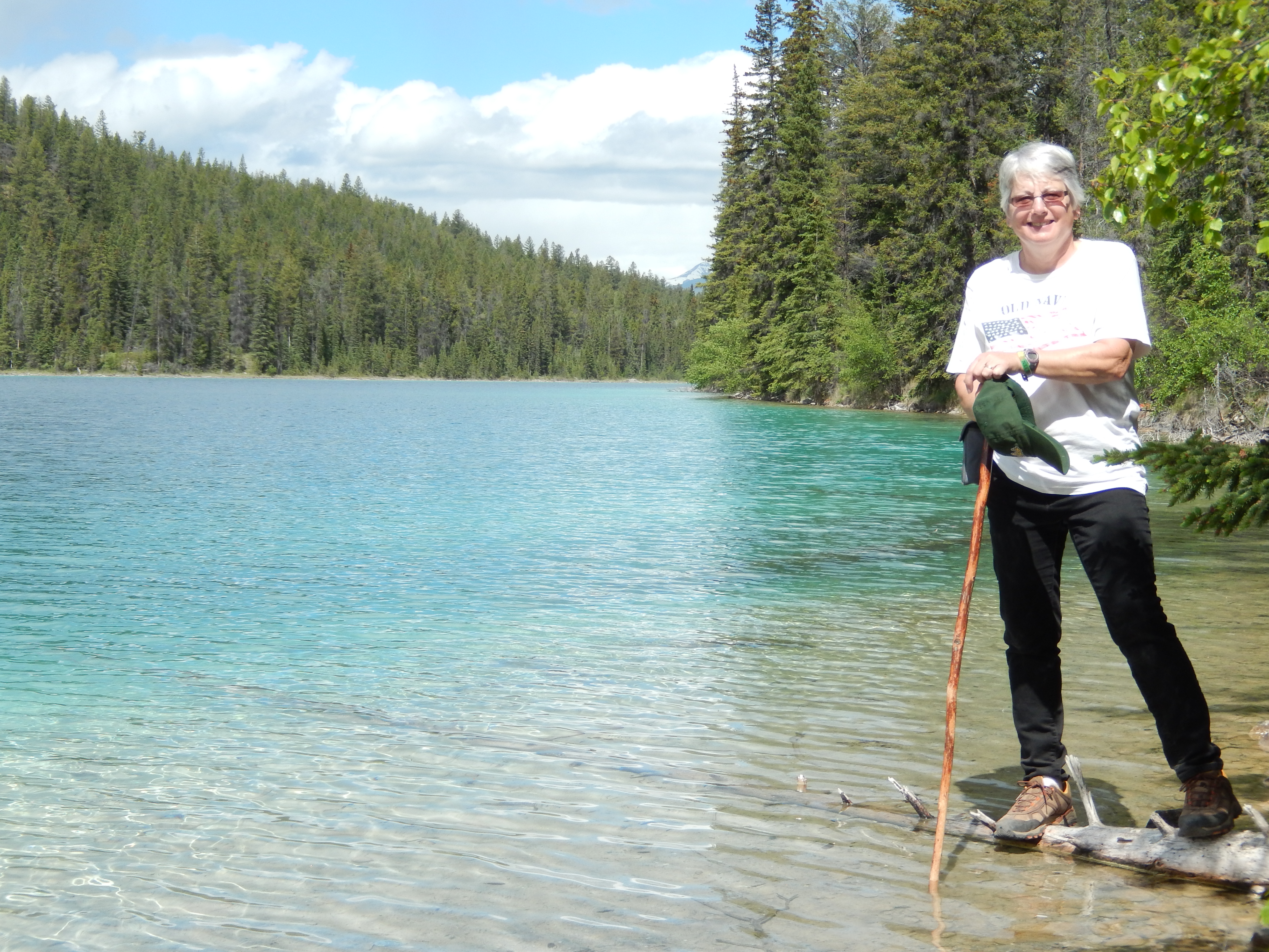
blue turquoise, caused by the glacier runoff. The temperature was cold, but at least it was dry, and low clouds covered the mountain tops. As the day went on, the sky started to clear, but we were still frustrated by low clouds preventing us from seeing the tops of the mountains. The trail was occasionally covered by snowfields that were tricky to cross. At one point we saw a father carrying his son in a backpack desperately trying not to slip and slide as he traversed the snow. DSCN1139At one point the trail hugged the side of a cliff that had cable attached to the cliff face to use as a hand rail. DSCN1179
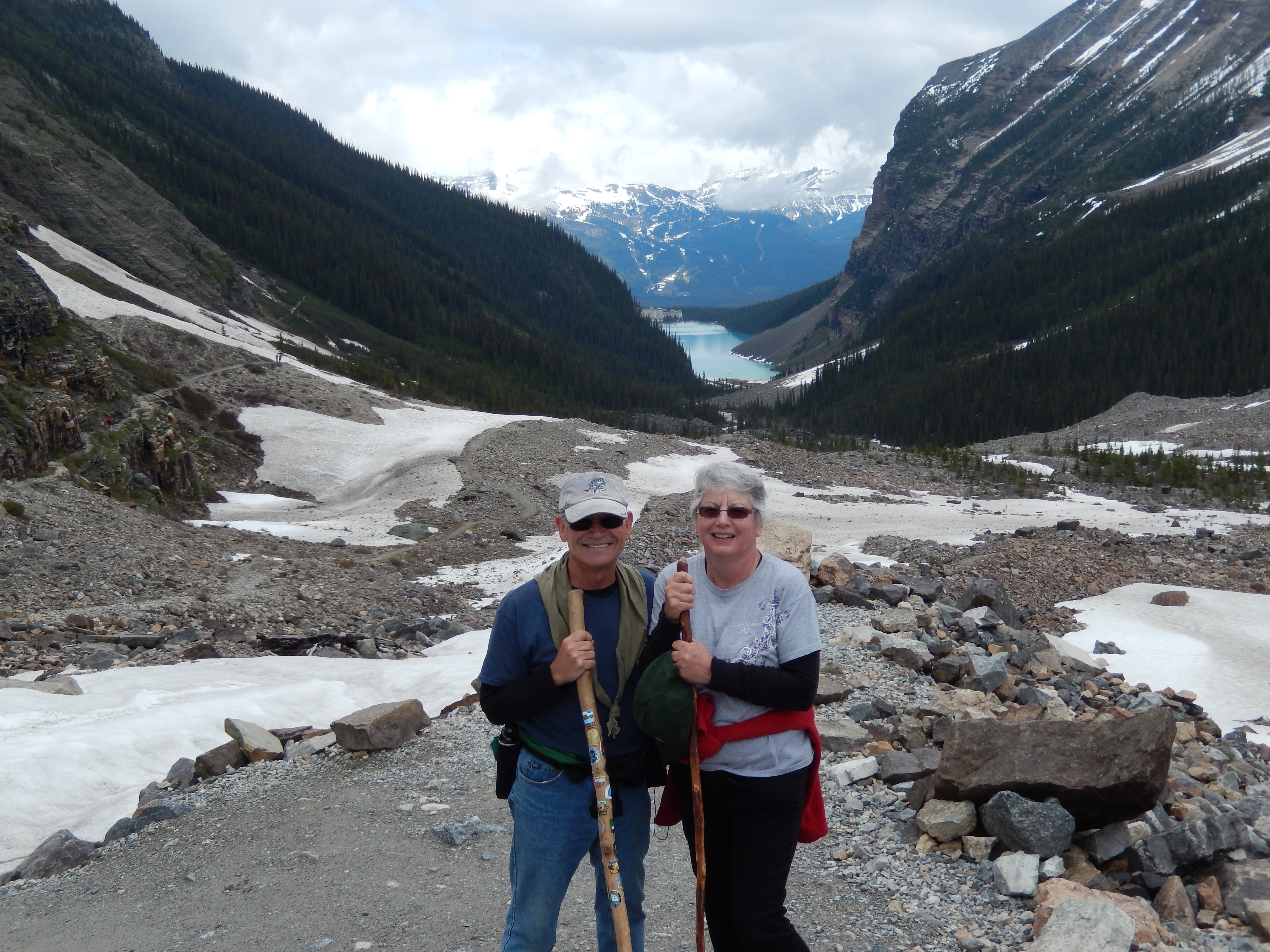
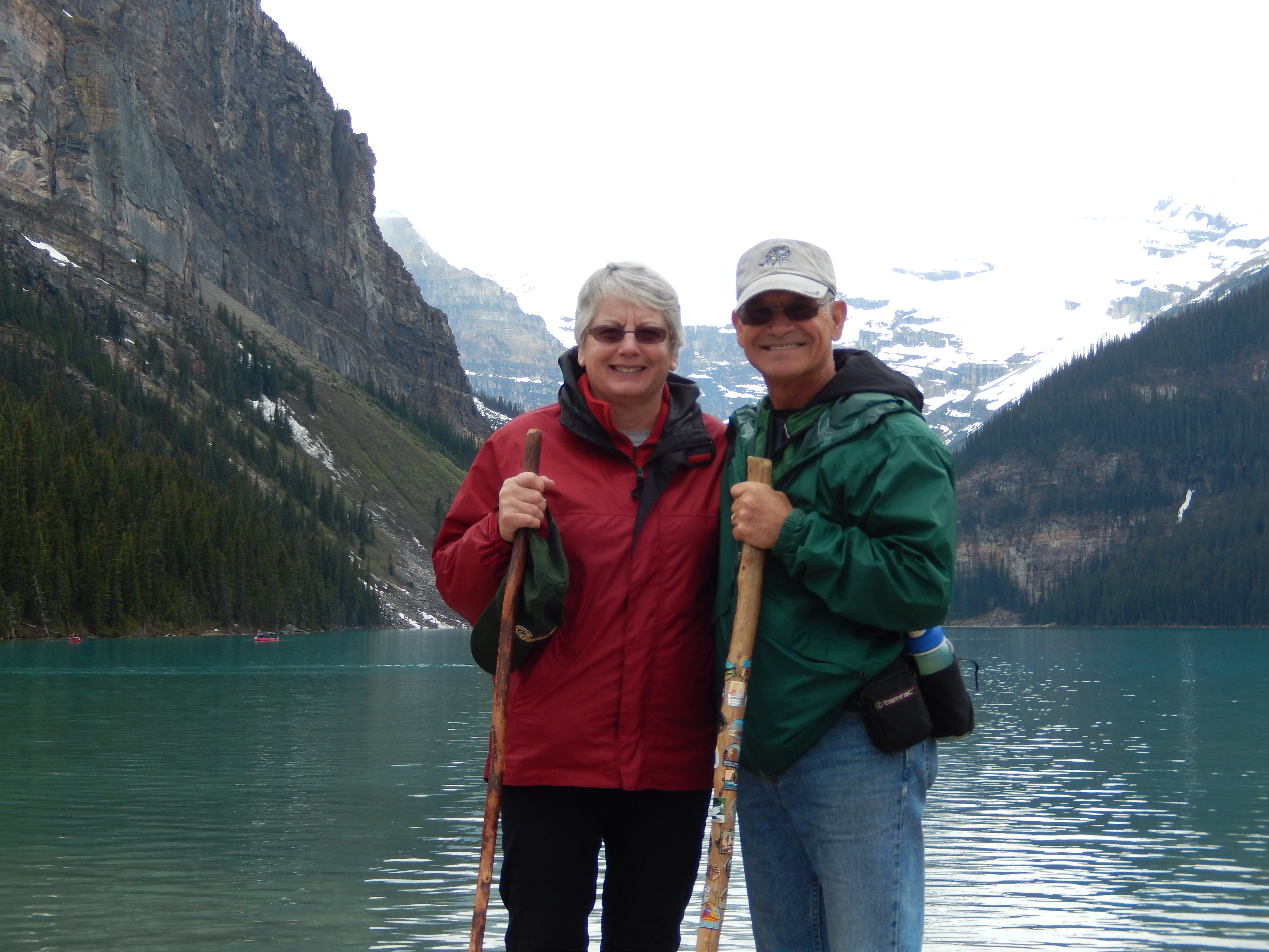
Needless to say we found the trail to be challenging. About three and a half miles up the trail we got to a point where we had a clear view of both the Victoria Glacier and Lefroy Glacier, and we decided to head back to the trailhead. On the way back we actually saw a small avalanche!

DSCN1182At the foot of Lake Louise DSCN1181we wandered through the lobby of the Chateau Lake Louise. If you are looking for a very upscale place to stay, this is it!

We woke up to sunshine! After so DSCN1205many days of dark skies, DSCN1219
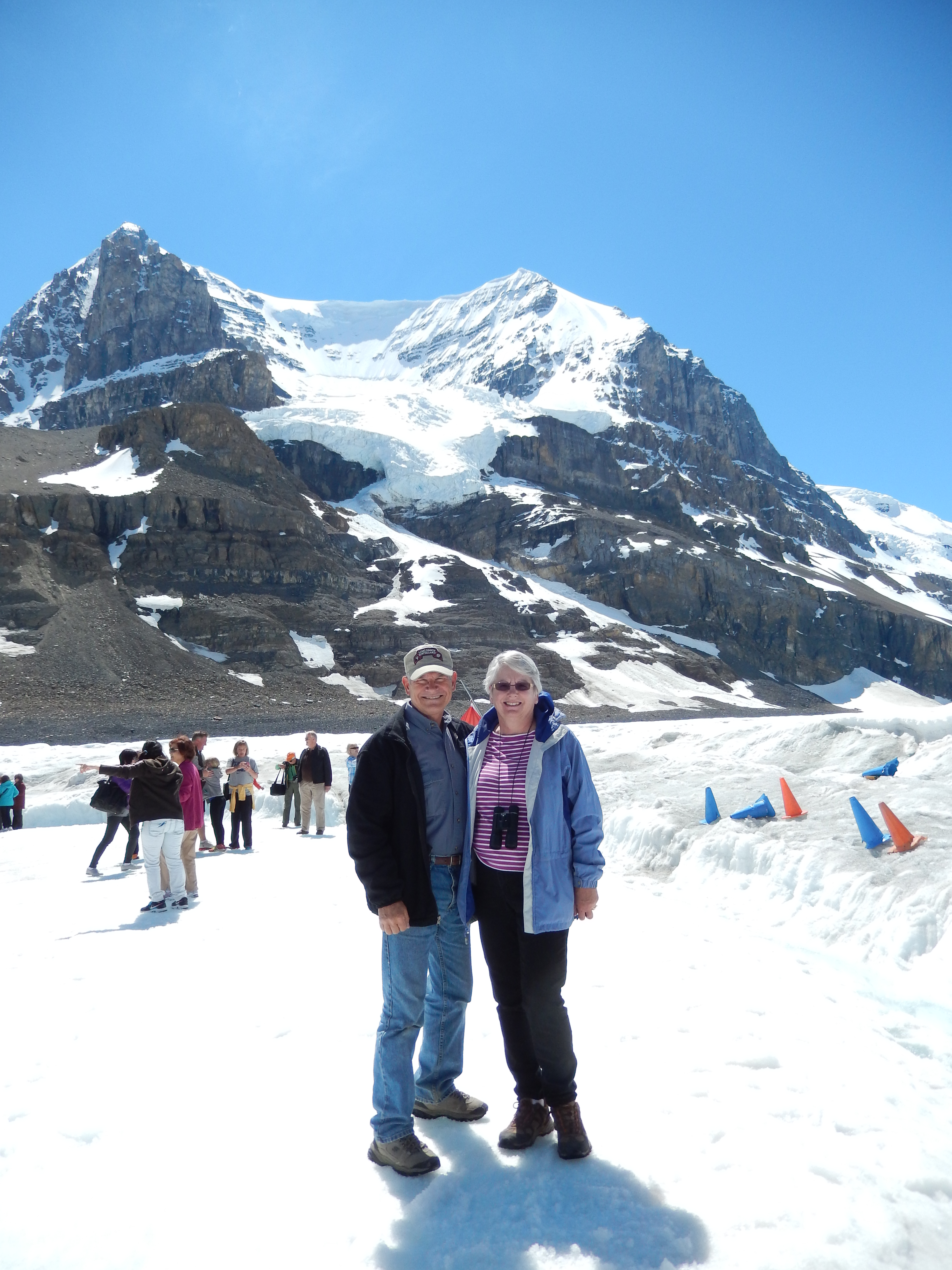
it was glorious. We took a short drive to Lake Louise to get some final pictures with the mountain tops silhouetted against a clear, blue sky. We considered a stop at the Columbia Icefield Discovery Centre an essential part of the trip. We drove up the Icefield Parkway to the Centre and then we were driven onto the Athabasca Glacier in a six-wheel Ice Explorer bus. This is the only way we could get onto an actual glacier, as normal hikers cannot go onto a glacier unescorted. There we were, standing on 900 feet of ice that had been there for thousands of years – what a feeling!

Jasper MapAfter setting up in Whistler’s DSCN1232Campground at Jasper National Park, we drove into Jasper to get more information from the Visitor Centre. We signed up for “Jasper, A Walk in the Past.” This is a walking tour of Jasper, led by a guide from Friends of Jasper National Park. It was interesting to hear how Jasper turned from a stop on the railroad where trappers and miners would get supplies into a town of 5,000 in the winter and 20,000 during the summer. One of the oldest buildings was the Visitor Centre which was originally the Park headquarters and residence of the park superintendent. One story is that he would sit outside with his wife and shoot at any animals disturbing his garden with his shotgun. Our guide also pointed out the high fence that surrounded the elementary school. She said it was not to keep the children in, but to keep the elk out and it was not unusual to find elk grazing on someone’s front lawn.

The next morning we had plans to hike a trail near Patricia Lake, but found out the trail was closed due to grizzly bear activity. Back in Michigan we never had to worry about elk grazing on our front lawn and grizzly bear roaming the woods 2-3 miles from downtown. Life in Jasper is certainly interesting!

DSCN1246During WWII there was a top secret DSCN1272project called Project Habbakuk to build an aircraft carrier made of ice. The prototype was built on Patricia Lake and was allowed to sink after the project’s completion. I was hoping to spot it from the surface while kayaking. Besides what better place to go kayaking with my wife, Patricia? The weather couldn’t have been nicer. We also paddled on the nearby Pyramid Lake, the reflection of the mountain on the still surface of the lake was like a picture.

DSCN1294I could spend a month here, but it was our last day in the park. We drove south of town to hike the Valley of the Five Lakes. The weather was wonderful, sunny and warm. The trail was an easy one after the last few hikes with only a elevation gain of 396 feet. The lakes were beautiful and made the hike that much more enjoyable.

I am posting this from the Jasper Municipal Library as we don’t have internet access with our mobile hotspot. We leave tomorrow morning for our 320 mile sprint to the starting line for our RV Caravan to Alaska. Next stop Milepost Zero RV Park in Dawson Creek, BC.

Because we will be traveling more than normal I will be changing the format of my posts to more of a diary or journal and will post whenever we get the opportunity. I hope you will “join” us on our Alaskan adventure.

Posted in Alaska RV Caravan, Canada, Fulltime RV, Michigan Traveler | Tagged , , , , , , , , | Leave a comment

Salt Lake City, UT – May-June 2014

SLC MapWe arrived at Cherry Hill RV DSCN0926Park in Kaysville, UT on April 29th. We choose this park because it is only about a mile and a half from our son’s house. Spending time with his family was our primary purpose for our stay in the Salt Lake City area and this was about as convenient as you can get. Cherry Hill operates a water park as well as the campground. It is a nice place to stay and the monthly rates make it very affordable. The park gets very busy on the weekends, but we never felt cramped or overwhelmed by the activity. While your camping fee does not get you into the water park, there is a playground and pool that are open to campers at no additional fee. This was nice for our granddaughters when they stayed with us.

I never considered Utah as a place to go SCUBA diving, but the Salt Lake area offers some unique diving sites. Scott and Sandra thought we should check out the Bonneville Seabase. Our first Saturday in town we left Pat to play with the girls while the three of us went diving. It was a unique experience as this is an excavation over a natural hot salt spring. You can dive in tropical conditions even in the middle of winter. They have constructed a shelter over the spring with areas to don your gear and walk into a tropical ocean setting, with tropical fish, including a shark. They feed the fish at 8:00 every morning and you can buy lettuce to feed the fish while you are diving. There are three lagoons that are connected by underwater tunnels, so you have a fairly large area to swim in. Unfortunately the visibility was only about three feet so I didn’t have much luck with underwater photography, but it was a fun dive.

In addition to seeing family, we were making our final preparations for our RV caravan to Alaska. This included getting wheel bearings packed and brakes inspected on the trailer and scheduled services performed on the truck. Fortunately we were within a short drive to Young Buick/GMC and the Kaysville Camping World, so it was a simple matter of making appointments and getting the work done. We also made the local AutoZone happy with our purchases of spares and lubricants to take on the trip.

DSCN0762We were able to have the girls join IMAG0051us in the campground on the weekends, when they didn’t have school. They were a joy to have around. I think one of their favorite activities is “dress up,” with some Halloween dresses we bought a couple of years ago. We would play at the local parks, the playground and pool at the campground. They enjoyed helping Pat with meals and going geocaching with me. We spent a lot of time finding geocaches in the area, often combining our caching with a bike ride. Sometimes they had the sharpest eyes and found the cache before I could.

We were able to have the whole family out to the trailer for dinner at least once a week as well. It was great to have them all together and have a relaxing time to enjoy each others company.DSCN0810

On Memorial Day, we attended the ceremony at the cemetery in Farmington. After the ceremony by the local American Legion Post we wandered through the cemetery looking at the gravestones. It was interesting to see some of the older Mormon grave markers showing several wives and one husband.

DSCN0797Hill Air Force Base offers a DSCN0798bowling special and we took advantage of that one Saturday. We all enjoyed the pizza and pop while bowling. The twins actually did pretty good, although they do have the benefit of having bumpers in the gutters!

DSCN0822We offered the girls a trip to DSCN0832the new Museum of Natural Curiosity for their birthday gifts and they jumped at the chance. The museum was HIGHLY interactive and great fun for all of us. In the Rain Forest they climbed on a huge, multi-layered spider web and DSCN0870climbed through pitch black tunnels. The Water Works has all kinds of displays to change the course of water, be in a virtual tornado, see how earthquakes destroy DSCN0840
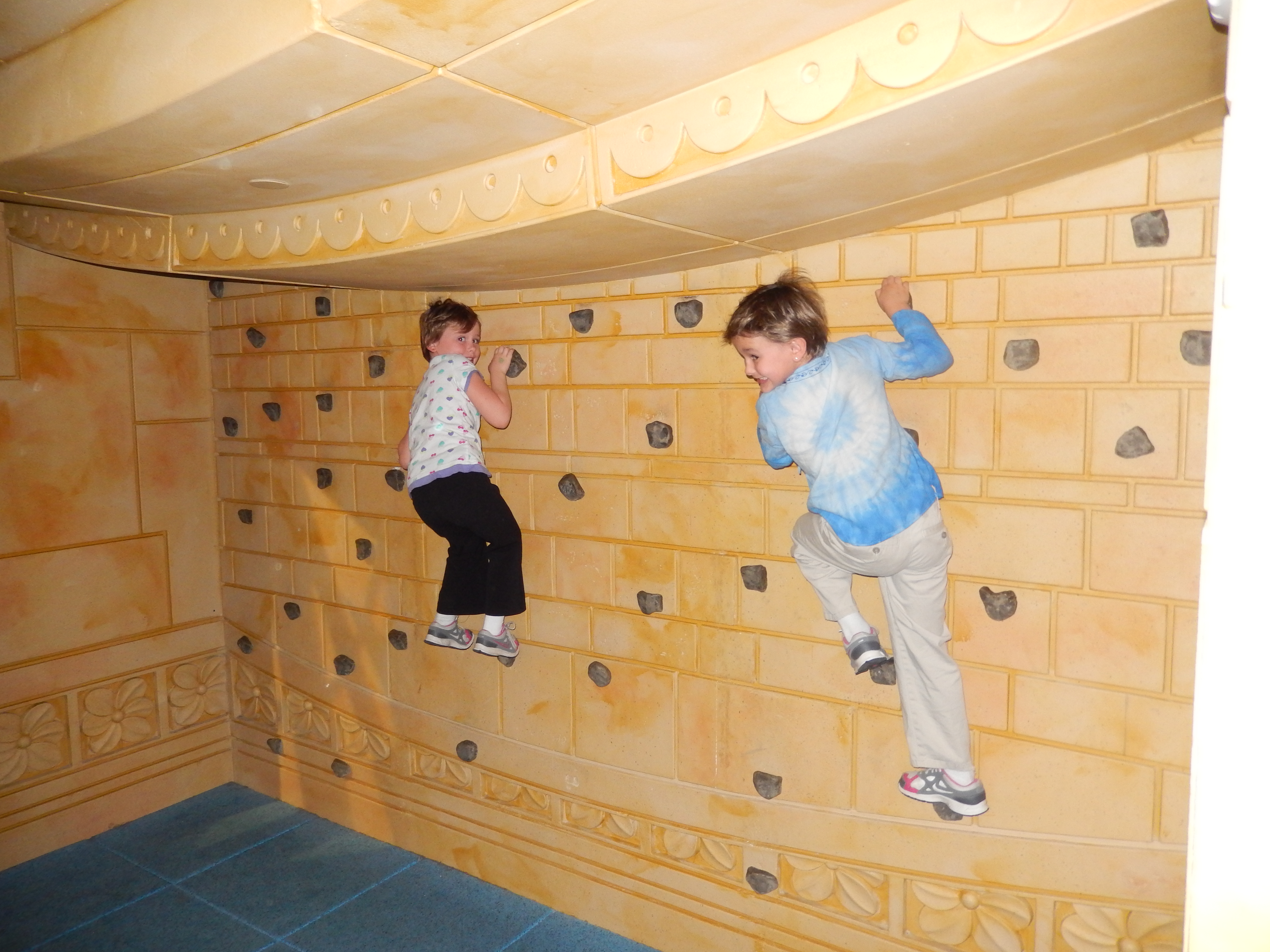
buildings, and much more. They had a chance to be bankers, act in plays, build bizarre shapes from blocks, and play electronic instruments in the Town of Kidopolis. After a picnic lunch, DSCN0848a walk through the outdoor maze and aquarium, brought us back inside. Our final stop was the Innovation Gallery where kids who had never met each other turned into a “flash mob” to build a wall almost the length of the room. This room is totally unstructured to allow the kids to use their natural creativity and curiosity with the materials available.

DSCN0885Starting on Memorial Day weekend IMAG0059the girls were able to use their season passes to Lagoon, a local amusement park that includes a water park. Pat and I also got season passes so we could take them as often as we wanted. One of the advantages of being an “official” senior citizen is my pass was half price! Lagoon was a popular activity, we were there every weekend. The rides and the water slides were fun for all of us and the girls never seemed to run out of energy.

DSCN0899One afternoon we picked up DSCN0898Katrina from her library program and took her out for dinner and to watch the Mormon Tabernacle Choir practice. The choir practice is every Thursday night and is open to the public. This was certainly not your normal church choir practice as there are hundreds of singers and a full orchestra. Katrina enjoyed the performance a lot. I am always amazed at the professionalism of the Tabernacle Choir. I would hear them sing a selection, thinking it was perfect and wonderful, and yet the choir director would stop them to point out how it could be done better and go over specific parts that needed work.

DSCN0914June 7th was the twins’ birthday and a local geocaching group was having a flash mob event at a local park. We played in the park playground until the scheduled time, then we all rallied at the appointed spot. The organizers asked who had a birthday and we thanked them for organizing this event just for the twins. They enjoyed having “Happy Birthday” sung to them by a bunch of strangers!DSCN0923

That afternoon the girls all helped bake the birthday cake. We all (Pat and I, Scott, Sandra, and the girls) went out for dinner then came back to the trailer to open gifts and have cake and ice cream. What a great celebration! Pat and I were happy to be a part of it.

All good things must come to an end. Sunday evening, we had everyone over for one last dinner together, finished off the remaining cake and ice cream and said our goodbyes. We are already looking forward to our return in October.

Monday, June 9th, we pulled out early in the morning to start the trip to join the RV Caravan in Dawson Creek, BC. We’ll have stops in Glacier National Park in the US, then Banff and Jasper in Canada before we arrive at Dawson Creek.

Posted in Fulltime RV, Michigan Traveler, Utah | Tagged , , , , , , , , , , | Leave a comment

The RVers Prayer

The RVers Prayer

God bless our traveling home

and guide us where ever we roam.

Help us to find the roads we seek

and please don’t let the plumbing leak.

Save us, please from engine trouble,

and mechanics who would charge us double.

As we travel on our way,

bless us with sunshine every day.

And while you’re watching over all,

could you let fuel prices fall?

Lead us toward good food and friends,

and when at last our journey ends,

Grant our rolling home sweet rest,

until the next endurance test.

IMG_4103


Posted in Fulltime RV, Michigan Traveler, Sayings Found on T-Shirts and Coffee Mugs | Tagged , , , | 4 Comments

Arches National Park, Moab, UT – April 2014

Arches NP MapWe arrived in Moab, UT on Thursday, April 24th and were surprised what a bustling town it is. When Pat was checking on grocery stores in the area, she only found two and we thought we would find a very small town. It turns out that Moab is a center for various high-adventure activities; four-wheel off-road riding, hiking, dirt biking, rock climbing, and skydiving to name a few.DSCN0634

The area is very popular for these activities and the campground at Arches National Park and nearby Bureau of Land Management (BLM) campgrounds were all full. We were able to get reservations at the Slick Rock RV Park, only a short drive from the park entrance. Throughout the RV park you could see four wheelers, dirt bikes, and other off-road vehicles.

DSCN0628We went over to the National Park Visitor Center to see what guided tours were available and pick up some maps. They had some very interesting video presentations that described how the arches were created in an easy to understand manner. I found the display on the roles of park staff and the tools used in their jobs to be particularly intriguing.DSCN0631

On the drive back to the campground I pointed out where a geocache was at the top of a huge sand dune, and Pat suggested that I go for it. I started climbing the hill and quickly found out how steep and slippery the sand was – Wow! What a climb! Once I made it to the top I found the cache and realized I probably could have taken an easier route if I had taken the time to plan it out.

As always, I checked out all of the potential geocaches in the area and there was a lot of them! I decided to combine my run the next morning with geocaching and I was able to locate four of the five on my list – a good start to the day!

On Friday Scott and his family arrived. DSCN0648We got the girls set up in the trailer then helped Scott and Sandra get their tent set up. In the afternoon we drove into the park to see the sights. Visiting a park like this with three girls, six and nine, was different from the easy pace we normally take.   Rather than leisurely strolling around and reading every interpretive sign, as soon as they were out of the car the girls were off to the races. Running down every trail, climbing on every boulder, and trying to climb to the top of every cliff – just one big energy burn, and we loved it!

DSCN0655We stopped at almost every arch and DSCN0654rock formation, the Organ, Courthouse Towers, Tower of Babel, Petrified Dunes. It wasn’t until we got to Balanced Rock that we stopped for awhile. There were some rock climbers doing their thing. I think that everyone found it interesting, but Scott and I were the ones most engrossed in watching them climb.

DSCN0675The next morning was cool and rainy, so our first stop was the Visitor Center. Pat and I had another chance to look things over, but now we were able to share the DSCN0679
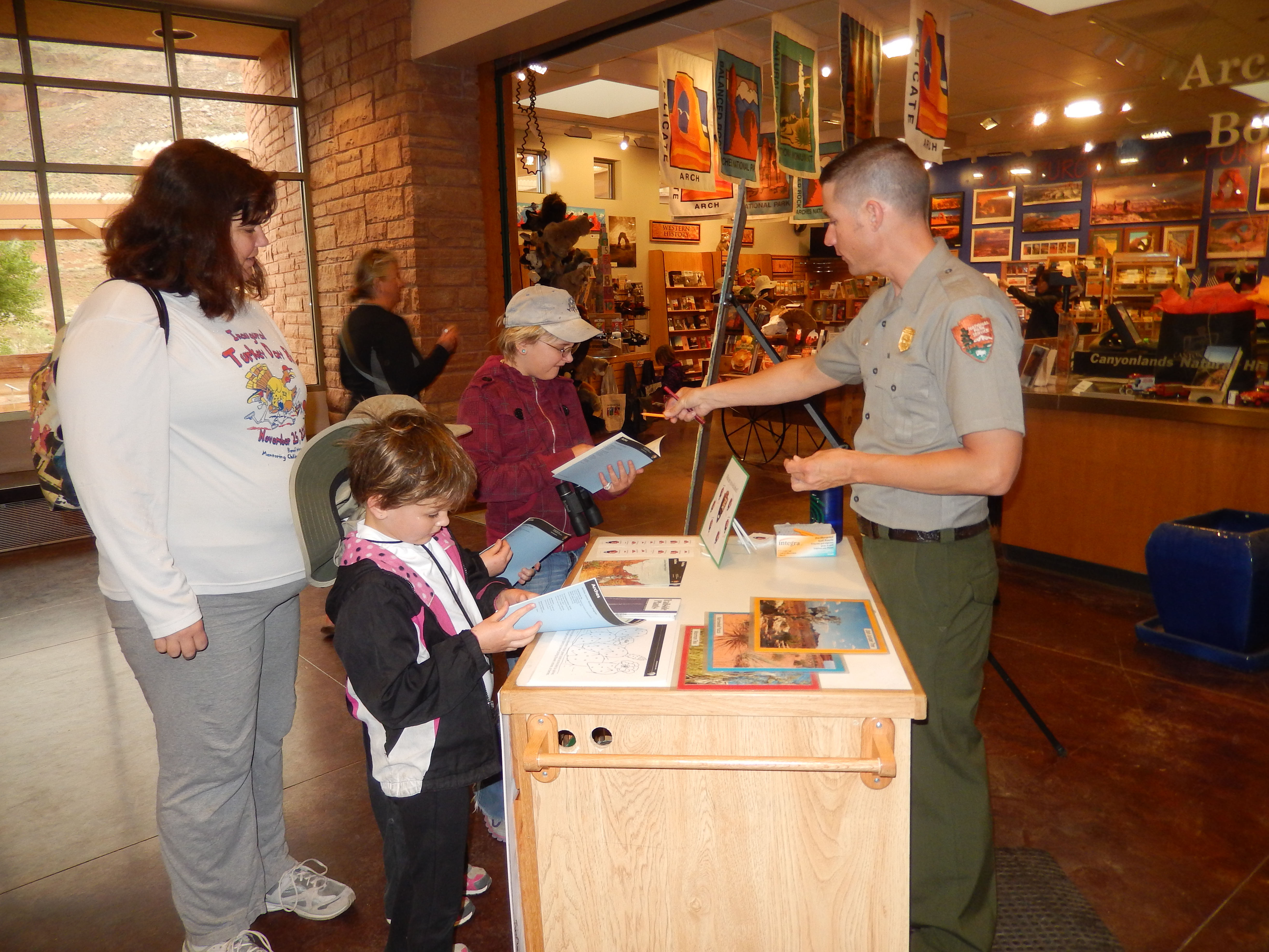
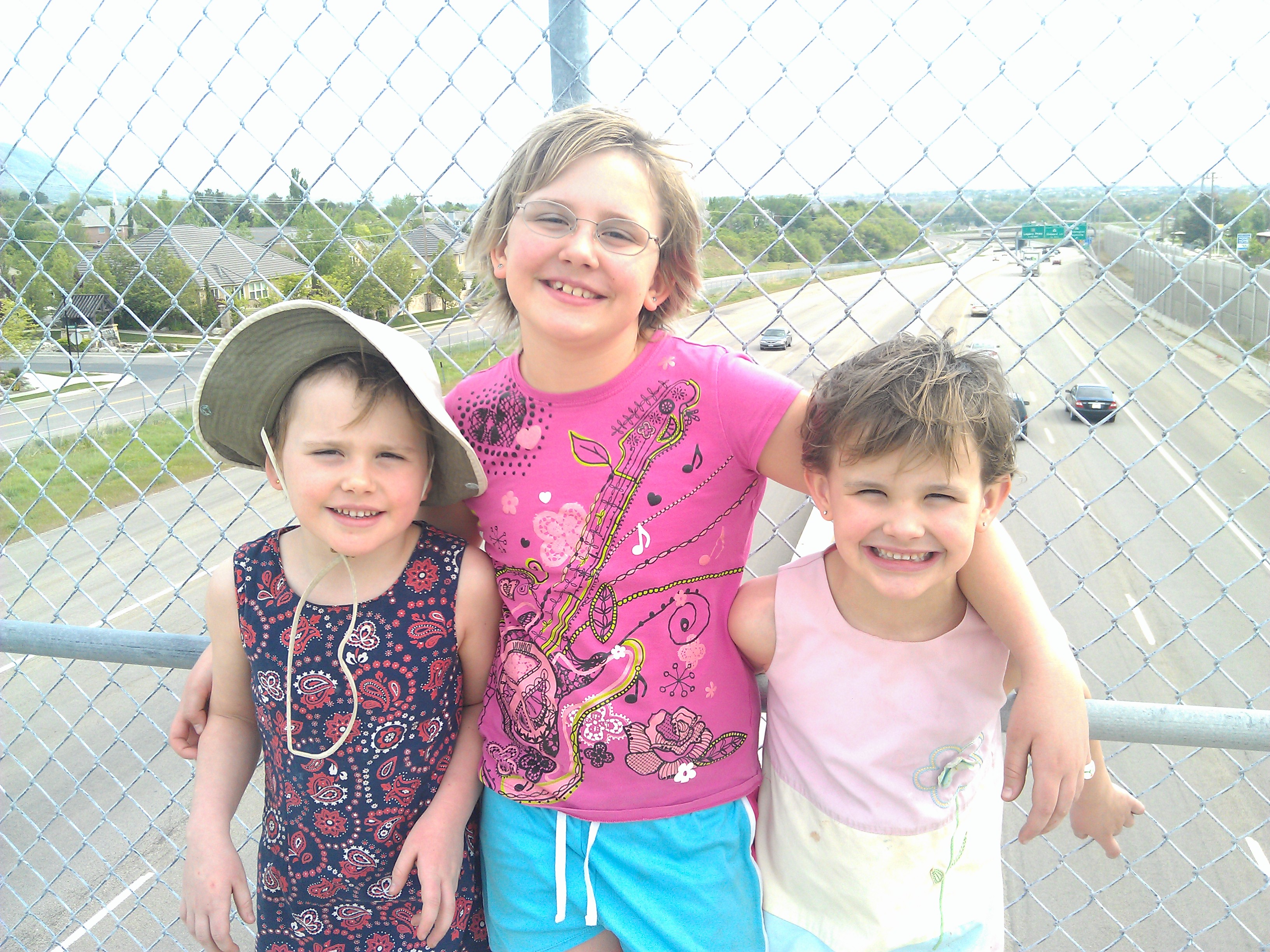
excitement with our granddaughters. They picked up their Junior Ranger booklets and were starting to check off the requirements before we got back to the car. I hope whoever created the Junior Ranger Program got a promotion, because this is a great way to get children interested in the education aspect of the National Parks.

DSCN0702
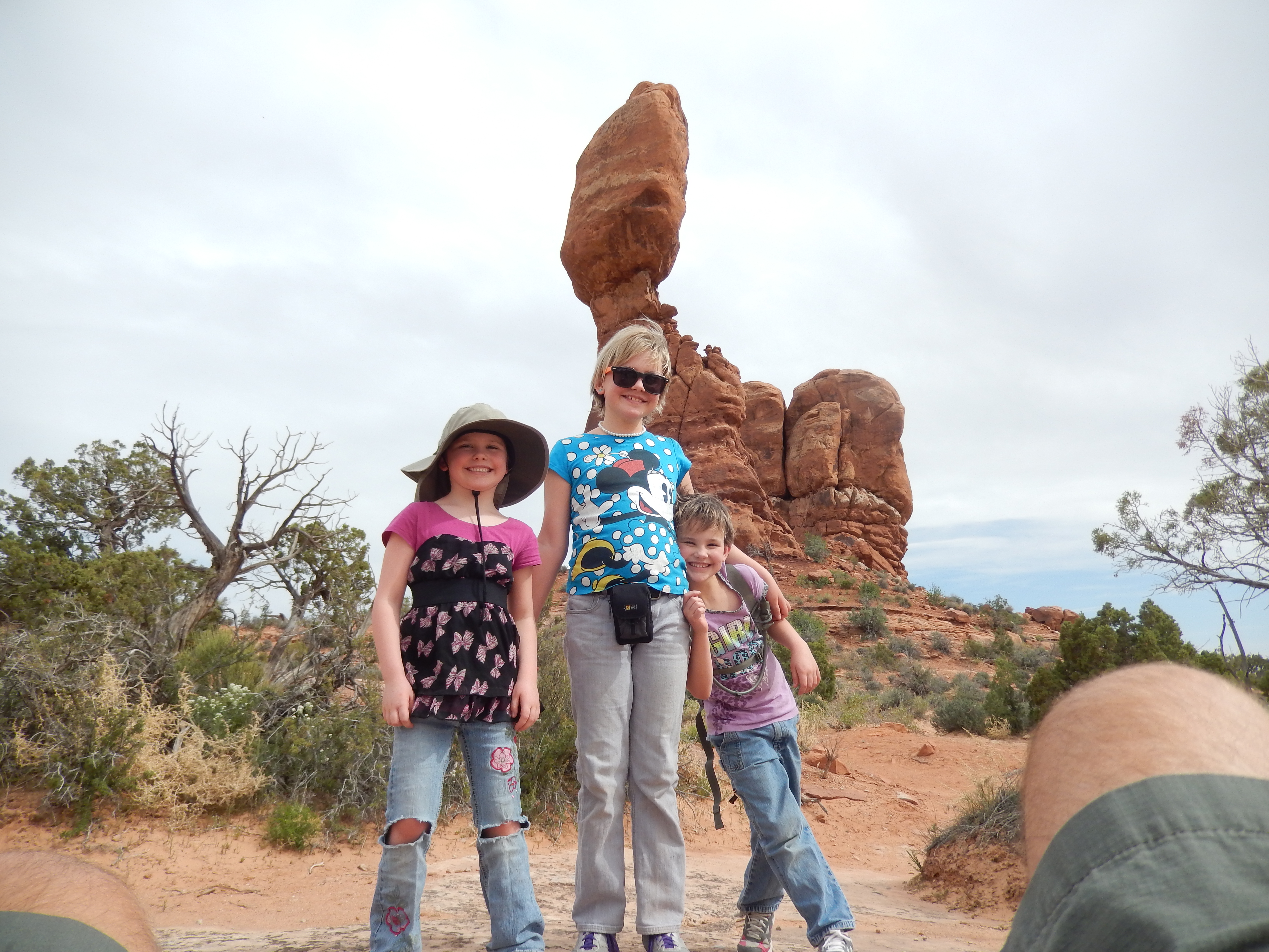
From the Visitor Center we drove to see the Garden of Eden and hiked the area called the Windows to see the Cove of Caves, Double Arch, North and South Window, and the Turret Arch. When the girls moved from DSCN0699Mississippi to Salt Lake with Sandra’s parents, they made a brief stop here. Katrina remembered seeing the Delicate Arch and seeing it again was her big priority. We all agreed that the hike all the way to that arch might be farther than we wanted to hike, so we were content to drive to the Delicate Arch Viewpoint, hike part way, then view it through binoculars.

DSCN0689We ate a picnic lunch in the amphitheater at the campground. From there we drove to Devil’s Garden. I’m not sure where the name came from, but there are a multitude of arches and different shapes and sizes. Of course, wherever there was a boulder or sand hill, the girls had to climb to the top!

On our last day in the park, the big event was the Ranger-led hike through the Fiery Furnace. If you ever get a chance to visit Arches National Park, I suggest that you make this hike through the Fiery Furnace a priority. Reservations can be made online, and should be made well ahead of time. It was the most excellent thing we did on this trip. DSCN0717
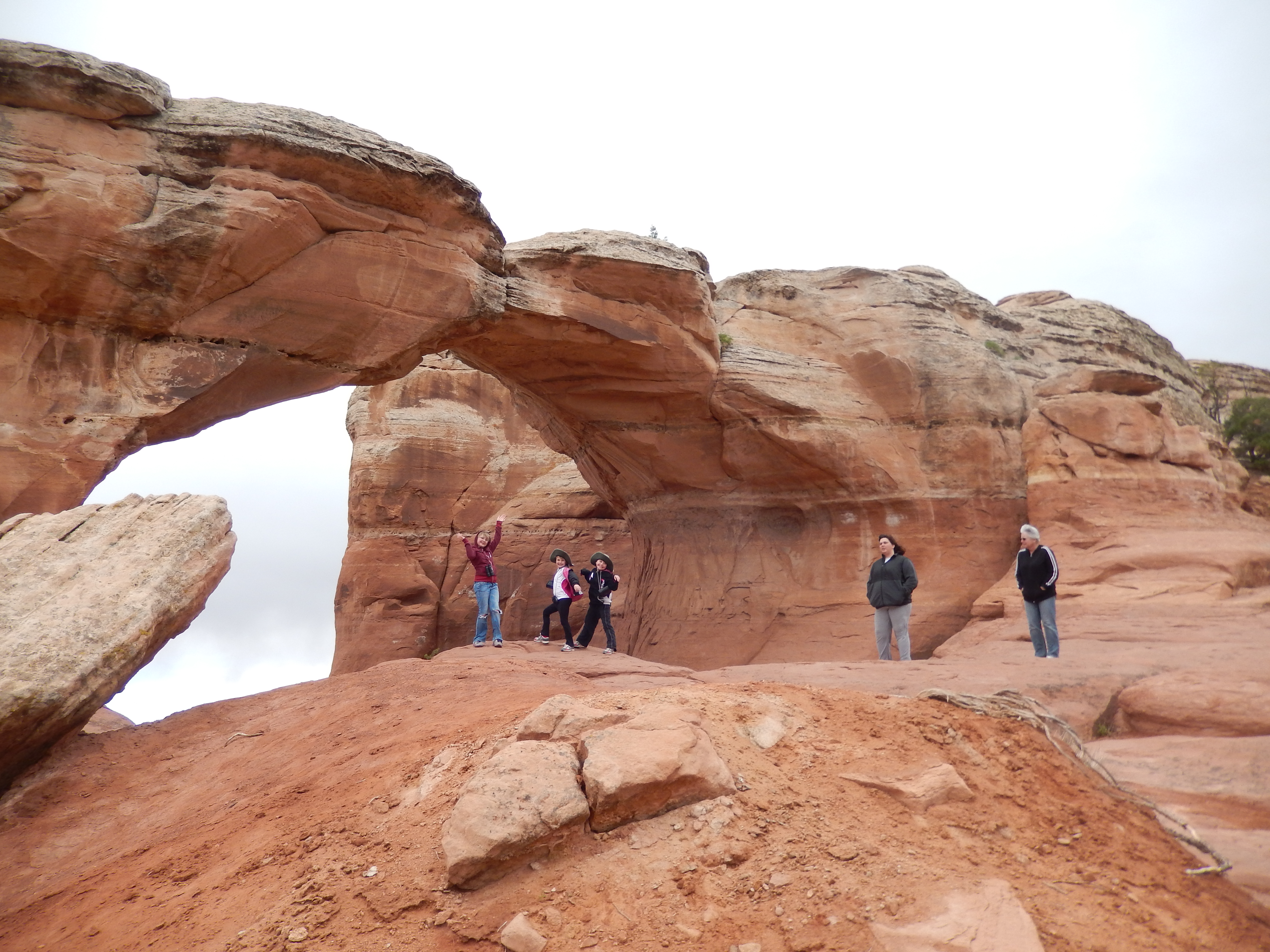
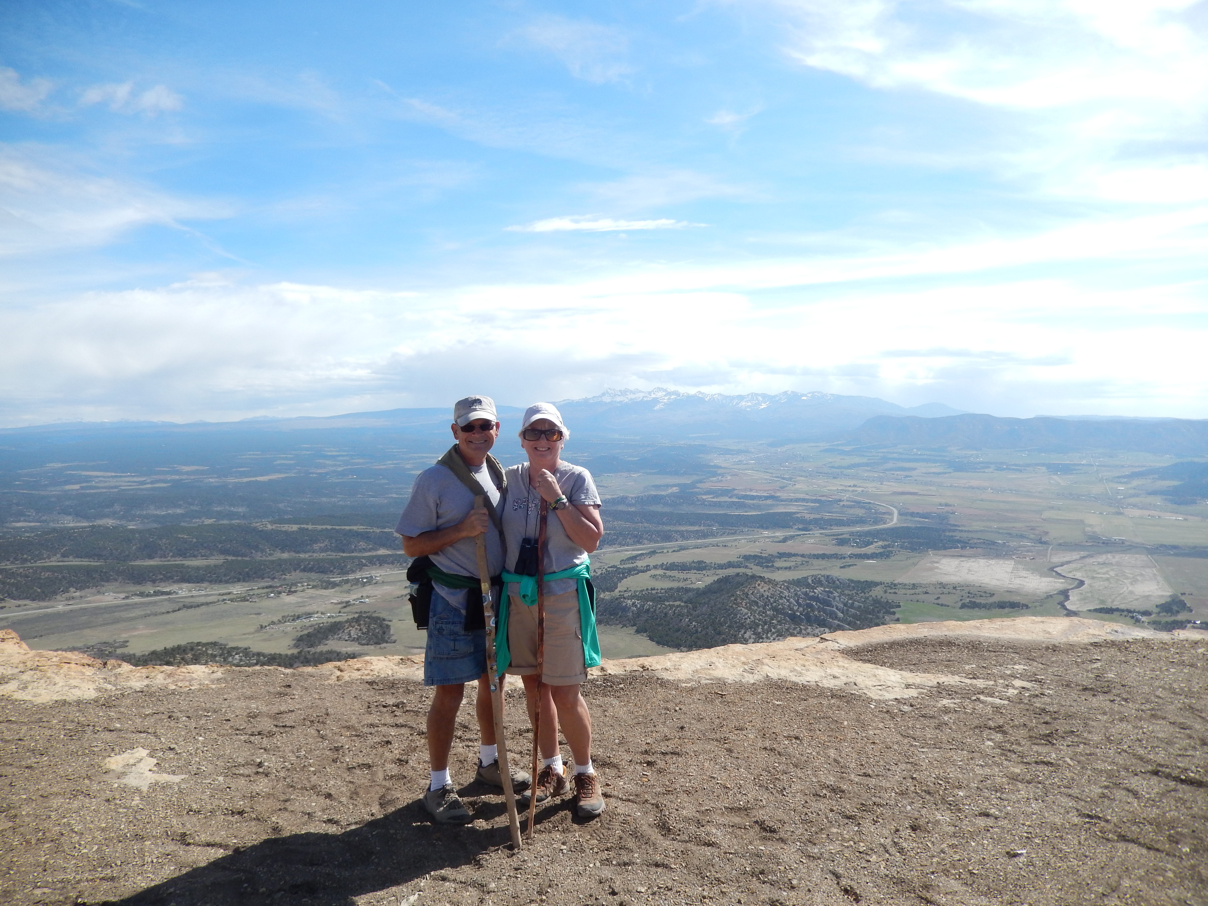
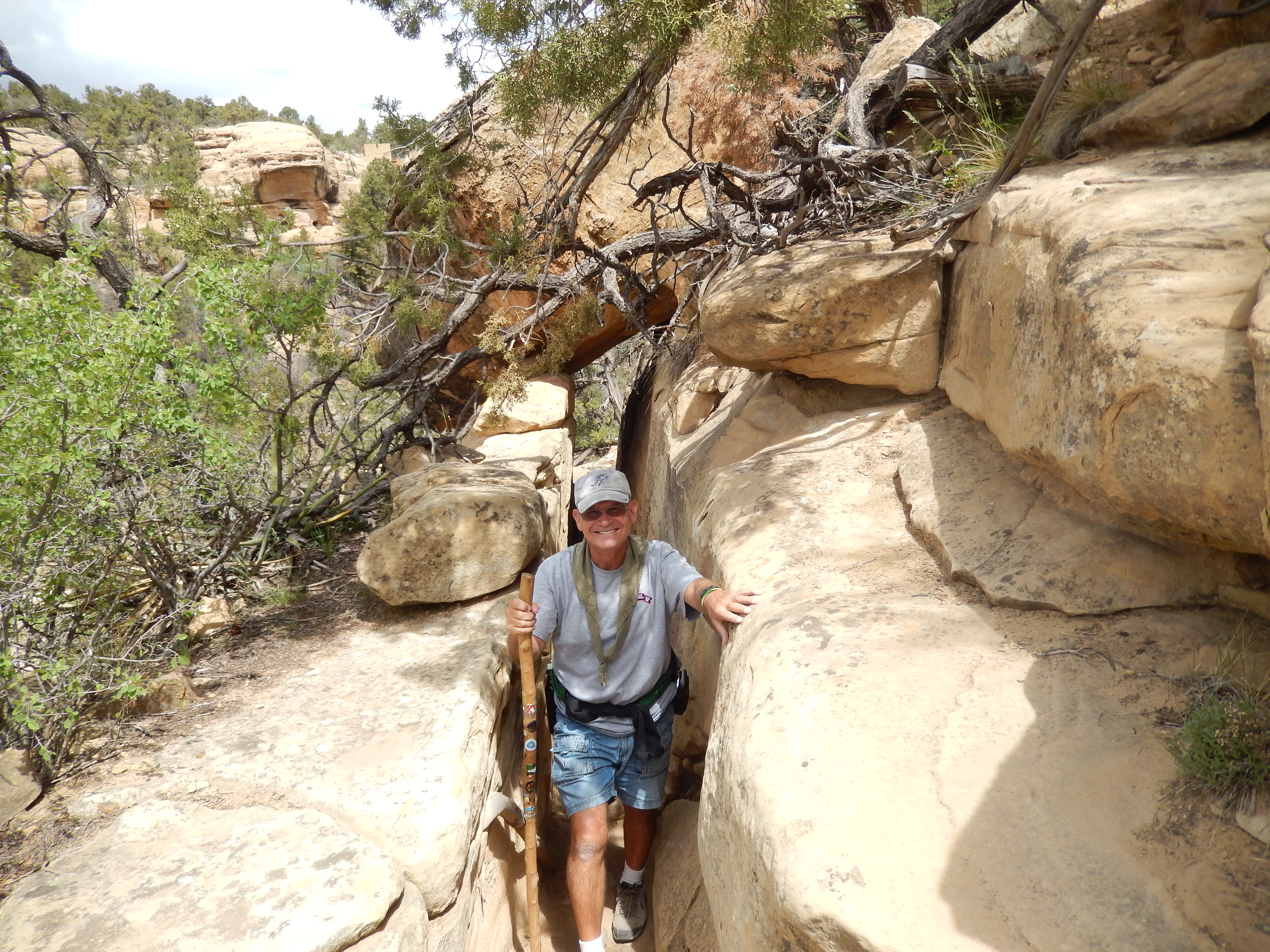
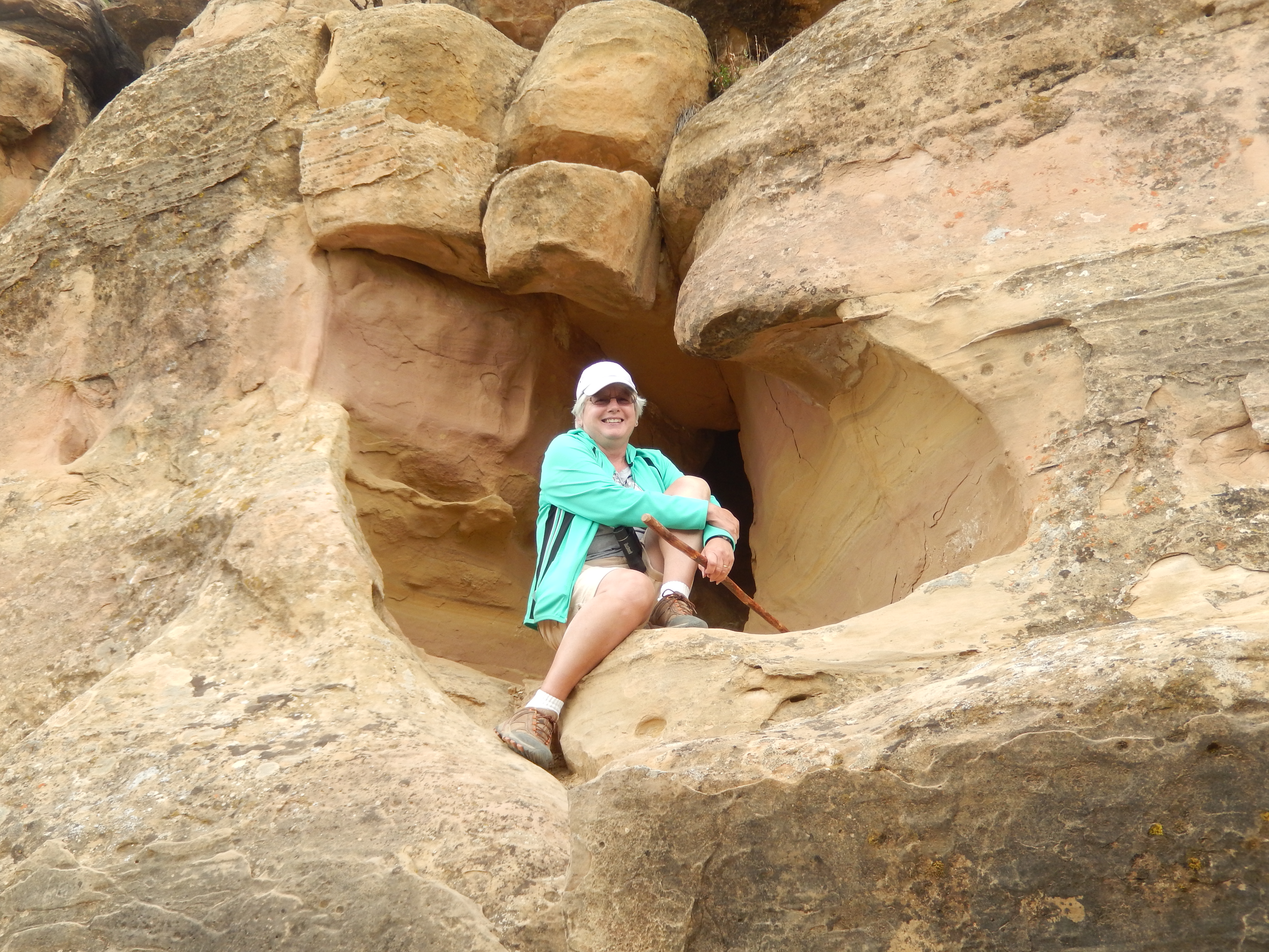
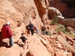
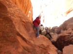
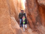
This hike takes you through a series of arches and passages where you have to crawl under arches, squeeze through tight passages, and stretch to cross over chasms in the rock. It was exciting for everyone. Of course, no matter how fast the pace may be, the girls were right at the head of the line! On our way out of the park, we stopped at the Visitor Center to have the girls’ Junior Ranger booklets checked and see them sworn in as Junior Rangers for Arches National Park.

Scott and family left early the next morning and Pat and I were able to have a lazy day. We visited the Castle Creek Winery and drove along the road that parallels the Colorado River so I could find a few more geocaches.

Tuesday, April 29th, we headed north for Salt Lake City.

Posted in Driving in Mountains, Fulltime RV, Michigan Traveler, National Parks, Utah | Tagged , , , , , , , , | 6 Comments

Mesa Verde, CO – April 2014

Mesa Verde MapMesa Verde National Park is in the Four Corners area of Colorado, so named because this is where the borders of Colorado, New Mexico, Arizona, and Utah meet. We arrived on Saturday, April 19th, before the true tourist season. The campground in the park was DSCN0448only open for primitive camping and none of their sites were large enough for our trailer. So we stayed at the Mesa Verde RV Park, a half mile from the Park Entrance. We were quite happy with our choice, as it is a very nice park and convenient to the National Park with a great view of Lookout Point.

DSCN0452The nearest town is Mancos and we found a Methodist Church to attend Easter Sunday services. It was interesting to attend services in such a small town and we were welcomed as though we were visiting relatives. That afternoon we drove to the National Park Visitor Center to get tickets for the Ranger-led tours as well as general information and maps for the park. We learned that the Ancestral Pueblo Indians settled in Mesa Verde (literally translated as “green table”) in about 550 AD. They lived on the fertile mesa top, often in clustered semi-subterranean “pit houses.” About 1225 AD they moved into communities built into the cliff alcoves. Around 1300 AD, they abandoned these dwellings and migrated south into New Mexico and Arizona. There is no evidence as to why they moved from the mesa top into the cliff dwellings and why they eventually migrated south.

DSCN0458The next morning we drove DSCN0464
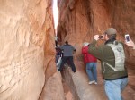
to the park to take our first tour of the day –
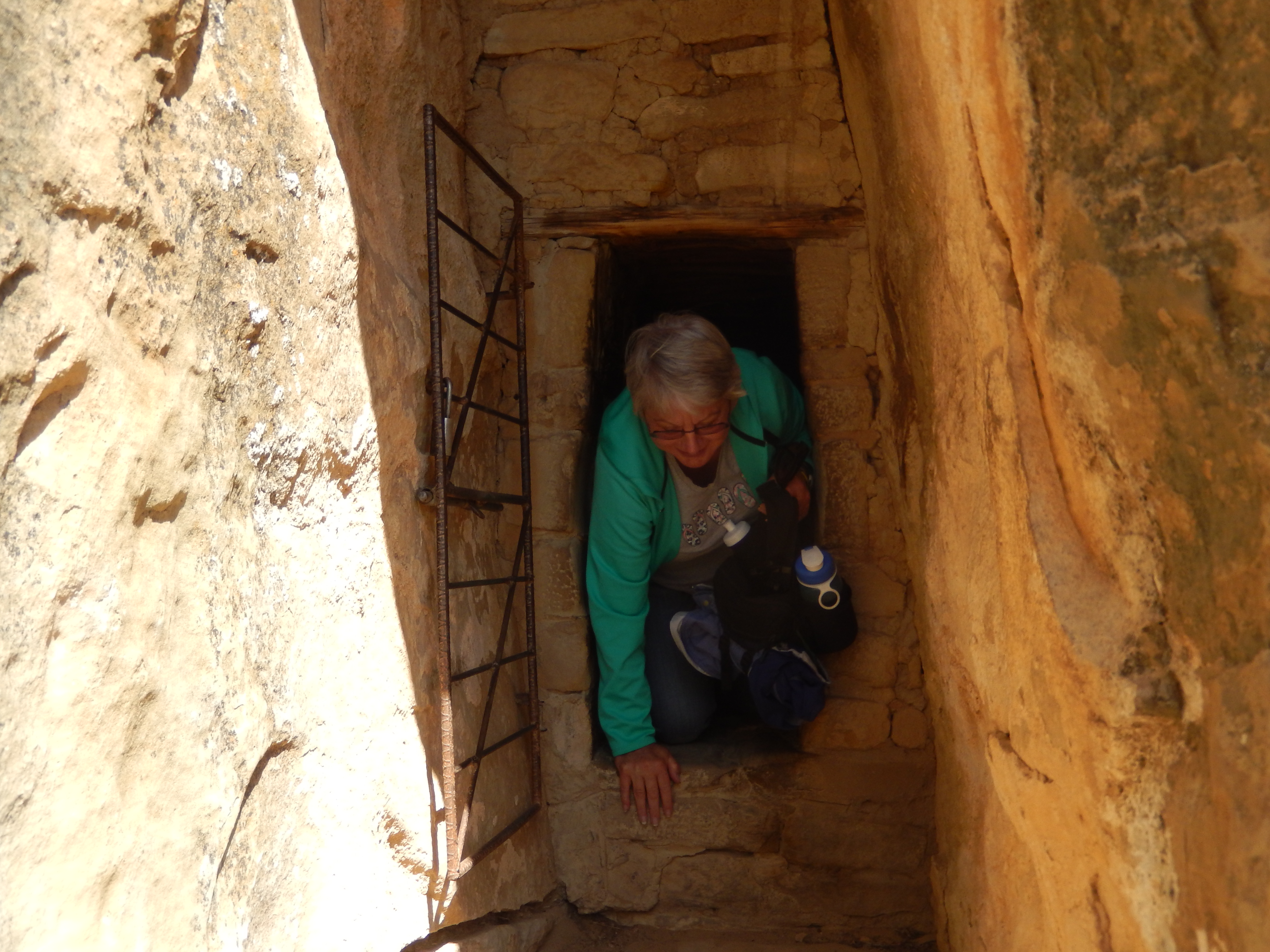
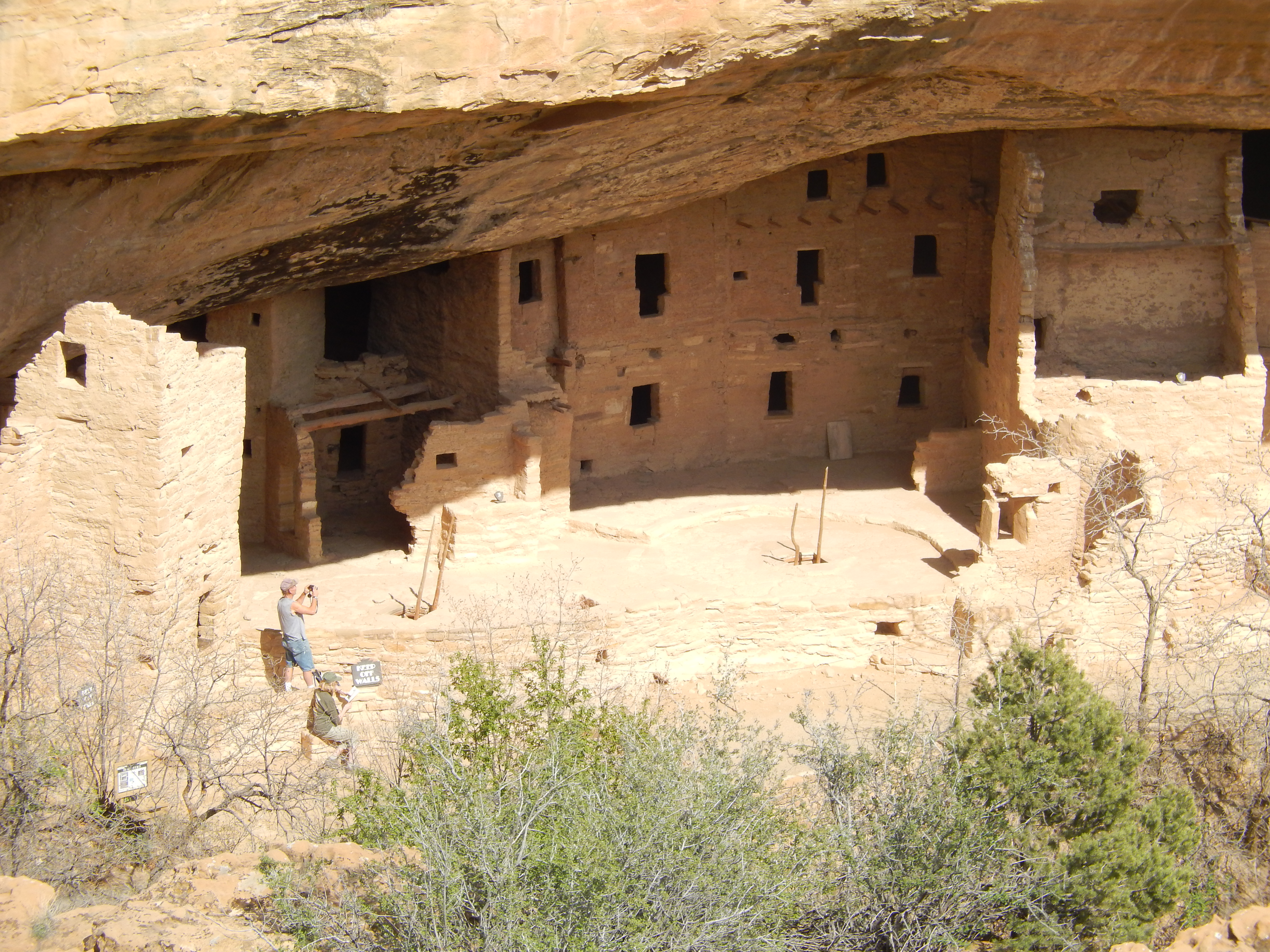
 Balcony House. This was an interesting cliff dwelling that has a balcony, protected by a wall along the cliff. None of the other dwellings we saw had such a wall, and it is a cause of much speculation among archeologists. Getting in and out of these dwellings was an adventure in itself. We had to climb a 32-foot ladder and crawl through an 18-inch wide passage to enter the site. To leave we had to climb an exposed cliff on ladders and a series of stone DSCN0481steps. The Ancestral Puebloans didn’t have these ladders and steps to assist them. The engineering technology and the difficulty of constructing these dwellings was truly amazing. These dwellings used stone, carved by hand with stone tools, yet the corners are as square as any modern building. The “kivas,” circular sub- subterranean chambers, reportedly used for social and ceremonial gatherings, were amazing examples of sophisticated engineering.

That afternoon we toured the Cliff Palace, DSCN0495the largest of the cliff dwellings. Cliff Palace contains 150 rooms and 23 kivas, and supported an estimated population of 100 people. It is thought that Cliff Palace was a social, administrative center with high ceremonial usage. The Ranger that led our toured encouraged us to challenge current theories about the Ancient Pueblo Indians. For example there is a structure in Cliff Palace called the “Head Man’s House,” but our Ranger commented that among the Ancient Pueblo Indians, the matron was the primary leader within the clans, and suggested that the “Head Man” may well have been a woman.

Later we visited the Chapin Mesa Archeological Museum. After seeing the remains of the culture it was interesting and enlightening to see how they lived, grew crops, hunted for game, and took care of their families. We saw how the use of hollow gourds developed into waterproof woven pots, and eventually to kiln-fired pottery.

DSCN0542Our next stop was to see the DSCN0538Spruce House. This is considered to be the best-preserved cliff dwelling in the park. It was one of the more interesting dwellings to visit as we were allowed to wander around the rooms with more freedom than in any of the other dwellings. For example, the Park Service has restored a kiva and you are allowed to climb down into it and get a sense of what it would have felt like to attend a meeting or ceremony in one.

DSCN0550Our final stop in a very full DSCN0558day was not a stop but a series of stops on the Mesa Top Loop Road. Along this route we were able to see twelve archeological sites that revealed a full range of architecture from the earliest pit houses to the latest cliff dwellings. It was interesting to see the progression of buildings and how later buildings were often constructed on top of earlier dwellings. The most fascinating site on the loop was Sun Temple. It was the last structure to be built by the Pueblo Indians. It contained nearly 30 rooms, but was never finished. There is no evidence that it was intended as a residence and archaeologists believe it was intended as a place of worship. We can only speculate why they put so much planning and effort into something like this and did not complete it.

DSCN0569Lookout Point is the most prominent terrain feature as you enter the park and we hiked over two miles (round trip) to the summit. We enjoyed what could be called the most spectacular view of the Montezuma Valley. We could look into four states from this point. DSCN0578Our next hike was the Petroglyph Point Trail. This is considered to be a challenging trail and it certainly was that. There were steep climbs and descents, as well as some narrow passageways that were a very tight squeeze. The views along the trail were absolutely fantastic. We could look across the canyon to DSCN0584see one cliff dwelling after another. DSCN0588I believe many people think there was one big village at Mesa Verde, but there are over forty documented cliff dwellings scattered around the edge of the mesa. At Petroglyph Point we observed these Puebloan carvings. An interpretive sign gave possible meanings of what the Ancient Pueblo Indians were trying to convey.

On our way back to the RV park we stopped at the Far View Sites, a mesa top farming community. Far View was one of the most densely populated parts of the mesa from A.D. 900 to about A.D. 1300. Nearly 50 villages have been identified within a half square mile area, and were home to hundreds of people. Here we saw five villages that had their own reservoir. While the dwellings were more advanced than the original pit houses, they were similar to what we saw at the cliff dwellings with blocks of connected rooms with centrally located kivas. It is believed that these people remained here while others moved into the cliff alcoves because of the fertile farming areas.

DSCN0614On our last day in the area I hiked the Knife Edge Trail. This trail follows the route of the original entry road into the park that was built by the Civilian Conservation Corps in 1914. The road proved to be difficult to maintain. At times it could only handle one vehicle at a time and was often closed due to landslides. It was abandoned when the Park Service built the Prater Ridge Tunnel. As I hiked along it I could imagine how difficult it was to maintain. While it was an easy hike overall, there were spots where the entire trail was almost covered with loose rock from landslides. I couldn’t imagine what it was like to try to drive a car along it! When I finished this trail, it was still early in the day so I hiked a portion of the Prater Ridge Trail as well. It was quite a steep climb to the mesa top, but the views of Morefield Campground and other areas of the park were worth it. Then the weather turned sour on me – cold, windy, and drizzling rain, and I headed back to our warm, dry trailer.

We departed Mesa Verde on Thursday, April 24th on our way to Arches National Park near Moab, UT. We were looking forward to meeting our oldest son, Scott, and his family there for a fun weekend.

Posted in Colorado, Fulltime RV, Michigan Traveler, National Parks | Tagged , , , , , , , , , , , , , | Leave a comment