
Big Bend National Park had been on my “to do” list for years. This year our route from Florida to Washington State made that stop possible. Big Bend is right on the Rio Grande River and shares a border with Mexico. Big Bend refers to the southwest Texas U-turn in the Rio Grande River – something that defines the park boundary for 118 miles. There are campgrounds in the park, but only one can handle a rig of our size. We were unable to make a reservation, so we had to stay in a commercial park, Big Bend Resort and Adventures, in nearby Terlingua.
If you plan to visit Big Bend, be prepared to do a lot of driving. The park covers a lot of ground, 1251 square miles, and some of the most direct routes are unimproved roads. During the four days we were there, we drove over 150 miles in the park.
Big Bend Resort and Adventures is as nice a park as you will find here. If you want big shade trees, green lawns and level concrete pads, you are in the wrong part of the country. This park is well organized, clean, and the staff was great.

We explored taking a raft or kayak trip down the Rio Grande, but discovered that the water levels were too low for that. In fact, the local raft companies had cancelled their one-day trips and only offered 2-3 hour trips. We decided that kayaking would have to wait until we found some good water.
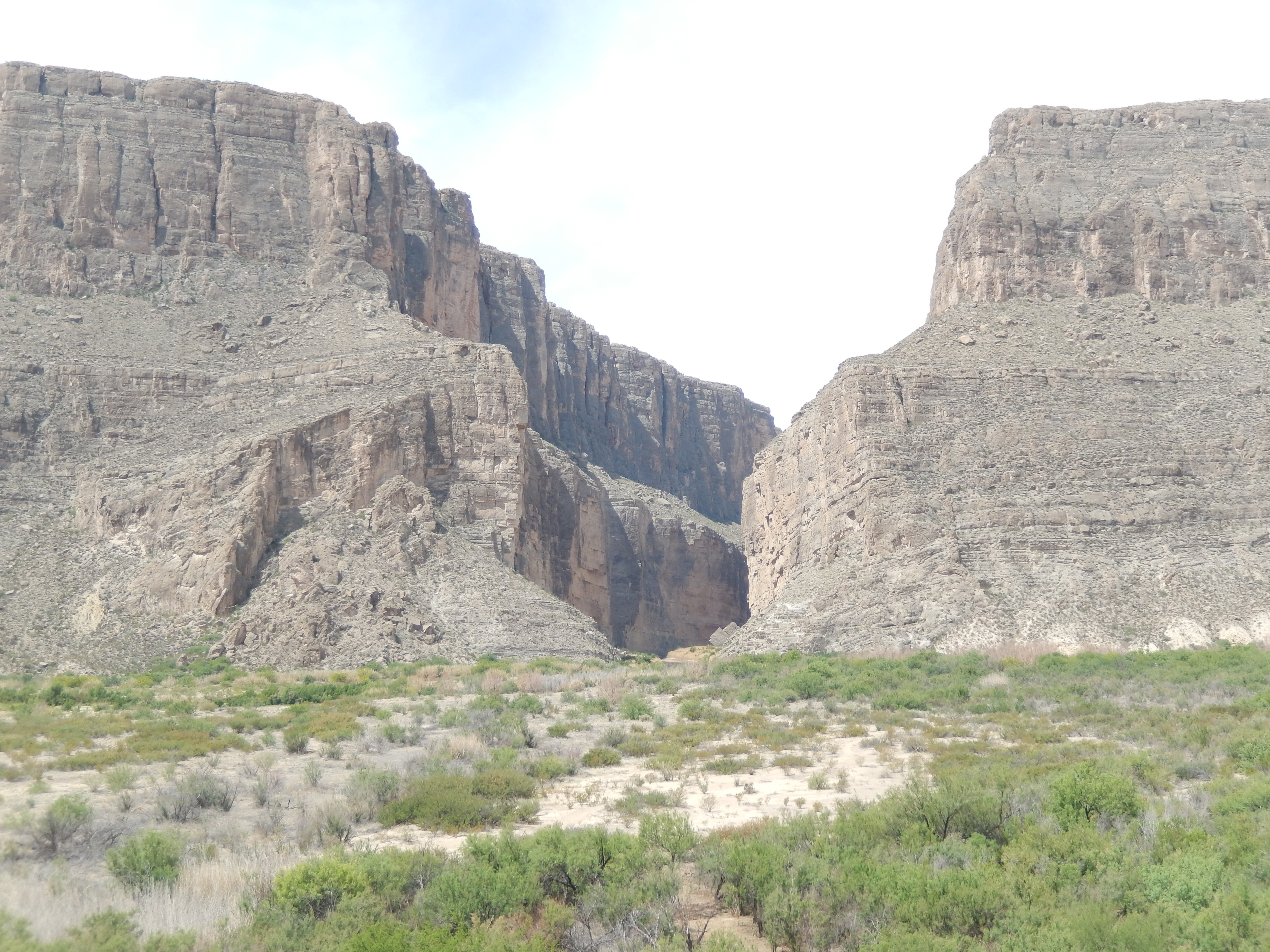
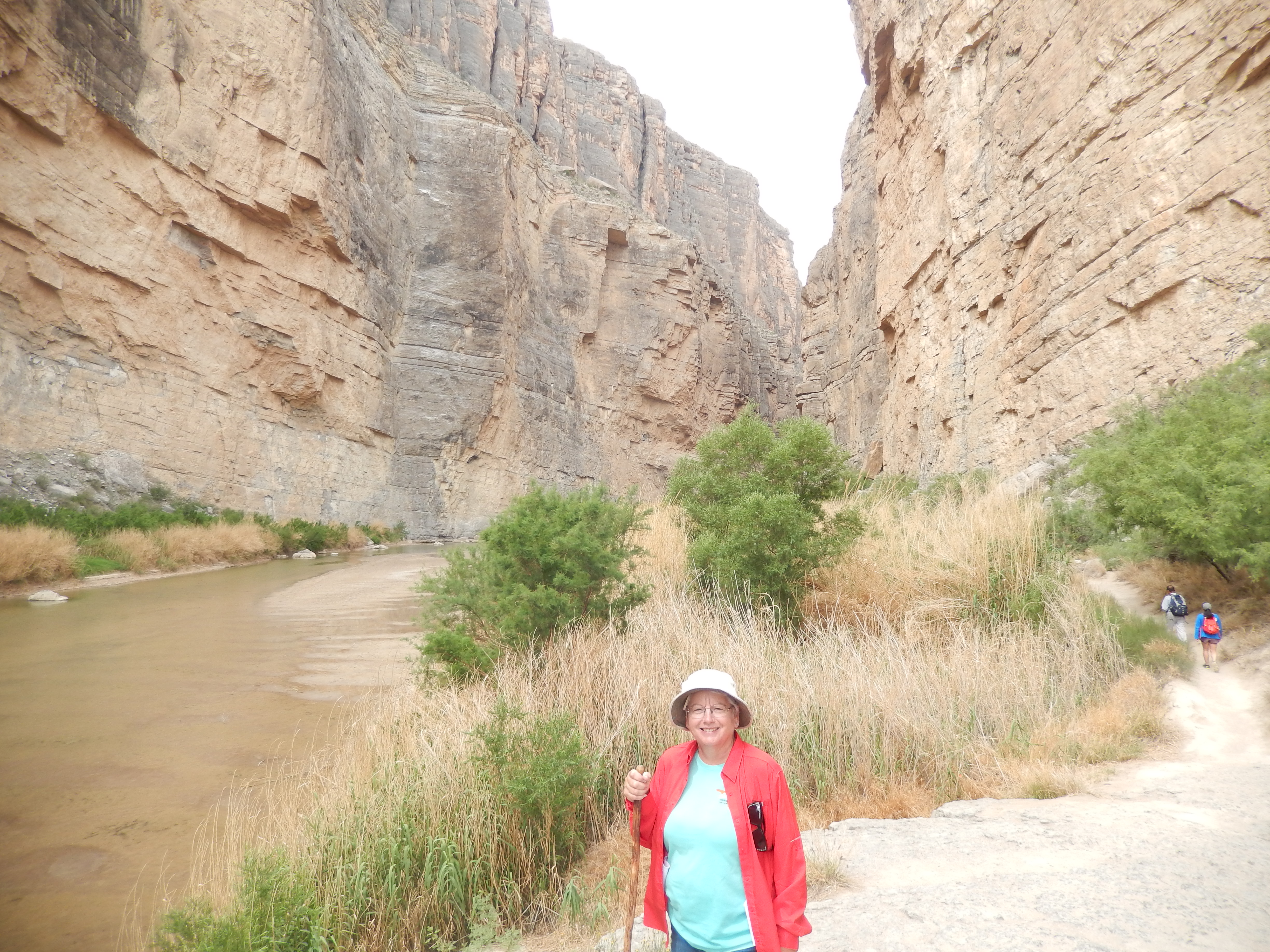
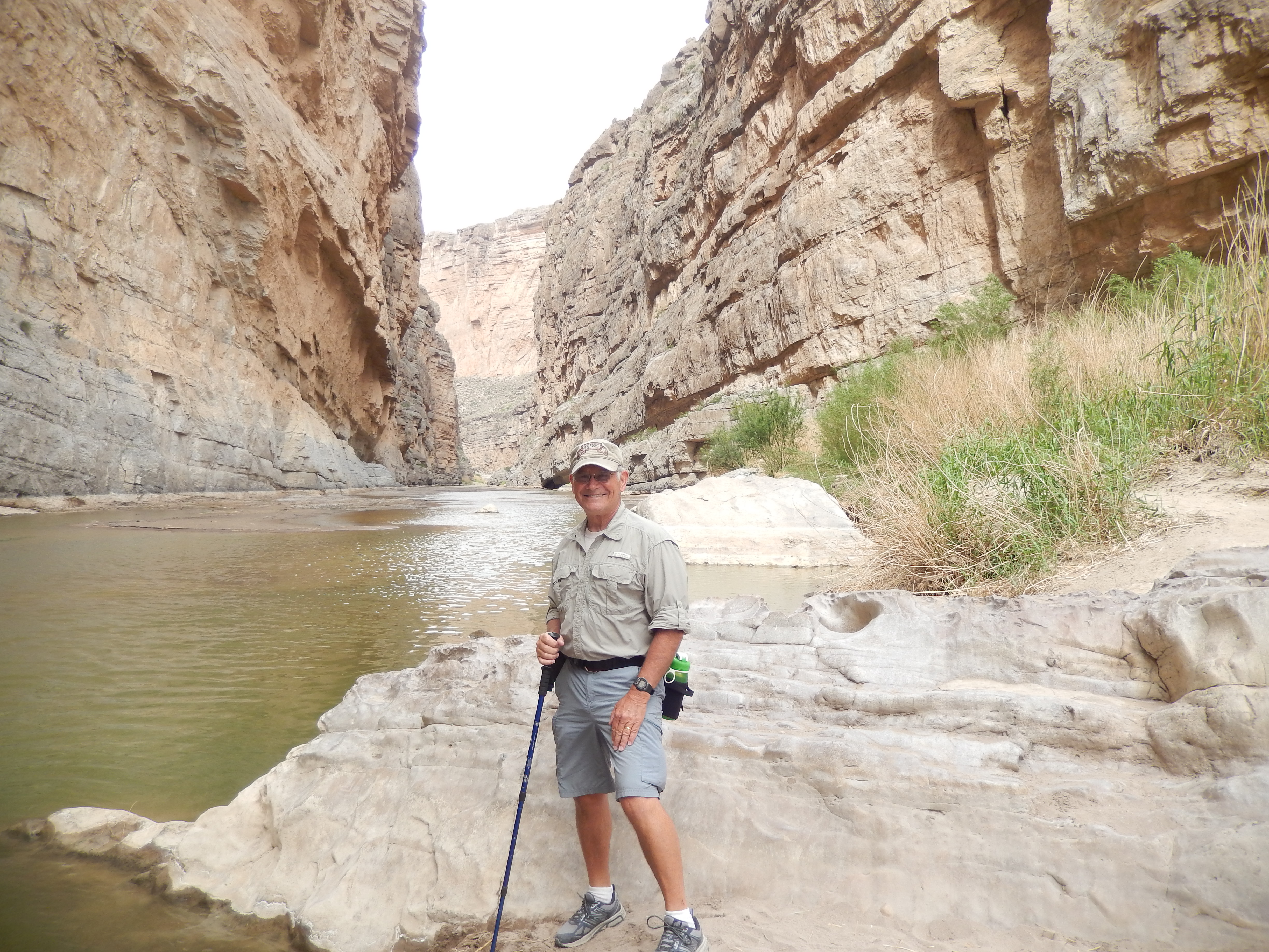
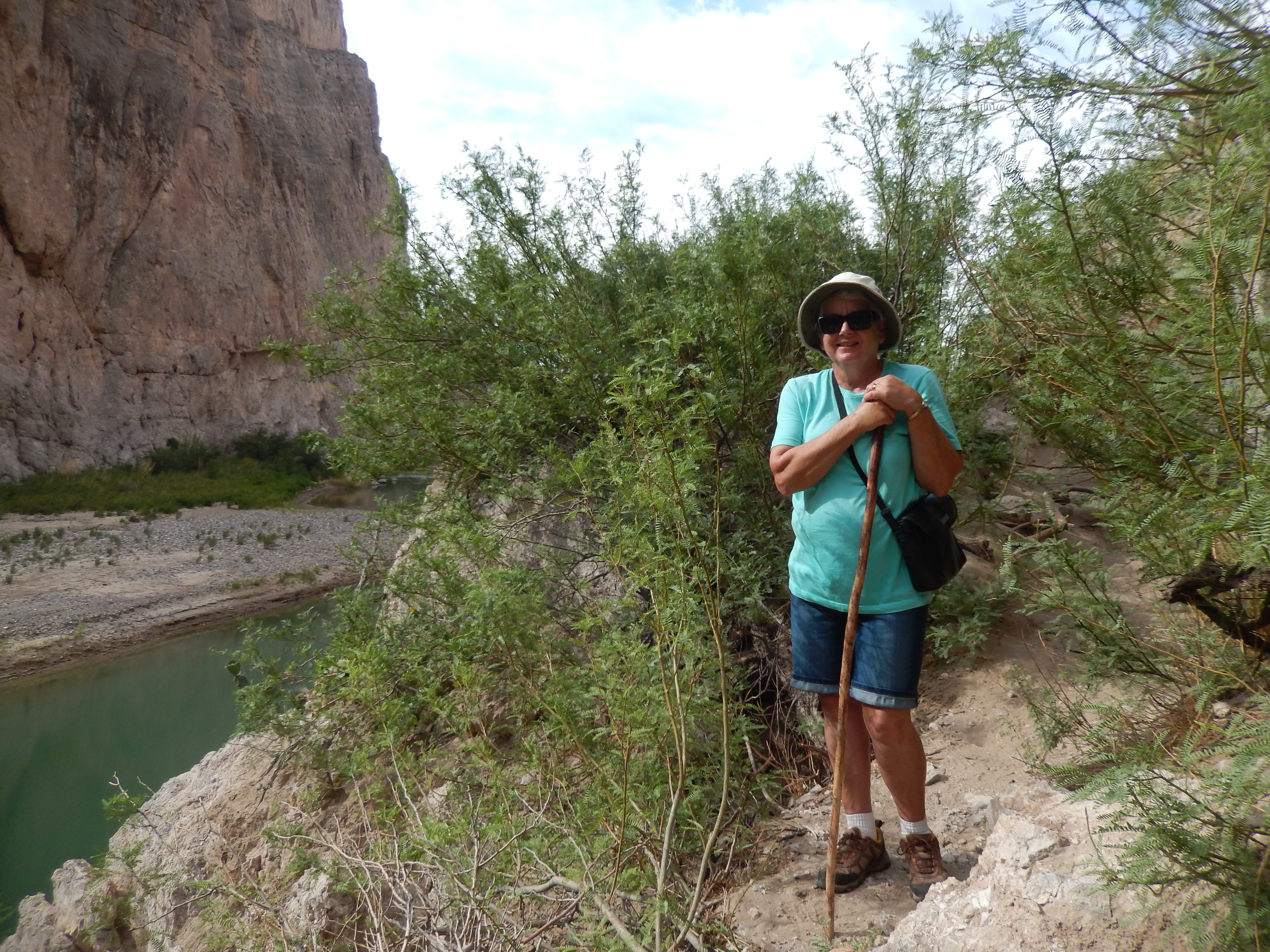
We decided to drive down the unimproved Old Maverick Road to the Santa Elena Canyon. The road was rough and wash boarded, but not terrible. We explored some side roads, looking for blooming flowers on the cacti. The Santa Elena Canyon Trail is an easy hike, but scenic. It follows the Rio Grande River. It is interesting to look across the shallow and narrow river that is easy to wade and see Mexico. Of course, in the canyon, there is no way to exit the river into Mexico, as the canyon walls are sheer cliffs.


From Santa Elena, we drove along the Ross Maxwell Scenic Drive to the Castolon Visitor Center. There wasn’t much to see here as much of the complex had been destroyed in a fire in May, 2019. The rebuilding is still in the early stages. We stopped to eat lunch in the Cottonwood Campground and it was obvious that we would have never fit into any of the campsites. We did enjoy a picnic lunch under a shade tree.
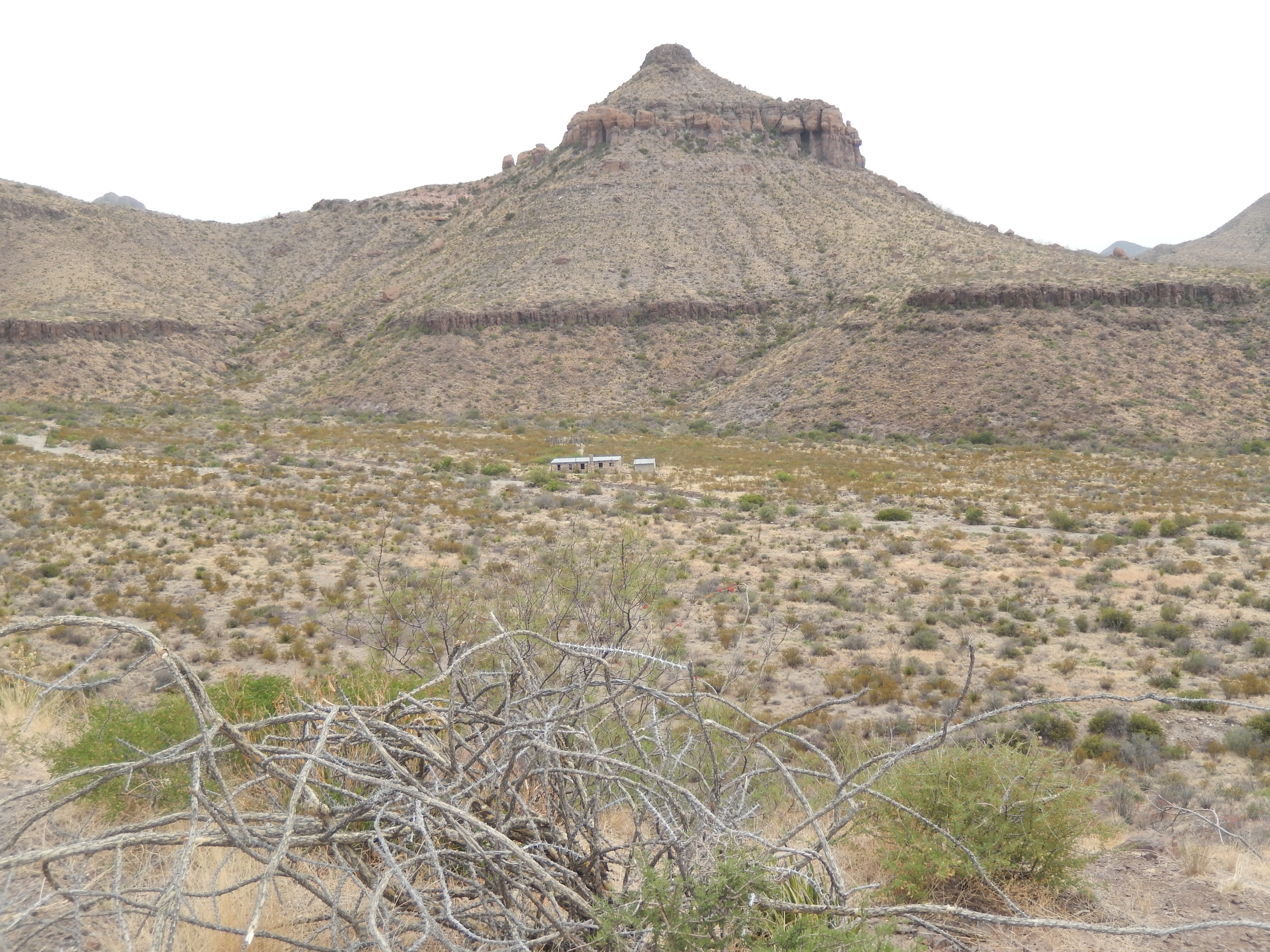
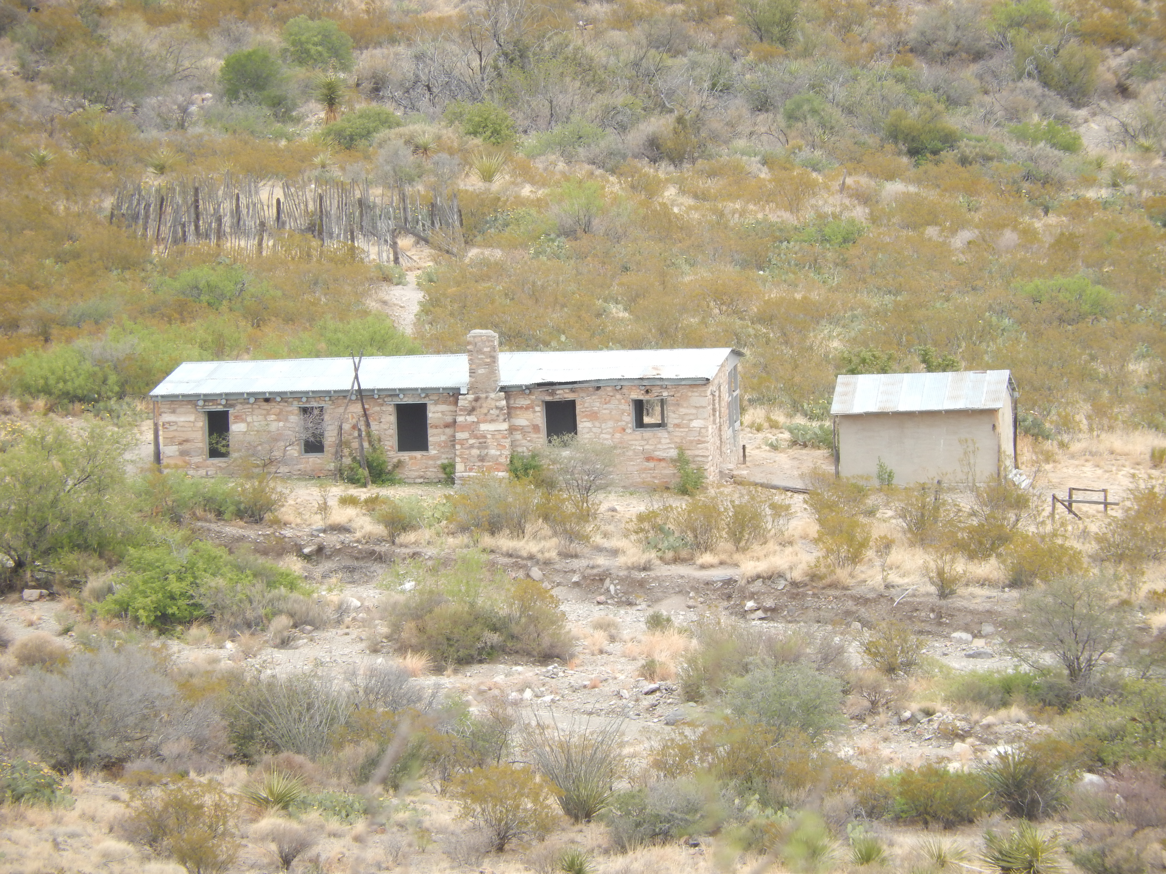
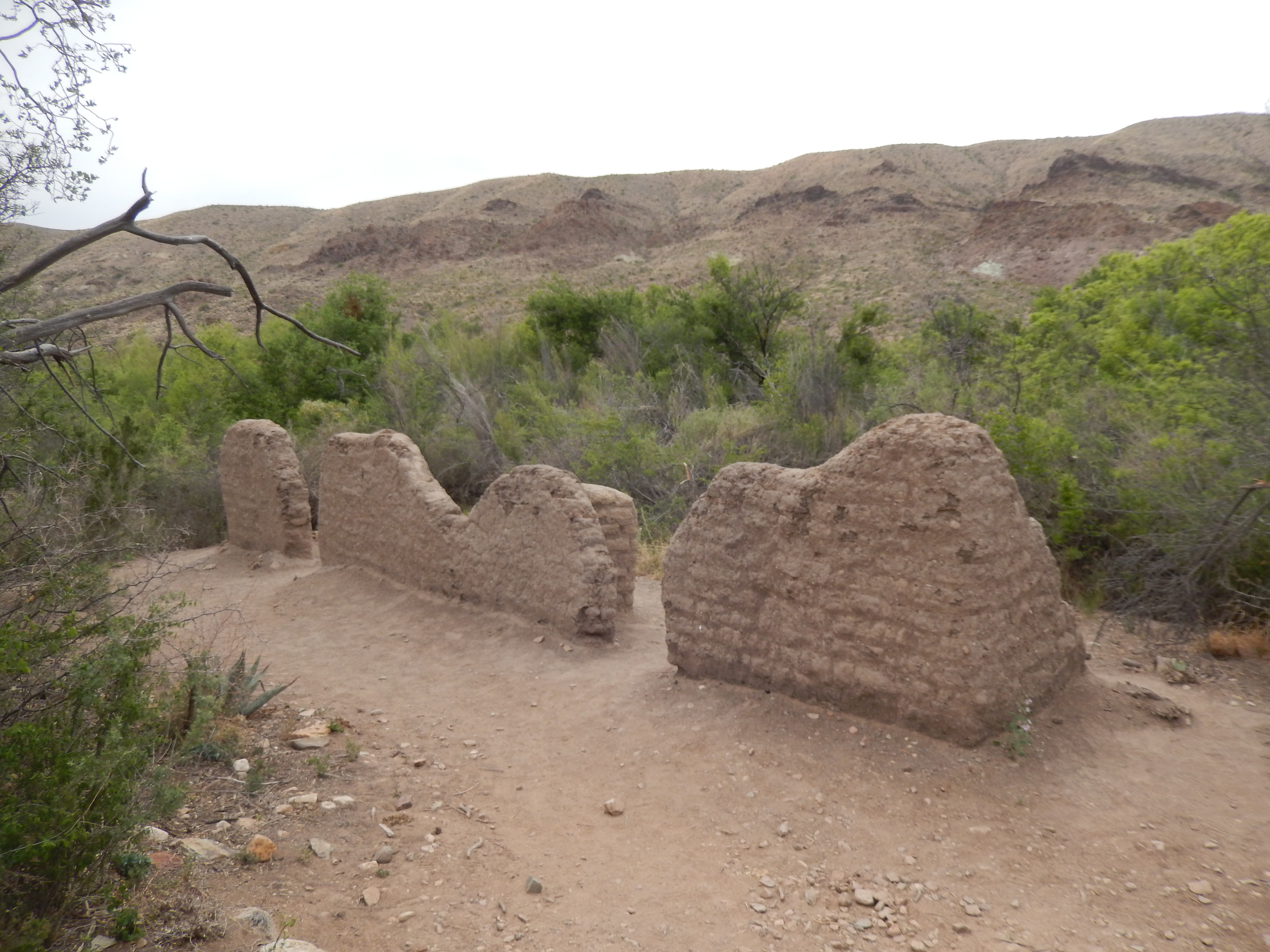
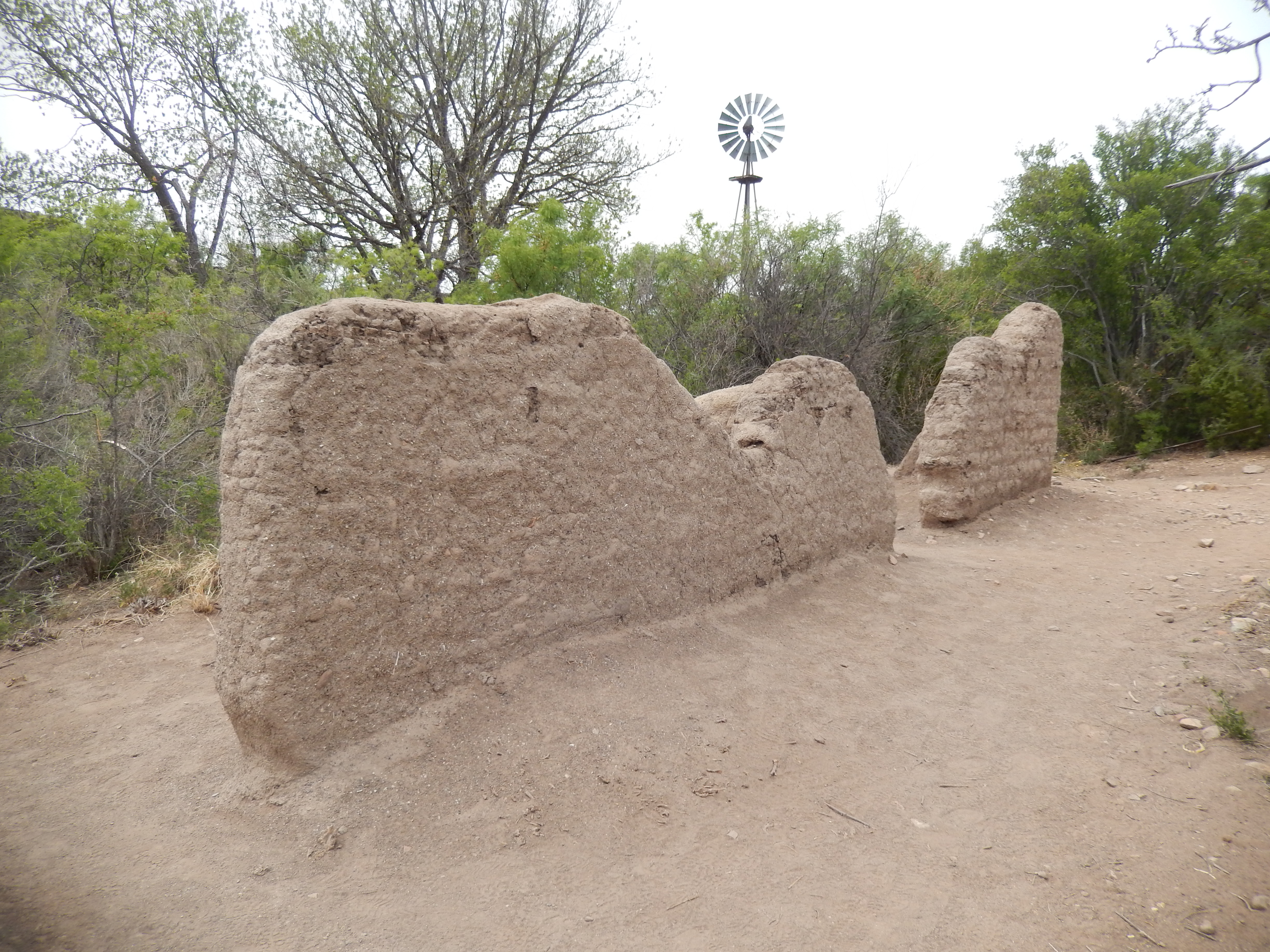
From there we drove north along the Maxwell Drive through the Mule Ears lookout, and stopped at the Homer Wilson Ranch. I was struck by the hardships that the early ranchers had to endure to make a life in this area. The Sam Nail Ranch was our last stop, here we saw where Sam and Nena Nail dug a well with a windmill to pump the water, built livestock pens, planted a garden, and dealt with drought, predators, and isolation.


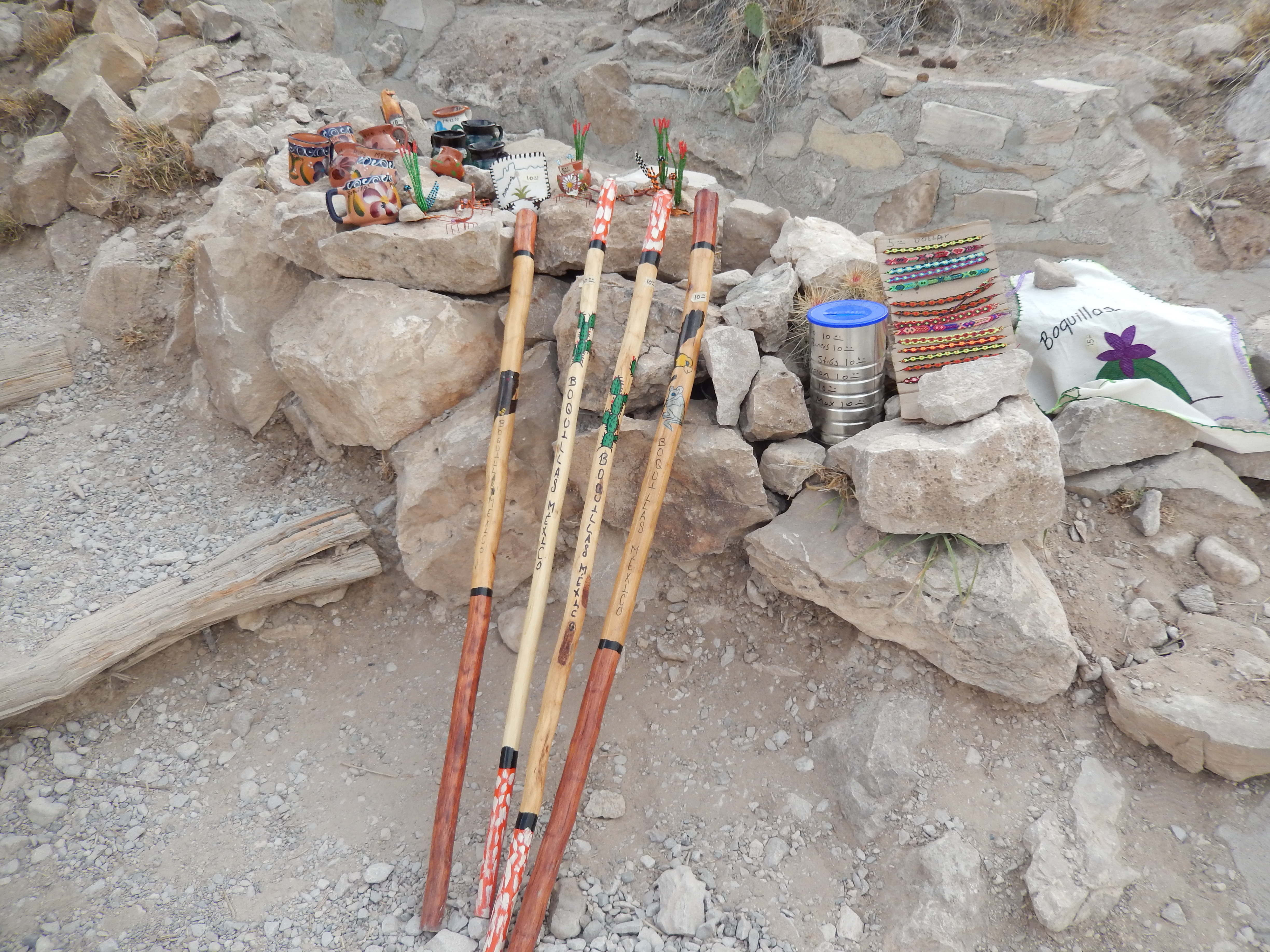
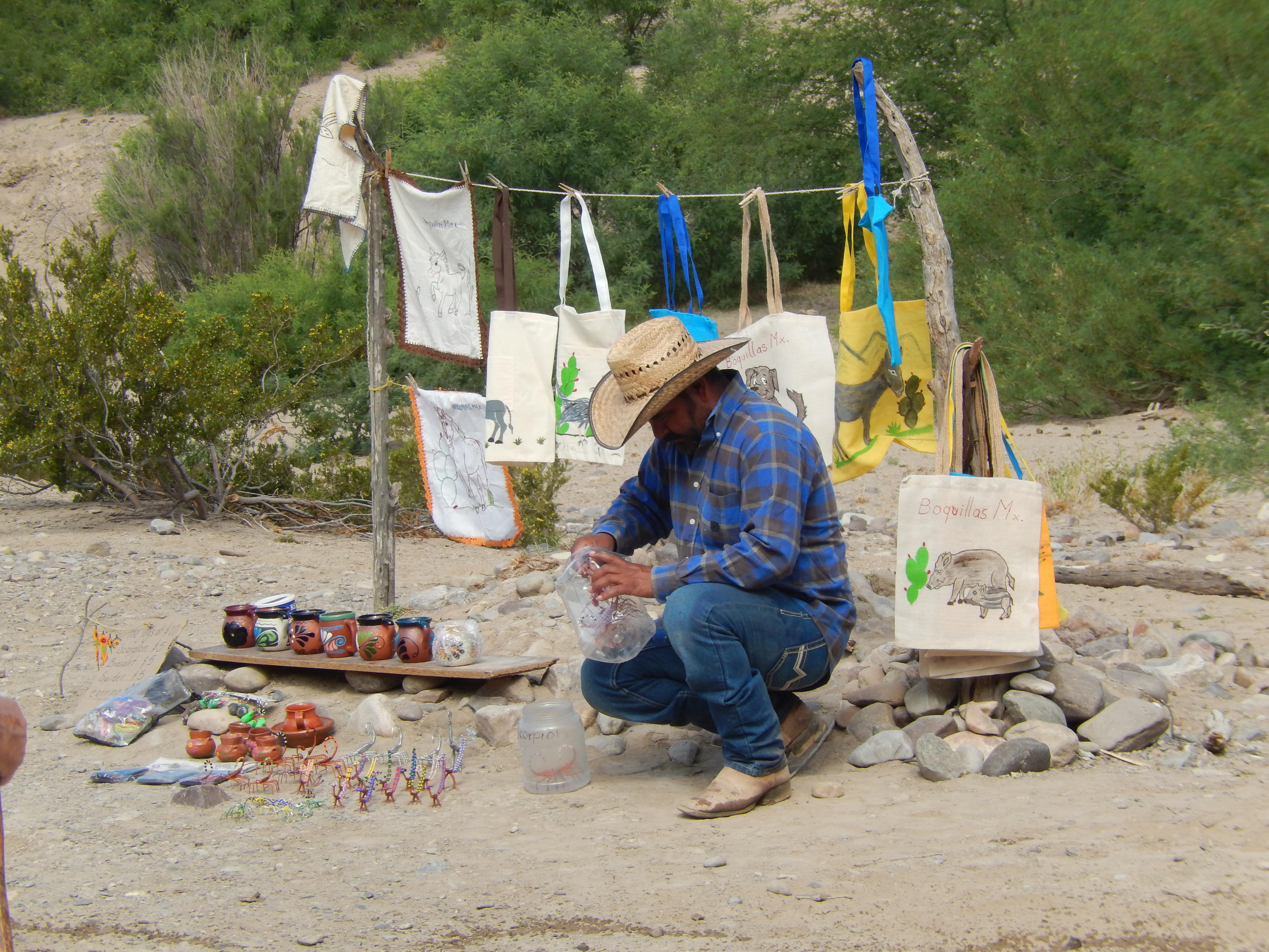
The next day we drove the entire width of the park to the eastern end, to the Rio Grande Village. We began by hiking the Boquillas (Bo-KEY-las) Canyon Trail. Boquillas is a Mexican village, just across the Rio Grande. During non-COVID times, visitors could cross the river at a Point of Entry and shop in Boquillas; however, the border crossing has been closed due to the pandemic. To make up for the loss of income, families from Boquillas have set up small camps on the Mexican side and ride across in canoes or horseback to set up small “stores,” some attended and some not. There were even a couple of men on horseback selling fresh tamales. The river was clear and reportedly has some great fishing. The canyon walls were interesting, with caves caused by erosion.


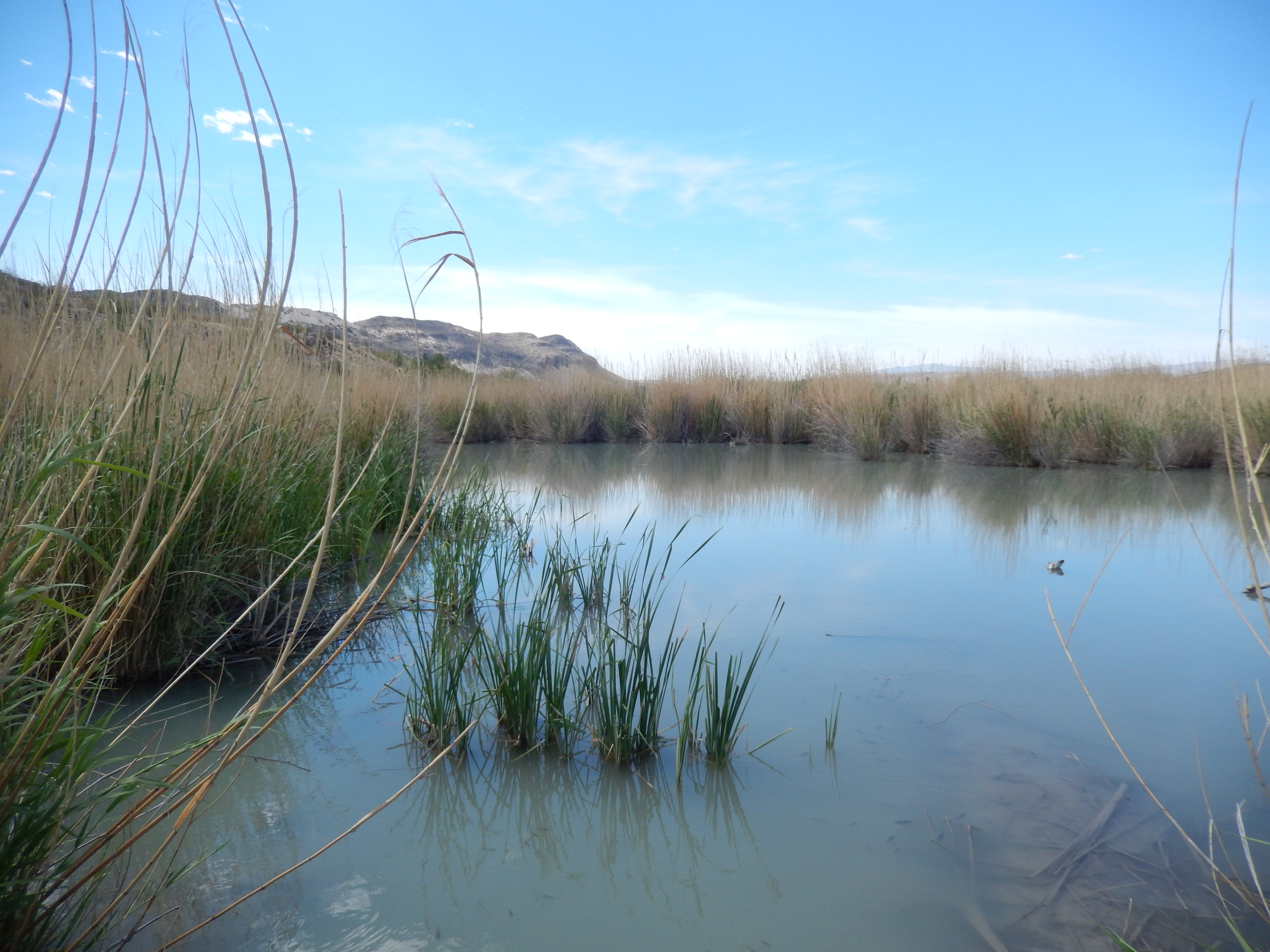
Our next stop was the Rio Grande Village where we hiked the nature trail that began with a beaver pond. Beavers in this area do not make beaver huts like they do up north, but tunnel into the riverbank. They do build dams that create these ponds. It was amazing to see this green oasis in the middle of the desert. In the space of a few miles we walked through a pond with fish and turtles, rocky foothills, and barren desert. Talk about a diverse ecosystem!


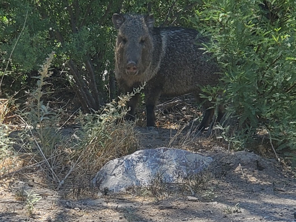
We ate lunch in an empty campsite near the trailhead. As we were eating, a javelin (a wild pig) approached from the other side of the road. It was ironic, I had just finished reading a notice to not leave food outside because of javalinas and now we had one almost walk up to us!

On our way out, we stopped at the Dugout Wells. Here we hiked a short nature trail and saw another example of the challenges that the early settlers faced. Around 1900 a settler dug a well and improved the flow with a windmill.


We didn’t think we were going to be able to hike in the central part of the park, the Chisos Basin. The whole area had been closed due to a fire on the south rim of the canyon. Fortunately, they reopened it shortly after our arrival. It had been getting hotter every day, and the road to the Chisos Basin area was being resurfaced and was closed between 8:00 and 11:00, so we decided to get there before the road closed. We arrived at the campground about 7:45 and began hiking the Windows Trail. We saw the sunrise on our drive out and we were able to see it again over the mountains as we began our descent along the trail. It was nice to hike in the cool morning. The trail was interesting with a variety of plants along the way. The end of the trail was amazing! The canyon wall opened up in a window that overlooked the basin.


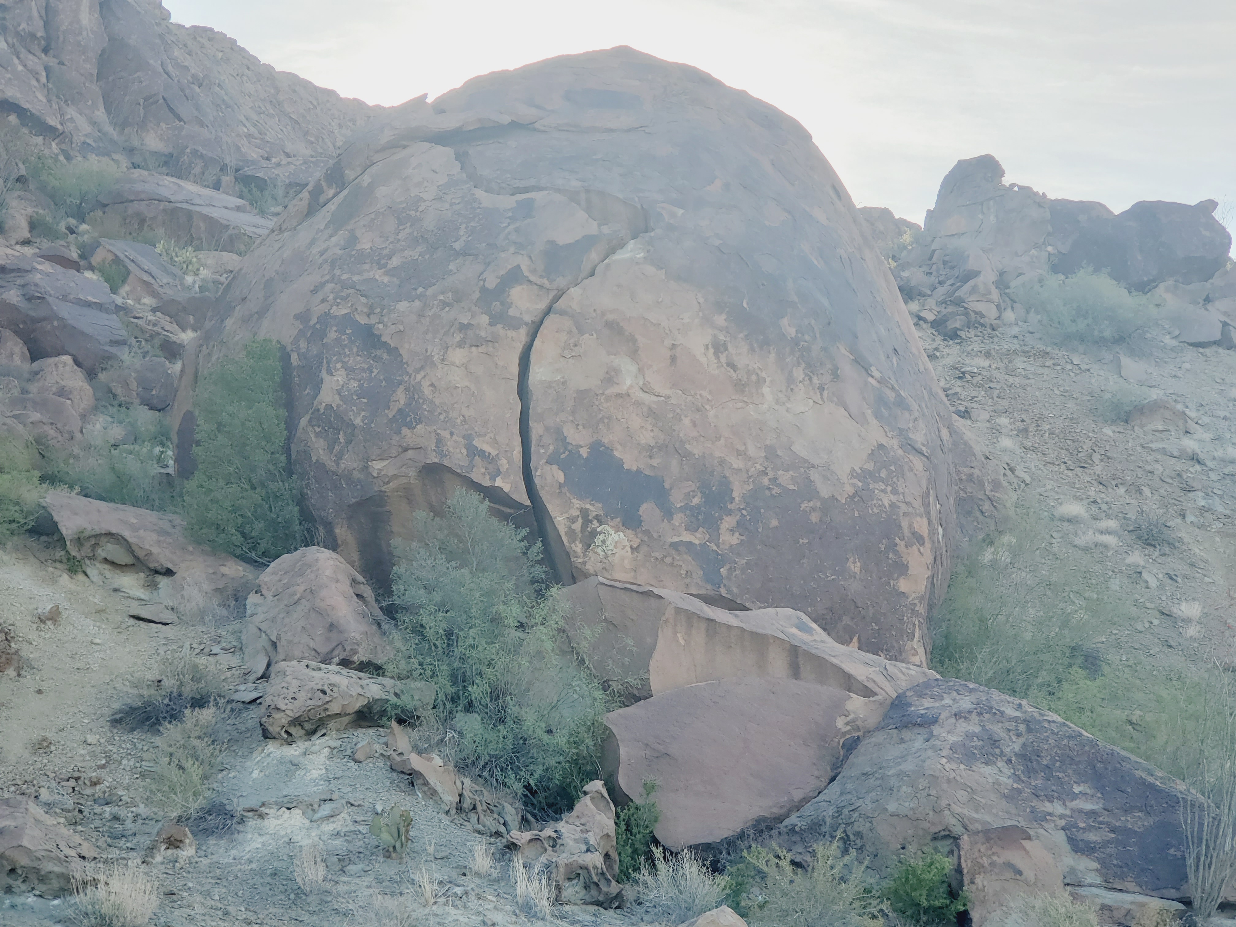
Our last day was forecasted to be the hottest day of our stay and we planned for a day off. The winds were light in the morning and we took advantage of that to ride our bikes. I integrated some geocaching with my ride and found a geocache called the Dinosaur Egg. It was an easy find, but required a little rock climbing to reach it.

The next morning we were on our way to Fort Bliss in El Paso, TX


Looks like a very nice hike and really cool to see a javelin in your photos!
Thanks for sharing
Yeah, the lushness of that nature trail was a surprise. The appearance of the javalina couldn’t have been any more timely.