Bonaire – Jan/Feb 2013

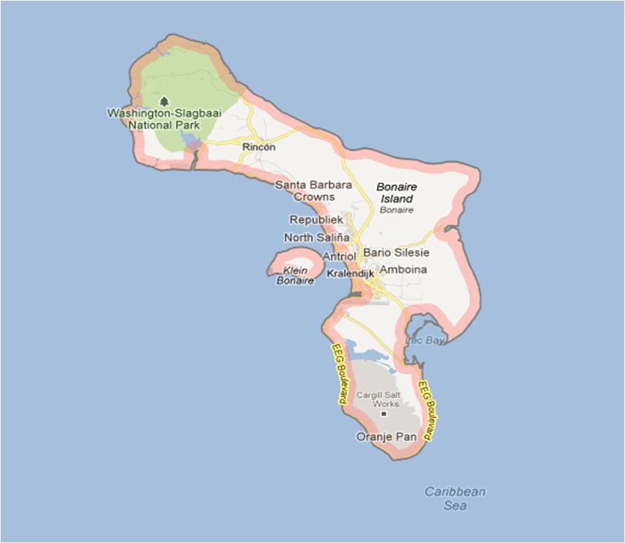
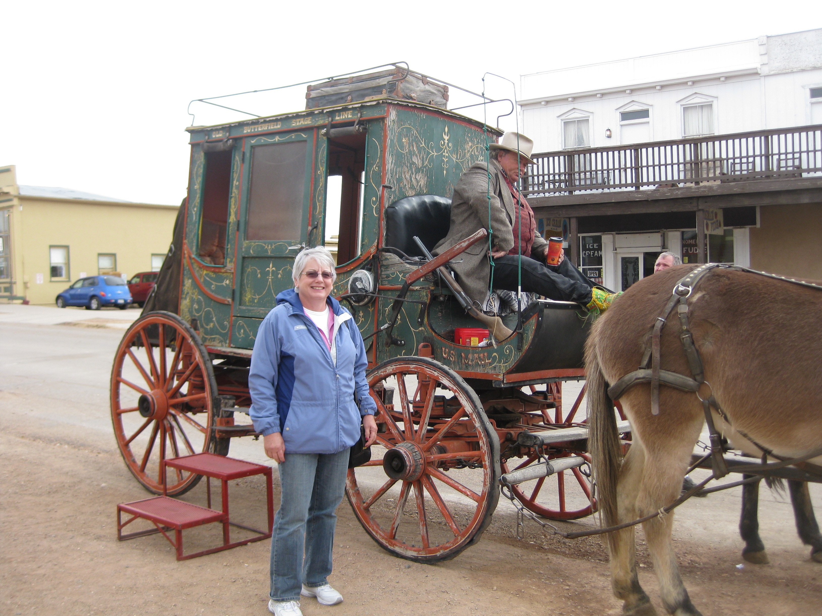
The Caribbean island of Bonaire in the Dutch Antilles is known as the Divers’ Paradise and is considered to be the best shore SCUBA diving in the world.  This was our third trip to Bonaire.  It is the place where Bob says he can dive until he is sick of it.  We picked up our rental truck (by the way, all trucks rented in Bonaire have wooden racks for air tanks as standard equipment because half the people that visit here are divers) and headed for the Black Durgon Inn.

Some of our friends often describe the Black Durgon as the best 1/2 star resort on the island.  Bob describes it as “an adult youth hostel.”  The Black Durgon is a small, family owned inn with ten rooms, and is a very basic bed and breakfast divers’ resort.  The best aspects of the inn are its location, (right on the shore near the Small Wall, a favorite dive site) and the family feeling you get as you meet other guests at breakfast.  Our friends from Lansing, Stan and Betsy Pash stayed at the same time, as well as Al and Maureen Pigeon from Vermont, whom we had met on previous trips.  Other guests included two doctors who meet there every year (one from England and the other from Slovakia), a couple from Kansas, a couple from Massachusetts, and another from Denmark just to list a few.  There is a breakfast every morning and a small kitchen in an open air porch for fixing lunch and dinner if you choose to eat in.  One of the first things we did was purchase food from local markets for snacks and meals.  It’s interesting to go shopping in a grocery store where the signs are only in Dutch.

The daily routine is pretty simple.  We exercise before breakfast, decide during breakfast where we are going to dive in the morning, go diving, relax and have lunch.  Then decide where we will dive in the afternoon, go diving, relax and have some wine and snacks during our informal “cocktail hour,” go to dinner or prepare a meal to eat at the inn.  Some nights we do a night dive off the pier at the inn, and after a night’s sleep repeat the process – what could be easier?!

The entire island is a maritime preserve and as a result there is abundant aquatic life, it is like swimming in an aquarium!  Even though Pat does not dive, she will normally go snorkeling at the same site where Bob is diving.  The weather was beautiful for our entire stay with daily temperatures around 840 and water temperatures around 800.  When it did rain, it normally rained at night and was clear during the day.  SCUBA diving in Bonaire is simple.  You get an air tank from the resort (you get an unlimited number of tanks), get your gear from the storage cage where is has been drying since your last dive, and load it in your truck.  Then drive down the road to your dive site which is marked by a large rock, painted yellow with the name of the site on it.  As there are over 80 dive sites accessible from shore, you never run out of places to dive.  Once you enter the water the top of the reef is typically 25-35 yards offshore and 20-30 feet underwater.  The shallow water above the reef allows you to be underwater for close to an hour on every dive – a true diver’s paradise!

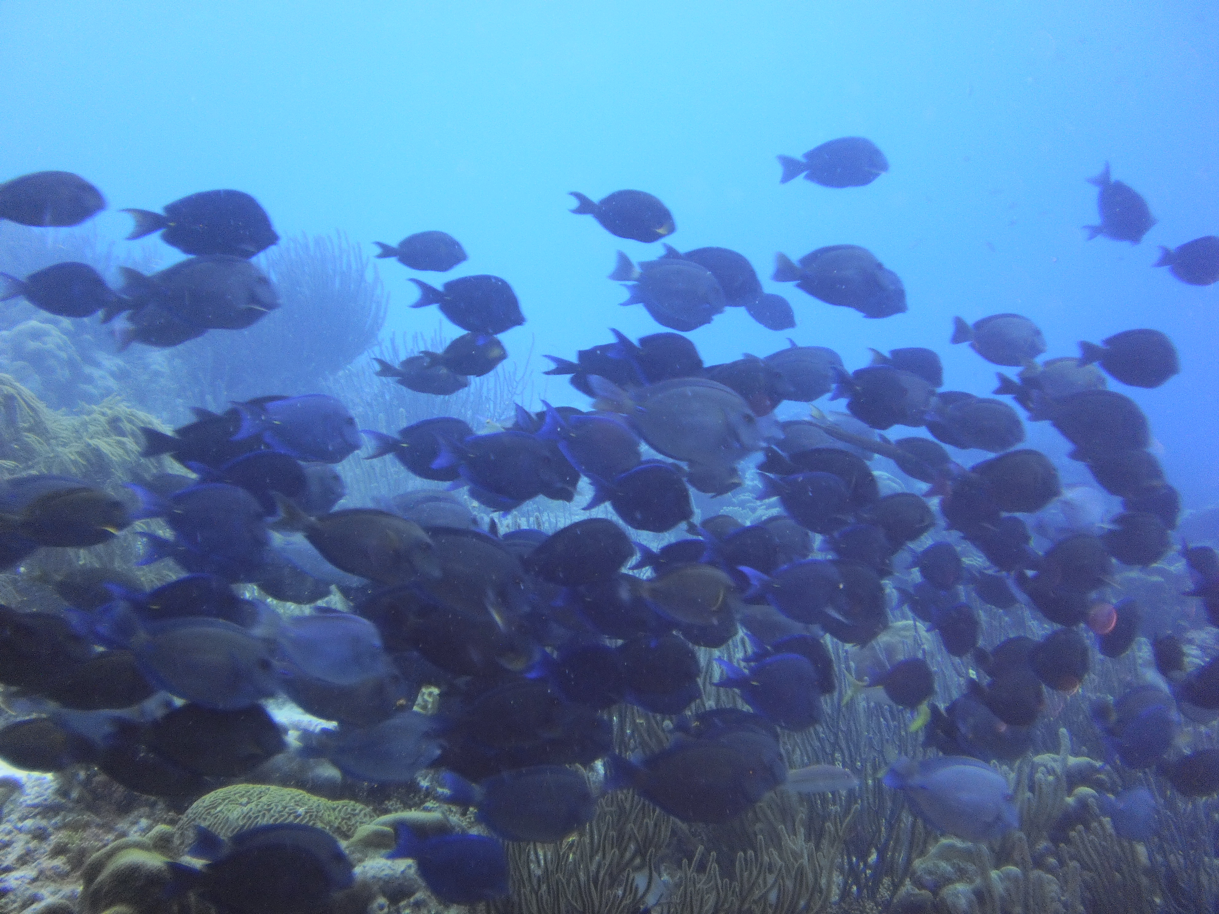
While diving occupied most of our time, we did do other things.  One afternoon a group of us drove to the little town of Rincon and visited the local distillery.  This is run by a Dutch couple who moved to Bonaire three years ago, renovated the property, and now make liqueurs unique to the Dutch Antilles.  They are also renovating the old cinema (movie theater) in Rincon.  Another afternoon we borrowed one of the  Black Durgon’s kayaks and paddled to Klein Bonaire (literally “Little Bonaire), an island offshore for snorkeling.

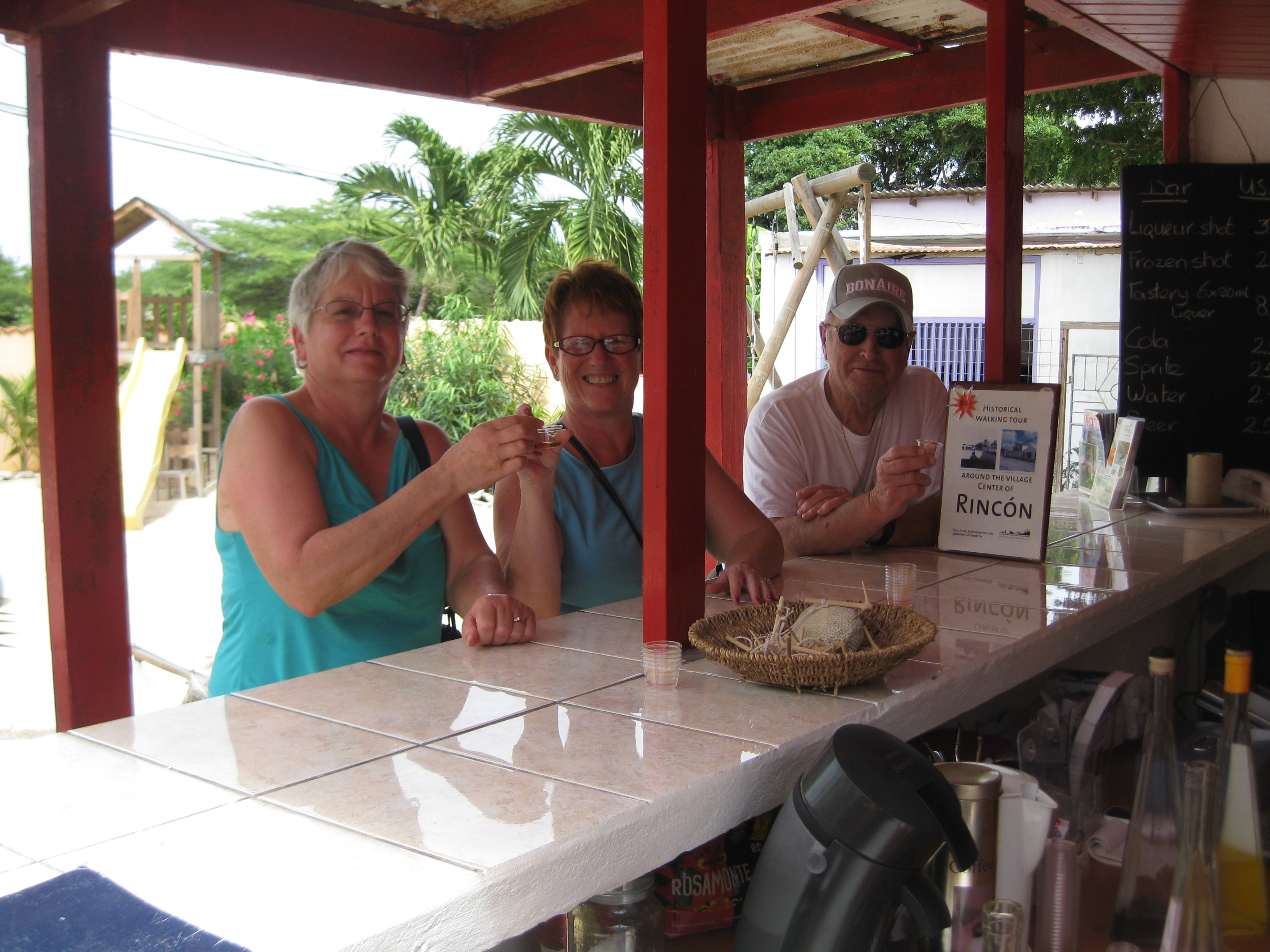
One of Bob’s favorite dive sites include the Hilma Hooker, a local steamer that sunk off the southwest coast of the island.  At 90 feet underwater and about 100 yards off shore, it is an easy dive.  The Hilma Hooker has no covers over her hatches which allows divers to swim inside the hull without fear of getting trapped in a confined space.

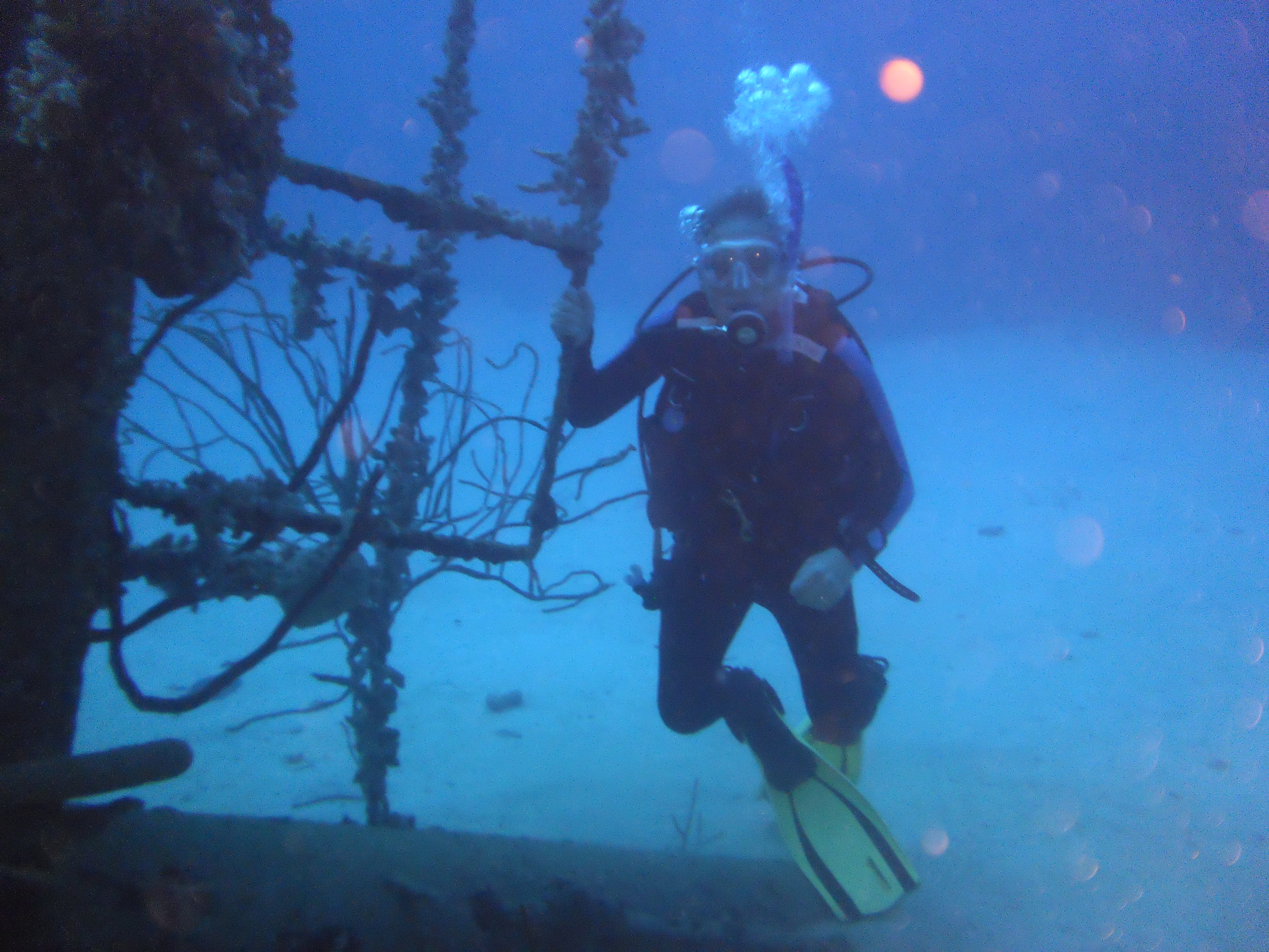
LaDania’s Leap is another favorite – on this dive you jump from a cliff about three feet above the water and drift dive to Karpata, another dive site for your exit from the water.  The hard coral formations are in great shape and there is a good chance of seeing turtles in addition to the normal selection of fish.

We dove a lot on sites on the southwest shore and were able to see some very healthy hard coral formations and bountiful soft coral. Other favorites include Red Slave, Angel’s City, Thousand Steps, and Oil Slick.

This slideshow requires JavaScript.

Unfortunately all good things must come to an end and on February 9th we flew back to San Antonio, TX.
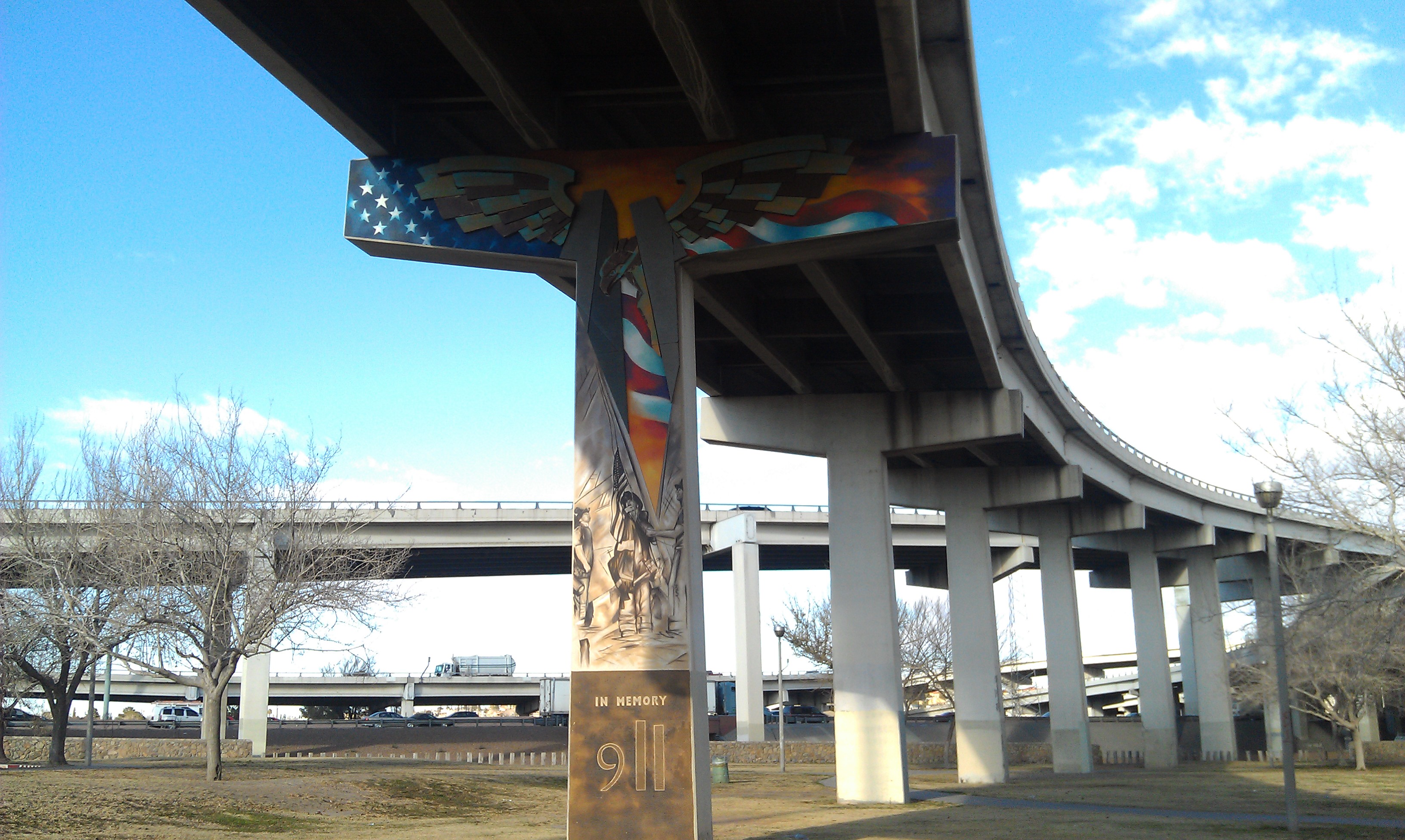
Posted in Fulltime RV, Michigan Traveler | Tagged , , , , , , | 1 Comment

Z Method for Backing a 5th Wheel

You have been traveling all day and now comes the hardest part of your day – backing a fifth wheel trailer into a camping spot can be a challenge.  Fifth wheel trailers are different than travel trailers in many ways.  When backing a travel trailer, the response of the trailer to the movement of the tow vehicle is quicker and more dramatic, fifth wheel respond slower, and respond in a different manner.

There are a few of things you should always do when backing a fifth wheel.

#1 – Do everything possible to insure that you will be turning on the driver side. Even if it means driving around the campground and up/down a few roads to get yourself turned around. The passenger’s side is your blind side and should be last resort.

#2 – You have to learn how long the reaction time is for your trailer to react. Go to a parking lot and practice. Always use your trailer’s rear axle as the reference point. The reaction time is the time it takes from the time you turn the tow vehicle steering wheel until the time the trailer starts turning.

#3 – There are three terms you need to know. Neutral, Jack, and Chase.

  • Neutral position is when the tow vehicle steering wheel is at the position where the truck is going in a straight line.
  • When you Jack the trailer you are causing it to turn the opposite direction that the truck is turning. Such as in jack-knife.
  • Chase is when you are trying to straighten out the truck and trailer, thus the term chasing the trailer.

#4Get out and survey the parking area (with your spotter) for obstructions. Determine where you want the trailer to end up and pick a reference point, which will act as the “edge of the parking area”.

#5 – Your spouse is normally the one who will guide you into your site.  Having the same person assisting you allows the two of you to have a better understanding of each other information needs and directions.  Your guide should never say “turn left or right.”  It is better to say “driver’s side” or “passenger’s side.”

#6 – Your guide should tell you which way the rear of the trailer needs to go.  You decide what you need what you need to do with the truck to move the rear of the trailer in the proper direction.  Place your hand on the bottom of the steering wheel.  If you want to the rear of the trailer to go to the left, move your hand to the left.

The Z Method –

It’s a way to set up the turn before backing in. If backing to the left, pull up (and stop) on left side of the road, with the rear wheels of the tow vehicle lined up with the left side of the campsite. Z-Method-1

Then turn hard right, and pull forward. Go as far as possible to the right of the road. Z-Method-2

Then turn hard left, and pull forward until the trailer rear is pointed at the entrance of the camp site. Z-Method-3

Stop and turn the steering wheel to the right, to begin backing in.Z-Method-4

This maneuver gets the rear of the trailer pointed in the right direction before starting to back in. And it gives the front end of your truck room on the left side to swing the front end around. Z-Method-5

Jack the trailer until it get to about 15-20 degree angle of the space you are going to park it then start chasing it.

If you’re running out of space to get the truck & trailer running straight, don’t be afraid to pull forward to help straighten it out.

If you need to back in on the blind side, just do the opposite as above. Some drivers try to never back in from the blind side. Even if it means going down the wrong way of a C/G access road. But get permission first, from C/G owners. And get someone to help control traffic, if needed.

We learned early on to use two way radios or cell phones rather than hand signals.  If you are going to use hand signals make sure that whoever is backing the trailer doesn’t move it unless they can spot the guide in the rear view mirror. In addition to being able to see the signals, it prevents accidents, like backing over your guide.

PRACTICE, PRACTICE, PRACTICE, PRACTICE, PRACTICE, PRACTICE, PRACTICE, PRACTICE, PRACTICE, PRACTICE, and never backup without a spotter.

Posted in Fulltime RV, Michigan Traveler, Military RV Parks, National Parks | Tagged , , , , | 30 Comments

El Paso, TX – January 2012

El Paso MapOur stay in the El Paso area started with our arrival at Fort Bliss which is just north of downtown.  It was a great location because it put us close to everything.  The campground is very close to the expressway and we were thankful that our site was in the inner area and therefore a little quieter than other areas.  The campground itself is very pleasant and well organized.  The weather wasn’t the best for sightseeing—it was chilly and windy during most of our visit.

We started playing tourist with a walking tour of IMAG0145historic downtown El Paso.  The tour takes you on  a stroll to historic architectural landmarks and sites dating back to 1881.  Many of the old buildings are now being used for businesses that do not show them to advantage—somewhat disappointing.   As we were leaving the downtown area we visited “the IMAG0160Murals of Lincoln Park”.  These are murals painted on freeway columns at what is known as the “Spaghetti Bowl”, the area where many freeways intersect creating numerous bridges.  The murals are painted by local groups of artists in honor of, or in memory of people or events which have affected the local area.  The first was painted in 1981 and several are very recent.  The pictures were very impressive!  Another area of interest near downtown is the Chamizal National IMAG0164Memorial which celebrates the peaceful settlement of a dispute over the international boundary at El Paso, Texas, and Ciudad Juarez in Mexico. On August 29, 1963, after decades of arguing about who owned a piece of land shaped and reshaped by the meandering Rio Grande river, the question was finally settled by diplomacy and technology.  The river was constrained within a concrete channel four and a half miles long, forming a permanent border between two nations.  The monument includes a museum with all the related historical information as well as extensive grounds for a park.  The building has a mural which incorporates U.S. and Mexico culture.  Our last stop was much more commercial—a visit to a store called “Saddleblanket”.  We had seen billboards advertising this place all along the road from Phoenix so we had to visit to see what it was.  Lots and lots of southwest souvenirs but not a lot that we needed.  We did buy two placemats!

Bob landing the Space Shuttle

Bob landing the Space Shuttle

IMG_4753At daylong trip to the north took us to Alamogordo, the home of the New Mexico Museum of Space History and to White Sands National Monument.  The Museum had a wide variety of space memorabilia as well as a worldwide astronaut hall of fame.  White Sands is a gigantic area (300 square miles) of sparkling white gypsum and is known as one of the world’s natural wonders.  It just didn’t seem right though, that all of those beautiful sand dunes didn’t lead to a lake!  We also found a New Mexico winery to visit and where we sampled the wines and the pistachios.  The wines were pretty good and we bought a few bottles!

IMG_4774There were still more museums to visit.  We toured the National Border Patrol Museum and Memorial Library just north of the campground.  It contained exhibits covering the history of the Border Patrol from the Old West, Prohibition and WWII right up to current operations.  Did you know that the Border Patrol was established along the southern border initially to keep out  the Chinese?  Fort Bliss itself has two museums—Old Fort Bliss, and Old IronsidesIMG_4787Old Fort Bliss gives the history of Fort Bliss and has buildings representing Fort Bliss as it was around 1880.  Bob also visited the Old Ironsides Museum while Pat explored and shopped at the amazingly large PX/Commissary complex.

On Saturday we set off early on the Old Mission TrailIMG_4810We visited three missions that were originally established by the Spanish and are still active today.  All are small parishes today but the old buildings are maintained and two of the three were open for us to see.  The third had a very interesting museum giving the history of the presidio (Spanish for fort or military post) and the area that the mission originally served.

Our final activity in the area was a ride on the IMAG0171Wyler Aerial Tramway to Ranger Peak in the Franklin Mountains.  The tramway takes riders to an elevation of 5,632 feet from where you can view up to 7,000 square miles including two countries and three states.  The view was truly amazing but the cold temperature and the wind made the visit shorter than we would have liked.

By Monday morning we were packed and ready to leave (after we thawed out the water hose)—on the road to San Antonio.  Hope it’s warmer!

Posted in Fulltime RV, Michigan Traveler, Military RV Parks, Texas | Tagged , , , , , , , , | Leave a comment

Kartchner Caverns, AZ – January 2013

Kartchner MapIt was time to leave El Mirage and we were looking for a location for an overnight stop enroute to Fort Bliss near El Paso.  There was not a convenient Walmart whose parking lot we could use, but as we checked out local campgrounds we discovered Kartchner Caverns and decided we should spend a few days instead of just an overnight.

We arrived on January 5th, IMG_4689early enough to ride our bikes to the visitor center to check out the area.  Our friends, the Astroths, had told us that we should visit Tombstone, the “Town Too Tough to Die,” while in the area, and we put that first on our agenda.

IMG_4696Cochise County is a high desert and we thought we would be in warm temperatures traveling through the south in the winter, but it was pretty cold when the sun went down.  We woke up to a brisk morning, and after some exercise and breakfast were on our way to Tombstone.IMG_4694  On our way we stopped in the town of Fairbank, a deserted town that existed during the 1880’s as a transportation hub.  The buildings and the museum were interesting; the qualifications to be a teacher on the frontier were especially interesting.

The first stop in Tombstone was the town cemetery, better known as “Boot Hill.”  As we walked through the headstones we could remember some of those buried there, such as Billy Clayton and the McLaury brothers, shot by the Earp Brothers at the OK Corral.  The number of people that died violent deaths as opposed to natural causes was impressive.

IMG_4707There are two Tombstones, IMG_4705the modern one with citizens that do normal work, go to school and church and live normal lives.  The other is the “Town Too Tough to Die.”  The old main street with wooden sidewalks and horse hitching rails are intact, although the buildings now serve different purposes.  There are stagecoach rides, gunfight re-enactments, and museums all over town.  It was a very interesting place to visit.

The next day we went on a tour of Kartchner Cavern.  This is probably the most unique cavern we have ever visited.  The story behind the caverns is almost as interesting as the caverns.  It was discovered by two cavers who kept it a IMG_4728secret for six years before telling even the Kartchner family who owned the land.  All of them realized they had something special so they sold the property to the State of Arizona.  It was developed into a state park that provides a marvelous experience.  We like to share our pictures, but cameras are not allowed in the caverns. We recommend this to anyone traveling to this part of the country as a “must do” on your trip.

That afternoon we hiked into the Coronado National Forest IMG_4712on the Guindani Trail.  We followed a wash up a valley (you had to keep a smart look out for trail markers or cairns to stay on the right trail) to the summit and returned on the outer slope.  The views were just outstanding!

The next morning we were on our way to El Paso, TX.

Posted in Arizona, Fulltime RV, Michigan Traveler | Tagged , , , , , , , , , | Leave a comment

Phoenix – November/December – 2012

Phoenix Map After our sightseeing through the west we were ready to find a place to just “hangout” for awhile.  We thought Phoenix, AZ would be a good place to stay and we would be close to an airport for Bob’s last trip to Pittsburgh and to fly back IMG_4510to Michigan for Christmas.  We decided to stay at the Pueblo El Mirage RV Park.  This was our first stay at an “RV resort” and we weren’t sure what to expect.  We were met by a guide in a golf cart that led us to our site and assisted us in backing into it.  Once we were set up we rode our bikes to the office to complete the registration.  We were given maps of the facility and the local area, told where grocery and drug stores were located, and given a list of the activities available to us.  These included a full wood IMG_4449working shop; two swimming pools and a huge hot tub; an exercise room with treadmills, elliptical machines, weight machine and free weights; lawn bowling; and tennis and pickle ball courts.  A couple of days into our stay there was an outdoor concert and we met some new friends, one of the couples was from Michigan!

The resort sponsored an opportunity to join a group for Thanksgiving dinner, another chance to make new friends.IMG_4458

We decided to try pickle ball.  This is a sport we had never heard of.  It is a combination of tennis and ping-pong.  The court is like a small tennis court, the racket is like a large ping-pong paddle, and the ball was a softball-sized wiffle ball.  We took a couple lessons and then started practicing almost every afternoon.  We got IMG_4453pretty good at it, but wonder if we will ever have the opportunity to play again as we travel farther east.

We made contact with some friends from Michigan who had moved to Phoenix years ago, Louis and Marilyn Astroth, and had them over for dinner one evening. We had a LOT to catch up on and it was a lot of fun to see old friends.

An interesting feature of Phoenix is that there are IMG_4486mountains in the middle of town.  We took a morning for a short hike in North Mountain Park, which is in the center of the metropolitan area.  It is a tribute to the vision of community leaders that they took action to protect areas like this from development.

IMG_4459We made a tree from Christmas lights in our “yard” and decorated the inside of the trailer.  Our inside Christmas tree is the small tree that Bob’s mother sent him while he was in Saudi Arabia during Desert Shield.  We may not have a house, but we can still decorate for the Christmas holidays.  IMG_4474It was interesting to travel around the RV park and see what everyone had done for decorations, we have some new ideas for next year!

Bob had more work than normal this month.  He was off to Pittsburgh for the Corps of Engineers and then spent a week on the road for SkillPath Seminars in Louisville and Cincinnati presenting training in project management. We can’t remember the last time he was traveling for business this much. Pat enjoyed the opportunity to relax and do some Christmas shopping.

IMG_4490Louis and Marilyn are active IMG_4492in their church choir and have even traveled overseas for choir performances.  They invited us over to their house for dinner and then we joined them at their church for a marvelous Christmas concert.

On December 19th we headed for Michigan to celebrate Christmas with our own family. See Home for the Holidays for the details.

We were back home on January 2nd, and it was great to be home again.  We know some people have a hard time understanding how a trailer can be a home, but it is our “Home Sweet Home.”

IMG_4548Bob has a friend, John Voreis, from his National Guard days who lives in Phoenix, but had been back in Michigan for most of our time here.  He and his wife, Fran, joined us for dinner, and John and Bob had a wonderful time sharing stories of good times together.

On Saturday, January 5th we were on our way again.  Next stop – Kartchner Caverns.

Posted in Arizona, Fulltime RV, Holidays, Michigan Traveler, Working on the Road | Tagged , , , , , , , | 2 Comments

Home for the Holidays – 2012

The last time we saw any of our family was in August and IMG_4566we were looking forward to flying back to Michigan for Christmas.  We took the “Super Shuttle” to the airport. This is a great service that is available in many cities. For a reasonable fee they picked us up at our site in the RV park and dropped us off at the airport. Less expensive than a taxi service and you don’t have to inconvenience friends or neighbors.

BuckeyesWe met our son, Dave, as soon as we arrived in Lansing to go shopping and had dinner together. What a great way to start a Christmas visit!  We stayed at the home of our friends, Susan and Gary Aten.  Great friends who said, “Make yourself at home,” and truly meant it.  We finished our Christmas shopping and made popcorn balls and “Buckeyes” to take to Bad Axe.  We had plans to meet Bob’s sister and brother in law, but a big snowstorm hit their area, they lost power, and were snowed in. Hopefully we will have better luck when we return this summer.  Sue Aten invited other friends to her house for dinner – it was a wonderful way to share the holiday with friends.

We discovered our nephew, Adam, was flying from Iowa into the Lansing airport so we stayed in Lansing a day longer and picked him up on our way to Bad Axe. Christmas in Bad Axe is a highlight of the year as the Smith side of the family comes together from Michigan, Wisconsin, Iowa, and in our case somewhere else IMG_4624to share the Christmas celebration together.

Christmas morning was like a picture postcard.  We had about an inch of new snow overnight.  Not enough to make driving hazardous, but enough to provide a clean blanket of new snow to enjoy.  The extended family had Christmas dinner at the Elkton Civic Center Hall with our traditional huge potluck dinner.  It is a perfect time for the family to get IMG_4600together.  As kids grow and begin their adult lives in new jobs, with marriages and births, it is harder to stay in touch and this event creates an opportunity to reconnect.  After dinner at the hall, it was back to Geri and Marcia’s to exchanges gifts with the immediate family.  Of course the center of attention was the newest member of our family, IMG_4584Ben and Tara’s daughter Adalyn, whom we call Addy.  Geri and Marcia have a big house, but how they manage to house all of us is a mystery.  Thank you, Marcia and Geri for your hospitality!

IMG_4630After a few days it was time for us to move on and we flew to Hattiesburg, MS on December 28th to visit Scott, Sandra and our granddaughters. It was quite a change to leave Michigan with snow and 10 temperatures to arrive in 600 and rain in Mississippi.  Our daughter, Elisabeth, had driven from North Carolina to spend IMG_4660Christmas with them, so we were able to see all of our kids.  We spent a couple of fun days, visiting and playing table games with them.  The big news was that Scott is leaving the active Army to take a fulltime position with the Army Reserve in Salt Lake City, UT.  He should be making this move shortly after the first of the year.  It looks like IMG_4670we may be traveling out west again sooner than we expected.

As all good things must come to an end, we had breakfast with Scott’s family and headed to the airport to fly back to Phoenix on Jan 1st.

Posted in Arizona, Fulltime RV, Holidays, Michigan, Michigan Traveler | Tagged , , , , , | 1 Comment

San Diego, CA – November 2012

What a change we had from Lone Pine to San Diego!  As you may have noticed, the area around Tuttle Creek Campground was pretty desolate, beautiful country, but still desolate.  In San Diego, we camped at the Admiral Baker RV Park, a facility of the San Diego Naval Station.  We were in a small valley, a couple miles from the Qualcomm Stadium.  The RV spaces surround a playground and picnic area, and it was a big change from the desert!

The San Diego area is blessed with an extensive public transportation network.  We immediately saw the value of not driving our one-ton, dual rear wheel, long-bed pickup truck through downtown traffic and purchased monthly passes.  Between the trolley and bus lines, you can go almost anywhere with little hassle.

San Diego is one of the busiest seaports on the west coast.  Not only is there a lot of commercial activity, but San Diego is home to the Navy’s Pacific Fleet.  We took a two-hour tour of the harbor and saw the submarine pens, the Naval Hospital Ship – USNS Mercy, the Naval Air Station at North Island (almost the size of San Diego International Airport), and dry dock and repair facilities (the aircraft carrier USS Carl Vinson was in port for repair).  We were able to watch planes landing at San Diego International and what made this particularly interesting was the landing approach brought them in at low altitudes right over the downtown – not a sight you see in too many cities.  In the harbor there is a live bait facility where fishing boats can pick up live bait before they head out to sea.  It is a favorite spot for sea lions to hang out! After the cruise we had lunch at a restaurant right on the harbor, where we could watch ships coming in and out.  On the dock next to us was the Star of India, the world’s most active sailing ship and HMS Surprise, the ship used in “Master and Commander, Far Side of the World,” starring Russell Crowe.

We were only a few miles from Mexico, so took the trolley to the border.  We spent an afternoon wandering around Tijuana.  We explored some shops and bought some vanilla, and one of the shop owners was able to convince Pat that she just had to buy a silver bracelet.  We stopped for an authentic Mexican Margarita and watched the street entertainers.  It was a very relaxing afternoon.  The only downside was the long line to return back to the U.S.  Between the vendors and the panhandlers, it was a depressing end to the day.  It certainly made us glad to be U.S. citizens.

La Jolla (pronounced La Hoya) was our first experience kayaking in the Pacific Ocean.  It was a great day, warm enough for swimming.  Just south of the beach are a series of caves that have been cut into the cliffs by the surf.  We paddled through one of them and found a group of sea lions relaxing on a shelf inside the cave.  There were sea lions swimming and sunning themselves all along the shoreline cliffs.  We had lunch on the beach, enjoying the sun.  Not too bad for November 3rd!

Bob flew out on Monday to spend most of the week in Pittsburgh for work.  Pat relaxed and visited Balboa Park.  Balboa Park is a 1,200-acre urban cultural park. In addition to open space areas, natural vegetation green belts, gardens and walking paths, it contains museums, several theaters, and the world-famous San Diego Zoo.

When Bob returned we went out to Point Loma, home of the Cabrillo National MonumentWe walked down to the shoreline to see the tidal pools.  Because the tide was rising we didn’t see much of the pools but the cliffs and rock formations along the shore were an interesting sight.  From the top of Point Loma we could see almost all of San Diego and the harbor, even the northernmost point of Mexico.  Point Loma is packed with history.  It is the site of Juan Rodriguez Cabrillo’s landing at San Diego Bay in 1542, the first recorded discovery by a European.  It is also the site of the first lighthouse in San Diego, and the coast artillery post for the defense of San Diego harbor in WW I and WW II.  There was more history than you can absorb in one visit.  Afterwards we drove to a nearby winery’s tasting room.  We had been in California since the middle of October and hadn’t sampled any California wine yet.  We found the San Pasqual Winery to have several wines that we liked and took home a few bottles to enjoy later.

We spent the next afternoon touring Old Town San Diego.  We wondered why Old Town was so far away from downtown San Diego.  In San Diego’s early days, as with any settlement, a source of drinking water was the first priority and while the San Diego River provided that, it was not near the natural harbor.  Later in the area’s development, fresh water was pumped to the harbor area and a downtown commercial area was created resulting in the population migrating to that area.  Old Town was a major way station and layover stop for the stage coach routes as well as a destination for raw materials and finished goods.  Much of Old Town is operated by the State of California as a state park with museums and interpretive guides.  It was interesting to relive the bygone eras of San Diego as a settlement of New Spain, as a state of the country of Mexico, and finally as a part of the United States.  Our guide told us the story of San Diego as though she was living that history and her stories made the history more real for us.

Veterans Day was spent exploring Balboa Park.  Between the gardens and Mexican era buildings, it was a delightful way to spend a pleasant afternoon.  Although the weather was chilly (temperatures around 600 – the locals said winter had arrived), we listened to an outdoor organ concert.  The organ is a huge instrument and the sound was incredible.  That evening we went to a local Applebee’s for Bob’s free Veterans Day dinner.

The San Diego Zoo is supposed to be one of the best zoos in the country.  We started by taking a bus tour to see the highlights, then we walked through to see the animals in more detail.  The benefit of taking the bus first was that we were able to see a lot of the animals while they were up and active early in the day.  Later, many of the areas appeared to be empty or the animals were laying down in the back corners.  The zoo lived up to its reputation.  The exhibits were some of the best we have ever seen and the layout was like taking a walk through the woods.  There were more animals, bigger ones, and in nicer settings than we had seen in other zoos.

Bob loves museums, especially military and maritime museums, with the aircraft carrier, USS Midway he got two for one.  Pat, on the other hand, had other interests, so we split up.  Bob toured the Midway and he said it is probably the best run military museum he has ever visited.  When you come on board you can pick up a free audio tour, keyed to a map of the ship.  On the video you hear a description of the areas of the ship and personal clips recorded by veterans who served on the Midway.  Volunteer docents led tours of the bridge and Combat Information Center (CIC).  There were also docents who were retired naval aviators who described what it was like to be launched by catapult and to land (or trap) on a carrier.  These personal touches made this a special experience.

While Bob toured the Midway, Pat and her bicycle took the ferry across the bay to Coronado, where she enjoyed visiting the shops and beaches.  It was a great day to ride around the peninsula.  The beach went on forever with beautiful, dark, sparkly sand.  It looked like someone had mixed gallons of gold glitter into it.  The numerous shops were interesting to explore, but she was able to resist souvenirs and bought only lunch.

On Thursday, Nov 16th we departed for Phoenix, AZ.

Posted in California, Fulltime RV, Michigan Traveler, Military RV Parks, National Parks | Tagged , , , , , , , , , , , , , | Leave a comment

Driving in the Mountains

When my wife, Pat, and I first started our journey as fulltime RVers.  Pat expressed her concerns about driving in the mountains with a rig as big as ours (38 foot fifth wheel).  We had driven through the Smoky and Appalachian Mountains, but our experience with mountains like we would find in the West was limited, and we had never driven in mountains at all with our new rig.  We spent out first year traveling in the East and, although some of the mountains in eastern Pennsylvania gave us some concern, we had no real problems there.  In our second year we decided to head West and we knew we would be getting into the unknown.  It is always better to admit you don’t know as much as you would like, and search out the answers, so we began our research.  Our first concern was Yellowstone National Park.  We knew, from a previous trip, that traveling there would include some very steep grades and switchbacks on mountain highways.  We began by posting our concerns on some RV forums and got a lot of good feedback.

One of the best suggestions was to purchase the Mountain Directory.

This became our bible for trip planning.  This directory is broken down by state, lists the major routes, and descriptions of  mountain passes, both east and westbound.  It describes the percentage of the grade and how long the grade is, the miles per hour for curves, as well as warning signs and location of  runaway truck ramps.  The value of the directory became apparent when we ran directions to Yellowstone on Google Maps and then looked up the route in the directory.  The description we read for part of the route said, “At this point the descent begins on what the locals refer to as ‘Oh, My God Hill.'”  After reading that we searched for an alternate route.  Any survival instructor will tell you the first thing you want to do is to avoid an obviously dangerous situation.  By using Google Maps and the directory in combination, we were able to find alternative routes that would place us on the least dangerous route.  In our Yellowstone example, the most direct route would have brought us in the North Entrance, but the easier route came in from the south.  This caused us to change our plans to visit the Grand Tetons and then Yellowstone, instead of the reverse.  In my opinion the most important factor in driving in the mountains is proper route selection.

In 2011, we spent some time visiting the Ohiopyle State Park in Pennsylvania.  The hills in the area have some very steep grades and you could smell the hot brakes on the cars that had been braking all the way downhill.  This is a great recipe for disaster due to brake failure.  During a descent you want to let the engine slow your vehicle, not your brakes.  This can be done in a number of ways.

First, you can shift your vehicle into a lower gear.  Even automatic transmissions will allow you to manually downshift.  As the speed increases the engine RPM will slow the vehicle to the speed for that gear.  The problem is excessive RPM for too long could damage your engine and/or transmission.

Second, you can use your cruise control.  As the speed of the vehicle increases beyond what you have set the speed at, the engine will drop to a lower gear ratio to slow the engine.  The benefit is that the engine will not run at an excessive RPM for too long.  The downside is the cruise setting may not be enough to slow the vehicle to a safe speed.

Third, the exhaust brake.  This is what truckers call the “Jake Brake.”  Most passenger cars will not have this, but most if not all, large pickup trucks and motor coaches will have it.  My first piece of advice is to read your vehicle’s owner’s manual!  I know, most of us don’t; but this is one case where it is a MUST!  We own a 2011 GMC Sierra 3500 pickup truck and, while your vehicle may be different, most are similar to what I will describe here.

When we are towing our trailer, we set the transmission in the “trailering mode.”  This adjusts the engine RPM to compensate for the weight and friction of the trailer, and provides for better engine efficiency and fuel economy.  When, in the “trailering mode,” I set the cruise control, the transmission will automatically adjust the gear ratio, slowing the vehicle when we are descending.  This will generally do what needs to be done on gentle grades.  If the grade is steep and/or long, I will press the button to set the exhaust brake.  The exhaust brake will automatically adjust the gear ratio to slow the vehicle during the descent.  The added benefit is that if I feel we are traveling faster than I am comfortable with, I just have to push on the brake pedal, hold for a short of time, and the gear ratio will readjust to slow the vehicle even more.  Once I have done this I can even speed up a bit if the grade gets more shallow for a period and the truck will slow down again to the same gear ratio after I let up on the accelerator.

I am not a professional commercial truck driver and I don’t pretend to be.  I know I descend slower than many drivers would prefer and I ALWAYS descend at or below the posted speed limit.  I feel it is better for me to be a little slow and safer than to roll my 50 foot combined length of truck and trailer and cause an accident.

Preventive maintenance is a MUST!  I always check my tire pressure and lug nuts before driving, under-inflated tires lead to blow outs and rollovers.  Don’t drive faster than your tires are rated for.  Too many RVers are traveling at 70 MPH on tires that are rated for no faster than 65 MPH.  Brakes should be inspected and wheel bearings should be inspected and repacked at least annually.  Last year I discovered that one of the seals had ruptured on one of the trailer wheels and the brake linings were coated in grease.  It was much better to find this out in the shop, than while descending an 8% grade!  If you are not towing a fifth wheel trailer, sway control bars should be used and have the appropriate pressure set.  You should be using a weight distribution hitch to keep your truck and trailer in proper vertical alignment.  Make sure your trailer brake controller is set for the appropriate pressure, you have good electrical contact between the truck and trailer, and all brake/directional lights are functioning properly.

Driving in mountains often includes driving through tunnels.  Do you know your overhead clearance?  Your paperwork from your manufacturer will tell you the maximum height of your trailer, but that may not be the maximum height when you are hitched to your tow vehicle.

Hitch your trailer to your tow vehicle, climb on top with a long pole and a level.  Extend the pole from the highest point on the trailer with a string on the end and use the level to insure the end with the string is the same height as the top of the trailer.  Then have the person on the ground mark the end of the string, that will give you the exact height of your trailer while on the road.  We discovered that one route into Custer State Park in South Dakota had tunnels that were neither tall enough or wide enough for our rig.  Good route planning allowed us to avoid an unpleasant situation.

Standard overhead clearance on all U.S. highways in rural areas is sixteen feet and in urban areas it is fourteen feet.  Trusses and highway signs must be seventeen feet above the roadway.  If overhead clearance is less than this, it will be marked with the lesser height.

Width is also a factor and that should be measured as well.  I found that if my extended mirrors will fit, everything else will too, but you should know the measured width before you get on the road.

Weight and, more importantly, weight distribution is important.  If you haven’t weighed your rig you should do so soon.  CAT Scales are available in many truck stops and you can find the one closest to you by going to the CAT Scale Locator.

The charge is generally around $10 and worth the expense.    You will need to weigh your tow vehicle separately from your trailer.  The weight of your trailer should not exceed to total Gross Vehicle Weight Rating (GVWR).  The weight of the rear axle of your tow vehicle with the trailer attached should not exceed to Gross Axle Weight Rating (GAWR) of the rear axle of your tow vehicle.  If your trailer is too heavy, you need to shed some weight by getting rid of stuff and/or moving stuff from your trailer to your tow vehicle.  If your rear axle weight is too high, you need to shift stuff to the rear of the trailer, get rid of some stuff, or  . . . buy a bigger truck.

A good recommendation is to have a 3 X 5 card in the cab of your tow vehicle with all of your critical measurements so you don’t have to trust your memory.

There are a couple of articles and web sites that will give you some advice on driving in mountains that I found to be beneficial and they may help you as well:

Mountain Driving – http://www.workhorse.com/Portals/0/documents/24-26%20Knaack-Mountain%20Driving%20JA10.pdf

RV’ing Without, BRAKES! – http://donfairchild.hubpages.com/hub/RVing-Horror-Story-BRAKES

We have traveled through the mountains of Wyoming, Montana, Utah, Arizona, Nevada, and California.  I don’t claim to be an expert, but I now have a few thousand miles under my belt of driving through mountains.  I hope you find this article to be beneficial to you.

Posted in Driving in Mountains, Fulltime RV, Michigan Traveler | Tagged , , , , , | 3 Comments

The Alabama Hills, Lone Pine, CA – October 2012

If you have ever watched an old time western, or a more recent science fiction movie like Ironman, then you may have seen where we have been camping.  Because of their unique formations, photogenic quality, and dramatic High Sierra backdrop, the Alabama Hills near Lone Pine, CA, has long been a favorite location for Hollywood producers of Western movies.  Old, old time stars like Gene Autry, Hopalong Cassidy, Randolph Scott, and the Lone Ranger rode these hills in their adventures.  Science fiction films made in the Alabama Hills include, “Screechers,” “Tremors,” and “Iron Man.” “Foreign-based” films such as “The Charge of the Light Brigade” and “Gunga Din” are among the 700 plus movies filmed in the Alabama Hills.  Lone Pine is home to the Lone Pine Film History Museum, where you can see a brief movie that highlights the film-making history of the area.  Over 10,500 square feet of exhibits and displays gives you an insight of this unique American cultural heritage.

We camped at Tuttle Creek Campground, which is operated by the Bureau of Land Management (BLM).  Tuttle Creek is in the middle of the high desert right next to the Alabama Hills.  The Alabama Hills got their name from Confederate sympathizers who prospected and mined the area during the Civil War.  In other words, there was not a lot of shade.  When we left our last site, June Lake, there was snow on the ground.  The 2,000 foot drop in elevation did wonders for the temperature.  It was much warmer here, and the view was outstanding!  What a sight to wake up to in the morning.

The next morning we drove to the Interagency Visitor Center.  There we discovered another instance of Los Angeles diverting water from the Owens Valley.  We learned that the water diversion had almost drained Owens Lake, destroying wildlife habitat and causing large dust storms in the area.  As with Mono Lake, the courts got involved and ruled that Los Angeles had to take corrective action.  Consequently, Owens Lake is maintained at a minimum level to eliminate dust storms and some of the habitat has been restored.

The Manzanar National Historic Site was our next stop.  Manzanar was one of ten War Relocation Centers established to relocate Japanese Americans away from the coastal areas in the states of Washington, Oregon, and California.  In February, 1942, President Roosevelt signed Executive Order 9066 and directed that 120,000 men, women, and children were taken from their homes.  Most moved voluntarily, but some were actually arrested and sent into these Relocation Centers.  Manzanar was typical of these camps.  They were quickly constructed and looked like prisoner of war camps, with barbed wire fences and guard towers.  The internees, as they were called, were told the security was to protect them.  They quickly noticed the lights and the guards were focused to the inside of camps, not the outside.

The 500-acre compound held 504 barracks that were divided into four rooms each.  Any combination of eight individuals were allotted to each of these rooms, family integrity was not always possible.  These rooms were furnished with an oil stove, a single hanging light bulb, steel cots with straw filled mattresses, and blankets.  They endured temperatures of 1100 F in the summer and winter temperatures were often below freezing.  The wind could blow right through the walls until improvements were finally made, mostly by the internees themselves.  The internees planted their own crops and gardens, worked in the infrastructure of the camp, and in shops that made camouflage netting.  In 1944, the military reinstated the draft for Japanese Americans or “Nisei.”  Nisei soldiers served with distinction in the 100th Infantry Battalion and the 442nd Regimental Combat Team (RCT).  PFC Sadao Munemori joined the Army one month prior to Pearl Harbor, but still his mother and siblings were interned at Manzanar.  He served as a member of the 442nd RCT and was posthumously awarded the Congressional Medal of Honor when he threw himself on a grenade in Italy.  Manzanar is a symbol of a sad time in our country’s history when we let fear trample all over the Bill of Rights.  Let’s hope we never let this happen again.

When we first pulled into our campsite, there was a smell of coolant coming from the engine compartment of the truck.  Bob checked it out and couldn’t see any sign of a leak and the coolant level looked correct.  He thought the filler cap may have been a bit loose so we decided to just keep an eye on it.

When we returned from Manzanar, the smell of coolant was stronger and there was a drop in the coolant level.  We decided we had to do something about it and did some online research to find a local shop where we could take it in the morning.

Friday morning, Bob drove into Lone Pine and found the radiator was definitely leaking.  He called GM Road Service because it was under warranty.  They arranged to have it towed to the nearest GM dealer.  Unfortunately the nearest GM facility was 150 miles away in Lancaster, CA.  Bob went with the tow truck, prepared to stay overnight.  Fortunately, the dealer ordered a new radiator when Bob called and they were able to repair the truck the next day.  Bob got back around 7:00 pm on Saturday.  Both of us figured there were better ways to spend our time than sitting around getting repairs done.

Mt. Whitney was just a few miles behind our campground.  At 14,497 feet, Mt. Whitney is the highest peak in the continental United States.  You can hike from the Whitney Portal trailhead along an 11-mile trail to the peak, but it is a change in elevation of 6,137 feet – not an easy hike!  We hiked a short portion of the trail and had lunch at Whitney Portal.  It was a beautiful day and we watched the water flowing down a partially frozen waterfall.  There were ponds with ice on the surface and one of the hikers we talked to said there was six inches of ice on the pond at the peak.

Tuesday we were up early and on our way to Hesperia where we planned to stay at the Desert Willow RV Resort to pamper ourselves after a couple of weeks of boondocking.

Posted in California, Fulltime RV, Michigan Traveler | Tagged , , , , , , , , , , | Leave a comment

Yosemite National Park – October 2012

We left Death Valley on October 18th, and traveled to the Inyo National Forest in the Sierra Nevada Mountain Range.  We had gotten an early start so we were not traveling in the heat of the day through Death Valley and arrived at the Oh! Ridge campground in the early afternoon.  Compared to our earlier camping in the desert outside of Las Vegas and in Death Valley, Oh! Ridge was a big change.  First, it had trees!  Not as many as you would have in a typical Michigan campground, but far more than we had seen lately, and it was at 4,000 feet above sea level.  Our campsite was beautiful with a terrific view of June Lake.  We spent the afternoon sitting in the sun, reading, and enjoying the view.

Friday we rode our bikes into town to go to the post office, the hills made the ride quite a challenge!  It was such a beautiful day we kayaked around June Lake.  Even though it was October 19th, the weather was so nice it felt like a summer day.  The water was as clear as tap water and the ducks were so used to people they would swim right alongside of our kayaks.  We stopped at a local marina and then walked to the local candy store for ice cream cones.

About ten miles north of June Lake is Mono Lake which has the same characteristics as the Great Salt Lake in Utah.  It is fed by streams and rivers but doesn’t discharge it’s water anywhere, except by evaporation.  As a result the salt and other minerals remain.  The salt content of Mono Lake is three times saltier than the Pacific Ocean.  Mono Lake is a stopover for many migratory birds, some of whom travel as far as Brazil and return each year.  Bob found Mono Lake to be an interesting story of progress and development versus conservation.  In the 1970’s Los Angeles purchased land in the mountains around Mono Lake and built aqueducts to divert water from the rivers and streams to Los Angeles.  As the population of Los Angeles increased, the amount of water diverted also increased and Mono Lake started to dry up.  Finally David Gaines, a local citizen, started a committee to challenge Los Angeles’ actions.  Eventually the U.S. Court decided that Mono Lake had to be maintained at a minimum level for the maintenance of the lake, protection of wildlife habitat, and the water needs of the local communities.  This effort is ongoing today and the lake levels are rising.  One of the interesting geologic features of Mono Lake are the Tufa.  These are created when the fresh water springs, rich in calcium, bubble up through the carbonate-rich lake water.  The calcium and carbonates react to form calcium-carbonate salt deposits which are called Tufa.  This solid, limestone-like material continues to develop, forming vertical towers with the spring water percolating up through them.  As the lake receded in the 1970’s, these Tufa became visible.

When we planned this stop, we had intended to go to Yosemite National Park.  However, our Mountain Driving Guide had stated that the tunnels in the park did not have enough overhead clearance for our trailer – this is why we decided to stay at Oh! Ridge.  Our revised plan was to spend two days at Yosemite (leaving the trailer at Oh! Ridge) and stay overnight at the Wawona Hotel near the Mariposa Grove of giant Sequoia trees at the south end of the park.  Based on weather reports we made our reservation for Sunday night, because the forecast was for rain late Monday-early Tuesday.

We visited the Interagency Visitor Center at Mono Lake just north of us near the town of Lee Vining to more information on Yosemite.  When we spoke to a Ranger about our plans she warned us the storm forecast of rain, with snow in the mountain passes, had been moved up to Sunday night instead of Monday night.  That might close the Tioga Pass on Route 120 into and out of Yosemite.  She advised us to go right away and return on Sunday.  We knew we couldn’t get a room at the Wawona that night and decided to take our chances the next day.

Sunday we were up before sunrise to get into Yosemite as early as possible.  As we drove through the Sierra Nevada Mountains we were struck by their beauty.  The downside was while Pat was admiring the scenery, Bob had to keep his eyes on the road.

Yosemite Valley is just a beautiful sight.  The cliffs that form the valley walls are impressive and the valley floor is lush forest and meadow, quite a change from the desert canyons of Bryce, Zion and Grand Canyon.  Because we were concerned about the weather closing Tioga Pass we covered a lot of ground in a short period.  By a combination of shuttle bus, hiking, and driving we were able to see El Capitan, Half-Dome, the Cathedral Rocks, Bridal Veil Falls, and others.  We hiked back into Yosemite Falls and while the view was great there was no waterfall – the source of Yosemite Falls dries up in late summer, so at this time of the year you can only see the site of the waterfall, not the waterfall itself.  The Ranger at the visitor center had told us the “must see” sights included the Tunnel View and Glacier Point, as well as the Mariposa Grove.  It was great advice!  Tunnel View gave us a whole different perspective of El Capitan and Half-Dome than we got from the valley floor.  Glacier Point was awesome!  You could see almost the entire Yosemite Valley from there, sights we saw on the ground we could now see from an “aerial” view.

It was late in the afternoon when we drove to the Mariposa Grove of Sequoias.  According to our Ranger, this is the best grove of Sequoia trees in the park.  We thought we would see a small collection of sheltered trees, but it was a forest full of them, one large Sequoia after another.  As we walked the trail through the grove we learned how the Sequoia trees are managed.  As with every other forest we have visited, fire is an essential element for healthy growth – fire clears the underbrush and unleashes seeds from the Sequoia acorns.  Of the many trees we saw in the grove, two stand out.  The largest Sequoia in the grove is the Grizzly Sequoia and it is estimated to be 1,800 years old.  It is 96 feet in circumference and 28 feet in diameter at the base.  One of its limbs is seven feet in diameter, larger than any other non-Sequoia tree in the grove.  The second is the California Tunnel Tree.  In 1895 this Sequoia had a tunnel cut through its base wide enough to allow horse-drawn carriages to drive through.  This is actually the second Sequoia to have a tunnel cut through it.  The Wawona Tunnel Tree was tunneled in 1881 and fell over after a record snowfall in 1969.

It was starting to get dark when we left the Mariposa Grove.  We went to dinner in the nearby town of Fish Camp and checked into our room at the Wawona Hotel.  This is a historical hotel, initially constructed in 1879.  We had purchased the historical package which meant we had to use a communal toilet and shower.  Little did we know that the facilities were not down the hall as we expected, but we had to go outside, and around the porch to the back of the building.  Fortunately the hotel provides all guests with warm bathrobes!

The next morning we were up early, had breakfast at the hotel, checked with the front desk and were informed that Tioga Pass was reported as open with no restrictions.  With this good news we were on our way.  Unfortunately, it took us about an hour and a half to get to the pass, only to find that it had closed since we left the hotel.  Now the fun began.

In order to get back to our trailer, we had to cross over the Sierra Nevada Range.  There are other passes over the mountains, but they could be closed as well.  We headed north toward Sonora and Placerville and when we got cellular coverage Pat called the California Department of Transportation hotline.  We quickly found out our next option, Sonora Pass on Route 108 was already closed, then we found out that the next one, Ebbetts Pass on Route 4 was closed as well.  Shortly after that we found out our third option, Carson Pass on Route 88 had been closed.  The hotline suggested that Echo Pass on Route 50 was still open, but you had to have tire chains or a four-wheel drive vehicle with snow tires on all four wheels.  We had four-wheel drive and good tires, but they were not snow tires.  As we drove into Jackson, CA we saw a sign for a California Highway Patrol station and stopped in.  Thankfully we were told we would meet the requirements with our vehicle and we just hoped Route 50 stayed open.  The higher we got in elevation, the worse the driving conditions became.  There was blowing wet snow and at least an inch of slush on the road.  This was nothing that we had not been used to in Michigan, but there you didn’t have a 7,000 foot mountain to slide off.

Finally, about 4:00 PM we were over the mountain range and headed back south toward the campground – we had been driving since 8:00 that morning.  From there on it was relatively smooth sailing and we got back to the trailer by 5:45 PM, what should have been a three hour drive (108 miles) turned into over eight hours and 340 miles!

The next morning we woke up to 310 temperatures and snow on the ground.  We decided to head to lower altitudes and warmer weather, so we packed up and headed to our next planned stop, Tuttle Creek Campground, near Lone Pine, CA.

This slideshow requires JavaScript.

Posted in California, Fulltime RV, Michigan Traveler, National Parks | Tagged , , , , , , , | 2 Comments