
When we left Manitou Springs on Thursday, April 21st, we were at about 6,500 feet above sea level. As we drove west through the Monarch Pass we climbed to 11, 312 feet and crossed the Continental Divide into the western watershed of the Rocky Mountains.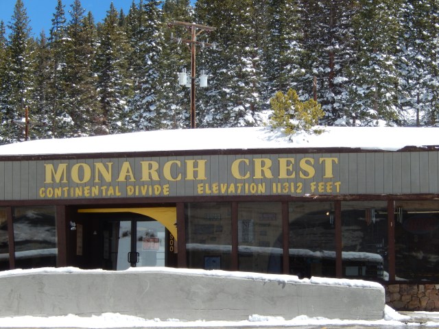 Needless to say the temperature was colder than in Manitou Springs and the snow was piled high along the shoulder of the road. We stopped for lunch at a parking area on the Continental Divide, enjoying the view and the warmth of the sun. As we descended to the Curecanti National Recreation Area near Gunnison, CO we were thankful for our previous mountain driving experience and the exhaust brake on our truck. Click here to read our post on tips for driving in the mountains.
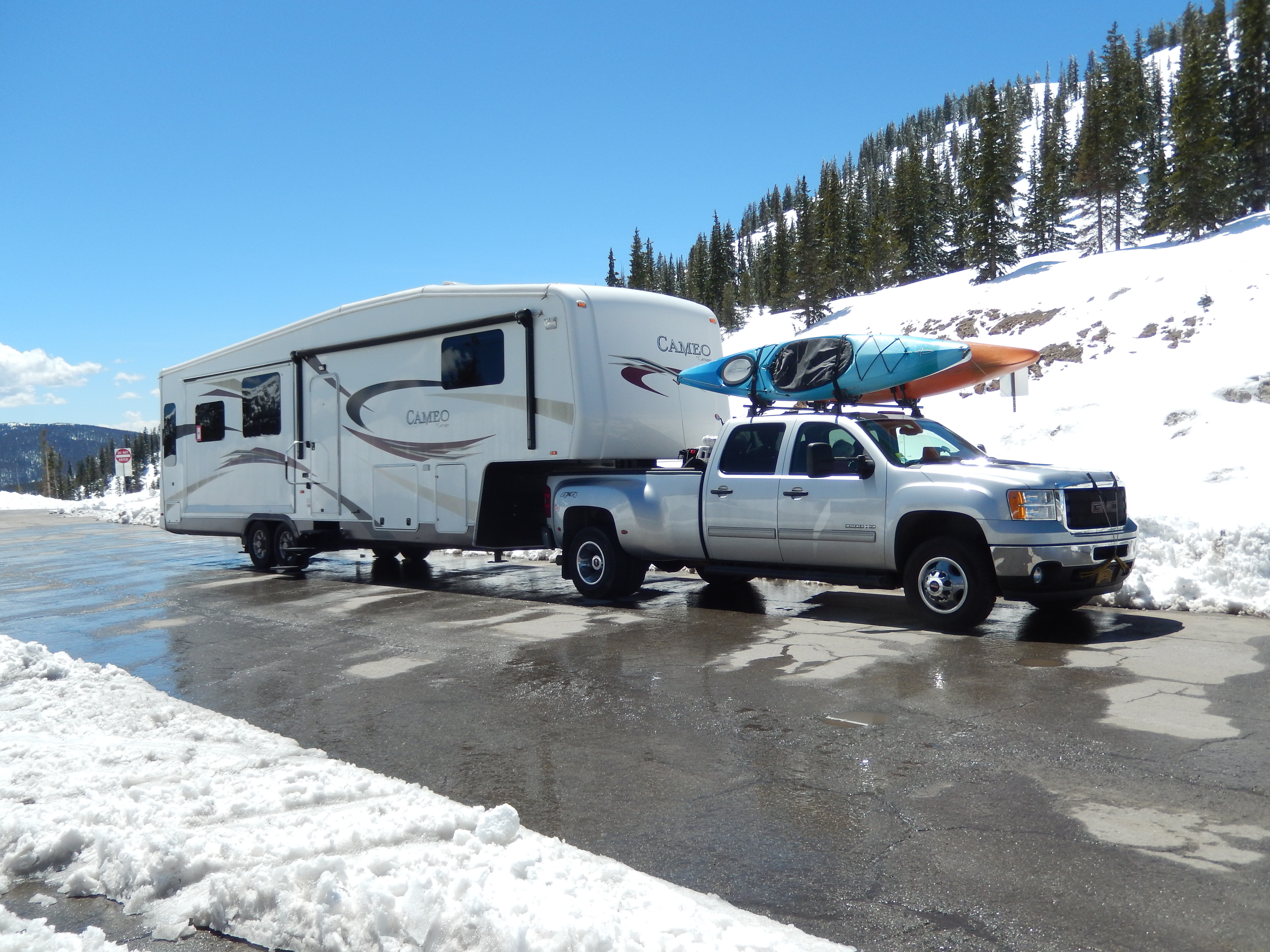
We arrived at the Curecanti National Recreation Area about 3:00 in the afternoon. We stopped at the Boat Inspection Station (where they check to insure you aren’t bringing any invasive species to the lake) and filled our fresh water tank. Curecanti offers mostly dry camping (no electric, water, and sewer hookups), but Loop D has 50 amp electrical hookups. Normally we would have filled up at the dump station, but we were so early in their camping season that they didn’t have the water turned on yet. One of the problems we have recently encountered is that the campgrounds we are staying at are just opening and are not always fully operational. After getting into a pull through site, we went to the Visitor Center to register and get some information on hiking and kayaking opportunities in the area.
The area around the Curecanti National Recreation Area is called the Blue Mesa because of the reservoir. The Blue Mesa Reservoir is one of Colorado’s must see destinations. Blue Mesa is Colorado’s largest lake being twenty miles long with 96 miles of shoreline. The reservoirs are all part of a hydroelectric project supplying electricity to the region. The reservoirs also play a very important role in water storage and management for the entire four corners area.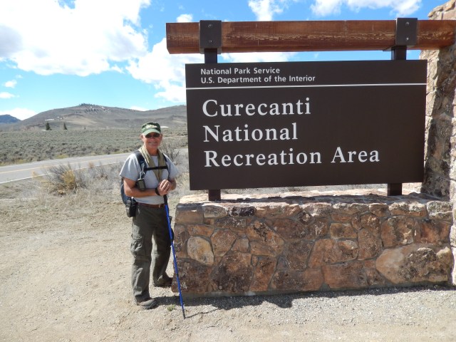
The Blue Mesa Reservoir is a popular destination for outdoor recreation. The lake is very popular with fisherman summer and winter. A number of fish species are in the lake, including lake trout which grow to be very large trophy fish.
Friday morning was cool but sunny and we decided to hike the Dillon Pinnacles Trail. This was a four-mile round trip that was not supposed to be very strenuous. As we started from the trailhead we talked to a couple of Park Rangers who were going to lead a class of sixth graders on the same trail. They suggested we might want to get started quickly unless we wanted to join their group for a sixth grade level geology lesson. As we left we could see their buses arriving and thought it would be better to he ahead of them on the trail.
I estimate that we climbed about 1,000 feet over the two miles to the turnaround. It wasn’t too bad but when you consider we were starting at an elevation of about 7,400 feet above sea level, the air was a bit thin and our breathing showed it. The trail was easy and the views were amazing! Much of the rock formations in this area are the result of volcanic activity thousands of years ago. On the cliffs you could see where the lava had flowed down the side of the volcanic cone and over the years the softer rock has been eroded away leaving big “creases,” for lack of a better term, down the sides of the cliffs. Years ago, volcanic debris and ash has piled on top of the cliffs and “cemented” by a combination of ash and water to make the caps harder than the surrounding area, more resistant to erosion creating the pinnacles.
 The next morning we decided to do another hike to find a geocache in Haystack Gulch, just across the road from the campground. We followed an old, two-track trail into the gulch and then went up a steep slope into the saddle between two pinnacles. The cache was at the base of one of the pinnacles and was a steeper climb to get to it. We found it and I logged my second find for the area. Our hike was only 3.68 miles, but we ascended 1,973 feet with most of that in a half mile distance! We descended into the gulch and hiked deeper into it before returning to the campground.
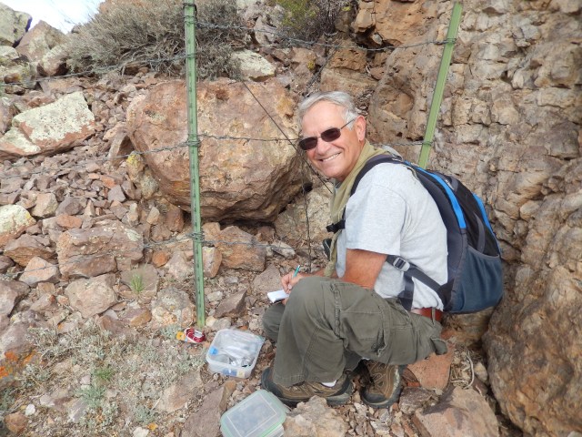
After we cleaned up and had lunch the weather turned for the worse and we had heavy winds, gusting to 30-40 mph with driving rain. By dinner it was starting to clear and we had hopes of being able to get our kayaks into the reservoir in the morning.
On Sunday morning we awoke to clear skies, but winds blowing at least 15 mph, gusting to 25, did not make very nice kayaking weather. Instead we decided to hike back into East Elk Creek to find another geocache. We were able to hike in along a dirt road to a group campsite. It looked like a great place to take a troop of Boy Scouts. We hiked past the campsite until my GPS showed the cache was straight off the trail to the East. We climbed up a very steep slope until we got to the base of a series of pinnacles. The pinnacles are composed of volcanic breccia from mud and debris from the now extinct West Elk Volcano. The breccia are capped by layers of welded tuff which are solidified red-hot ash belched out of the San Juan volcanic centers located 40-50 miles to the south. 
I was pleasantly surprised to climb to the back side of a pinnacle and see the cache hidden by a small pile of rocks, but in plain view. After logging my find, we enjoyed the outstanding view and headed back.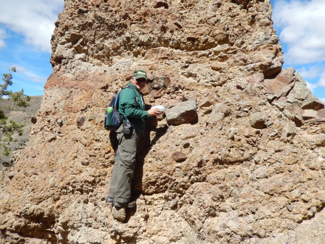
On the trek back we observed a mountain stream that had a heavy flow of water from the spring snow melt. We commented that it was going to take a lot of water to raise the lake levels up to where they were before. You can see from the sandy shore surrounding the lake that the level was down considerably.
There were high winds forecasted for Monday so we were up early for an early start on the next leg of our trip, Moab, UT – Canyonlands and Arches National Parks here we come!


