Wreckage and Raptors – Myrtle Beach, November 2016

myrtle-beach-map
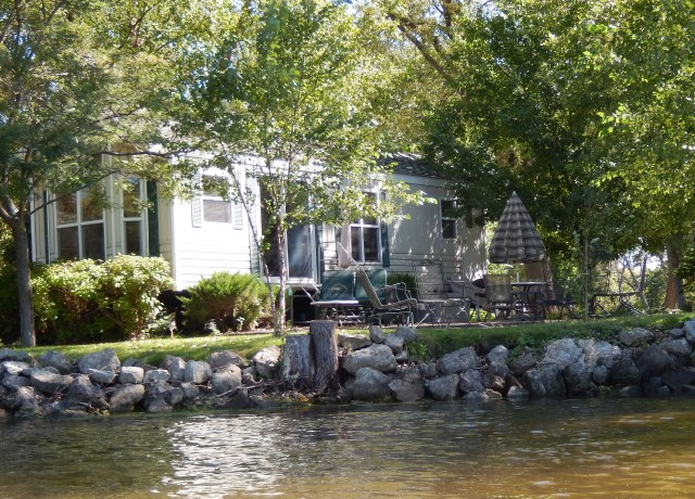
We stayed in Myrtle Beach in April a couple of years ago and thought a fall visit would be fun  on our way south.  November is definitely “out of season” for this area.  The crowds were almost non-existent. There are many beach side camping resorts in Myrtle Beach, and this time we choose to stay at the Myrtle Beach State Park – what a great choice!  As opposed to the commercial RV resorts that seem like parking lots, this is an actual campground!  There is plenty of room between sites and lots of trees, a typical camping experience.  It is like a nature oasis in a desert of commercial development, in fact, part of the state park is a nature preserve.

Hurricane Matthew had passed through this area a month ago and you could see the results of the storm.  The two nature trails were closed due to downed trees, although one of them was reopened while we were there.  Two of the parking lots were full of cut up trees that had been blown down by the hurricane.20161115_153650

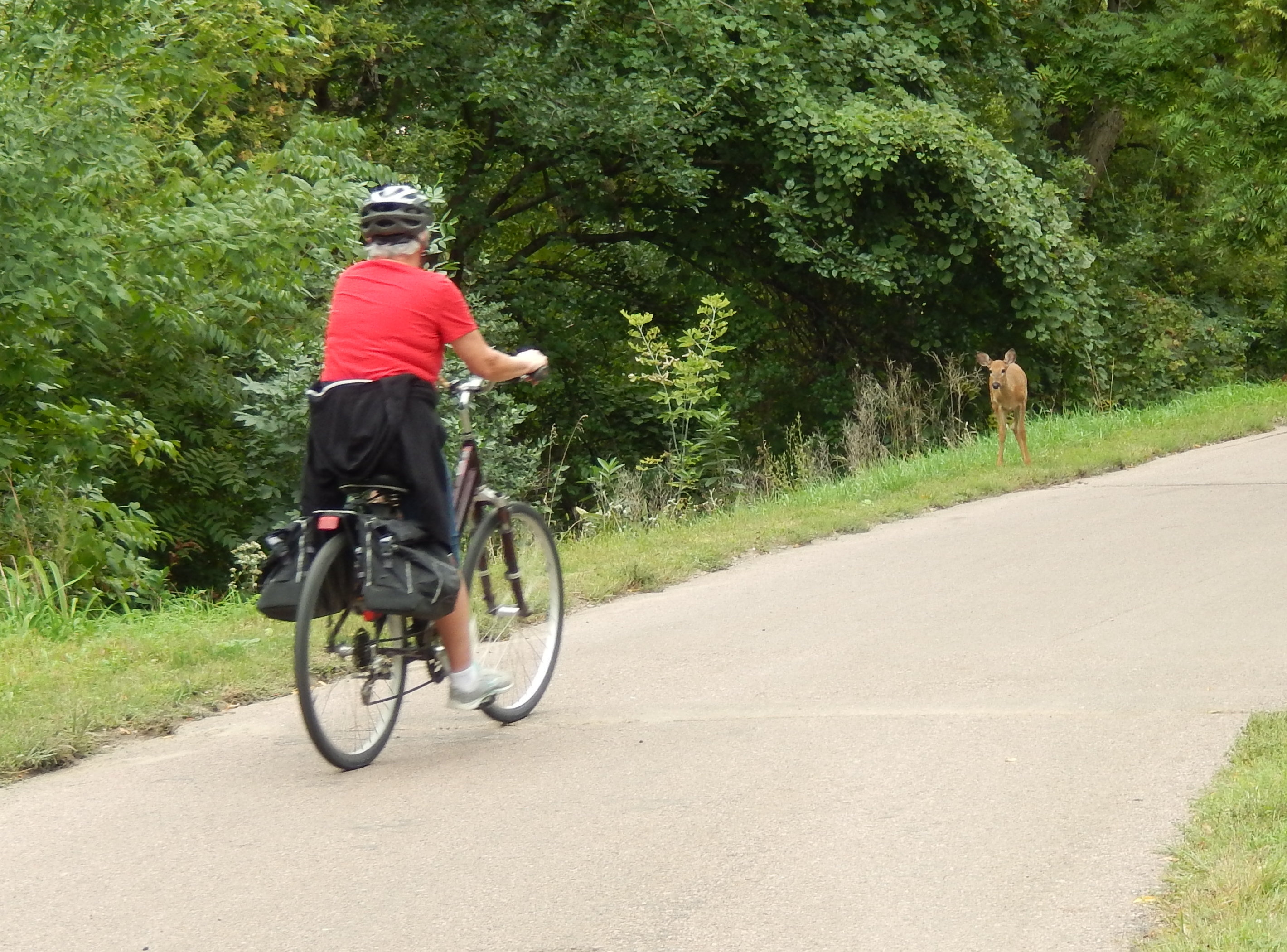
For the last month and a half we had been doing our exercise walks on the roads in the campground.  It was different to walk on the boardwalks and along the beach each morning – a pleasant change of pace. Instead of deer, we saw seagulls.

The Myrtle Beach commercial airport used to be an Air Force base and the former base area has been developed for commercial use.  The nearby Commons Market was once part of the base and honors the history of the base with interpretive signs about the base, some of its key leaders, and those responsible for its development.  It was an easy bike ride from the park for shopping and a great place to do some Christmas shopping!

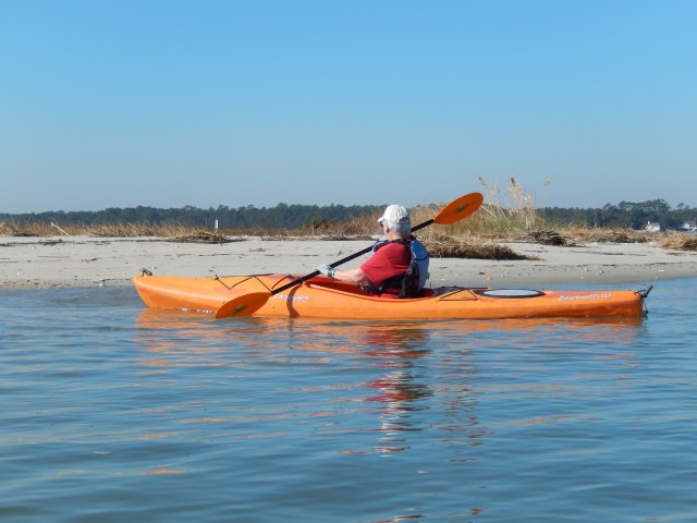
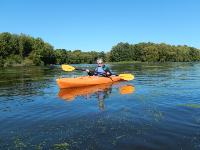
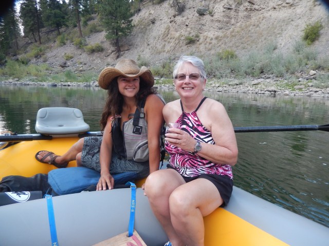
You can’t be this close to the water and not go kayaking.  We really had no desire to paddle our kayaks (they are built more for rivers, than oceans) in the Atlantic Ocean.  Consequently we looked at inland waters and estuaries. Murrells Inlet was a short drive down the coast and offered us some nice kayaking along a protected shore.  We were able to kayak to the boundary of Huntington Beach State Park and walk along the shore.  On one sandy beach we were able to see a crab running from his hole when we walked up and surprised him.  As we paddled along the shore we could see some of the damage left from the storm and the repairs being completed as the sound of power saws echoed across the water.

dscn1358dscn1377

A couple of days before we left, the park sponsored a presentation on raptors, birds of prey, by the Center of Birds of Prey from Charleston, SC.  We were able to see a Barn Owl, Harris Hawk, and a Black Vulture.  It was interesting to see the birds flying, on command, from station to station as we heard a description of how they seek and hunt their prey.  The birds used in the presentation have been “humanized” and cannot be released back into the wild.  The goal of the center is to take injured birds, keep them from being humanized, and after rehabilitation, release them back into the wild.

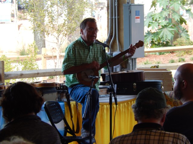
We weren’t so busy that we didn’t have time to just relax.  Over the last few months we have been fortunate to stay in parks that allowed ground fires. There are a lot of parks that don’t allow campfires at all, so this is more of a treat than one would imagine.  I love sitting by a campfire, it puts the “out” in the “outdoors.”  There is nothing like reading or playing my guitar by the fire to make my day!

dscn1408

On Tuesday, November 22nd, we were on our way to celebrate Thanksgiving in the first city in Georgia – Savannah.

Posted in Fulltime RV, Michigan Traveler, South Carolina | Tagged , , , | 2 Comments

State Fairs, Halloween, and Backpacking – Raleigh, NC

In our travels we have attended state fairs all over the country and we make a point of attending the North Carolina State Fair whenever we are here in the fall.  I don’t suppose that there is anything special about this state fair compared to the others we have attended, but it is fun.  One exhibit that we have not seen in other fairs was the lawn exhibits, part of the Flower and Garden Show.  The garden and lawn exhibits showed some real creativity.  There were also volunteers available to offer advice to amateur gardeners.

dscn1327

dscn1304

We toured one unique hall, the Village of Yesteryear, filled with artisans specializing in trades of years gone by – potters, woodworkers, tin workers, makers of musical instruments, and weavers to name a few.  I just loved wandering through this place, admiring the products of these craftsmen.

Another unique performance was the Folk Music Festival.  The performer I liked the best was Jeff Robbins.  He played a selection of Appalachian music on a number of homemade instruments, such as a banjo made from a fruit cake tin.  He even showed how to make a one string guitar from a soup can, 1 X 2 board and a old guitar string.  He was a great show!dscn1307

We enjoyed some of the rides, checked out some of the animal buildings and watched some of the competition.  I think the most fun was the pig races.  We saw pig races for the first time at the Florida State Fair and made a point of seeing them again here. Even though it’s called the pig race, there were pigs, chickens, and small goats as well.  Each section of the crowd has its champion and cheered them on.dscn1317

The most fun about attending the fair is the food.  We strolled past many food vendors before making our decision. You haven’t eaten at the state fair if you haven’t had a funnel cake!

Camping in a state park does not facilitate door to door trick or treaters.  The staff and the Friends of Falls Lake put on a Halloween Party in the campground.  There was face painting, popcorn, nature talks, and ghost stories at the campfire followed by a spooky night hike. All had a great time!

20151024_175312

The Mountains to Sea Trail is an extended trail that runs from the Smokey Mountains to the Atlantic coast.  A major section of the trail traverses the Falls Lake State Recreation Area.  In the last two years I have backpacked different sections of this trail.  This year I started near the Falls Lake Dam.  The weather was perfect for backpacking – cool, but not cold.  The clear, sunny sky made for a beautiful day.  The trail closely parallels the shoreline of Falls Lake.  As I hiked I searched for geocaches, which were in abundance along the trail.  In fact there were so many that I had to stop trying to find them or I would run out of daylight before I reached my campsite for the night.  With the fall color change, the forest was colorful.  I’m not sure what the other sections of the Mountains to Sea Trail are like, but this stretch is beautiful.  20161025_094739

The sun was fading as I arrived at my campsite and I worked quickly to get my hammock set up and water bottles filled before it was too dark.  Consequently I fixed and ate dinner by the light of my small campfire.  As inconvenient as that may have been, there is something special about being alone in the woods, surrounded by darkness, being able to relax and focus inward without distraction.  The night was on the cold side, but my hammock system worked well and I was comfortably warm all night.20151014_072911

The next morning I was up early and had a relaxing breakfast while waiting for the morning chill to pass before I resumed my trek.  It was a bit cooler than the previous day, but just as beautiful.  I found a few more geocaches along the way and finished up at the Barton Creek Boat Launch where Pat picked me up.  I look forward to exploring other sections of this trail in the future.

Posted in Fulltime RV, Michigan Traveler, North Carolina | Tagged , , , , , , , | Leave a comment

Riding Out Hurricane Matthew – Raleigh, NC October 2016

As we drove south from Michigan we saw reports of Hurricane Matthew forming in the Caribbean.  We arrived at the Holly Point Campground on Tuesday, October 4th to serve as Camp Hosts.  Ranger Dave Mumford (our boss) stopped by to give us our keys and go over any changes since the last time we were here.  He said they were closely watching the development of Matthew and would let us know if they had to close the campground, and if they did we would have to evacuate.

hurricane-matthew-4
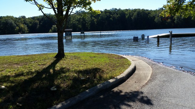
By Thursday we were starting to get some rain, although it looked like North Carolina would be spared as the track was forecast to turn east into the Atlantic Ocean. We started to get some moderate rain on Friday from another weather system.  By Saturday morning it was raining hard!  While the treetops were swinging back and forth in 10-20 foot arcs, we experienced only light winds at ground level.  We weren’t too concerned about families that were in trailers or motor homes, but there was one family camped in a tent in one of our lowest sites that I checked on throughout the storm.  Fortunately they stayed dry but they must not have had too much fun being cooped up in a tent for the weekend.
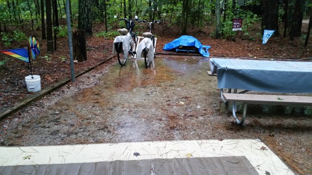
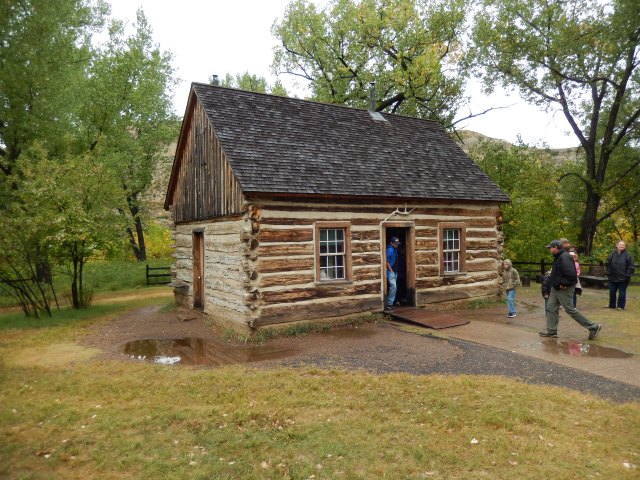
By Saturday afternoon the area around our trailer was flooded with 2-3 inches of water and we had been “hunkered down” watching the 24-hour weather coverage.  20161008_133537

Our campground is on a U.S. Army Corps of Engineers flood damage reduction project.  The Falls Lake Dam was built to reduce the downstream damage from flooding on the Neuse River.  As we walked around the campground we could see the water level rising on Falls Lake as the dam held the storm waters back.  By the end of the storm it had completely covered both swimming beaches and the boat launch.  20161010_103404

There were several campsites on the shore that were also flooded.  The Rangers had to move one motor home out of a site as the water was rising higher into their site.20161010_111225

Finally the rain stopped early Sunday morning.  We were so glad to see the sun shining.  I had never been in a storm with continuous rain for that long!

There were still warnings not to drive in certain areas and to never drive through standing water as you never know how deep the water is and what damage may have been done to the submerged road.  It didn’t take long before we realized how lucky we were.  Many towns downstream from us, such as Lumberton, Kinston, Tarboro, and Princeton, were totally underwater.  It wasn’t until yesterday, October 18th, that the rivers started to withdraw to their original banks.hurricane-matthew-5

Being from the Midwest, I am used to tornadoes where the storm comes through and the next day people start making repairs.  Here, the inland flooding will keep people out of their homes for weeks or more, some maybe a year before they have rebuilt.  The poor town of Princeton was destroyed by Hurricane Floyd in 1999, was rebuilt and now has been destroyed again.  How would you like to go through two Hundred Year Floods in seven years?

Fortunately we have seen sunny skies since October 9th and there are only slight chances of rain in the forecast giving people good weather for the recovery to begin.

Posted in Fulltime RV, Michigan Traveler, North Carolina | Tagged , , | Leave a comment

What the heck is GEOCACHING?

geocaching-com-logo-pinI learned about geocaching from a friend while camping in Key West, FL.  He and I traveled all over that part of the Keys, finding geocaches of various types.  It has become a fun hobby and I have searched for geocaches all over the country.  Geocaching is a real-world, outdoor treasure hunting game using GPS-enabled devices. Participants navigate to a specific set of GPS coordinates and then attempt to find the geocache (container) hidden at that location.

At its simplest level, geocaching requires these 8 steps:

  1. Register for a free Basic Membership at Geocaching.com.
  2. Visit the “Find a Geocache” page.
  3. Enter your postal code and click “search.”
  4. Choose any geocache from the list and click on its name.
  5. Enter the coordinates of the geocache into your GPS Device.
  6. Use your GPS device to assist you in finding the hidden geocache.
  7. Sign the logbook and return the geocache to its original location.
  8. Share your geocaching stories and photos online.

oregon-600tThe only necessities are a GPS device or a GPS-enabled mobile phone so that you can navigate to the cache, and a Geocaching.com Membership.  Geocaches can be found all over the world. They may be at your local park, at the end of a long hike, underwater, or on the side of a city street.

How did Geocaching begin?

On May 2, 2000, twenty-four satellites around the globe processed their new orders, and instantly the accuracy of GPS technology improved tenfold. Tens of thousands of GPS receivers around the world had an instant upgrade. Prior to this GPS signals had been “scrambled” for civilian users.

On May 3, Dave Ulmer, a computer consultant, wanted to test the accuracy by hiding a navigational target in the woods. He called the idea the “Great American GPS Stash Hunt” and posted it in an internet GPS users’ group. The idea was simple: Hide a container out in the woods and note the coordinates with a GPS unit.

Jeremy Irish, a web developer for a Seattle company, stumbled upon Mike Teague’s web site while doing research on GPS technology. Irish decided to start a hobby site for the activity, and created Geocaching.com and created tools to improve the cache-hunting experience. With Mike Teague’s valuable input, the new site was completed and announced to the stash-hunting community on September 2, 2000. At the time the site was launched there were 75 known caches in the world.  Today there are over a million geocaches around the world.

Geocaches vary greatly in size and appearance. You will see everything from large, clear plastic containers to film canisters to a fake rock with a secret compartment.

Micro – Examples: a 35 mm film canister or a tiny storage box typically containing only a logbook or a logsheet. A nano cache is a common sub-type of a micro cache that is less than 10ml and can only hold a small logsheet.
Small – Example: A sandwich-sized plastic container or similar.
Regular – Examples: a plastic container or ammo can about the size of a shoebox.
Large – Example: A large bucket.

In its simplest form, a cache always contains a logbook or logsheet for you to log your find. Larger caches may contain a logbook and any number of trade items. These items turn the adventure into a true treasure hunt. Remember, if you take something, leave something of equal or greater value in return. Quite often you may also find a Travel Bug, a sort of geocaching “game piece” that can be moved from cache to cache.

20151118_150015

When you find the cache, sign the logbook and return it to the cache. You can take an item from the cache if you like – just make sure to leave something of equal or greater value in its place. When you are finished, put the cache back exactly as you found it, even if you think you see a better spot for it. Finally, visit the Geocaching.com cache page to log your find and share your experience with others.

While I use a Garmin GPS device, I started with a GPS-enabled cell phone with a free GPS application.  As of the date of this post I have hidden seven geocaches and have found over 300.  I have often found that looking for a geocache will cause me to explore an area that I would have otherwise not visited at all.  This has been a great hobby and I encourage anyone to give it a try.  You never know what a cache may look like!

If you are interested in learning more about geocaching, or trying it yourself, check out http://www.geocaching.com and click on Geocaching 101 to learn more.

Posted in Michigan Traveler | Tagged , , , | 2 Comments

Porcupine Mountains Wilderness State Park, September 2016

Porcupine Mtn MapThis was out third trip to Porcupine Mountains Wilderness State Park but it was different from our past trips.  This time we were meeting Pat’s brother and sister and their families.  Where normally we would be out on the hiking trails, our time was spent mostly visiting, strolling through the Union Bay Campground, preparing group meals, and playing with our niece’s daughter, Addy.

Mary Lee, Pat’s sister, from Wisconsin and our niece, Tara, from Michigan were planning a camping trip to the Upper Peninsula of Michigan.  Since it roughly coincided with our return to the Midwest, we invited ourselves to join them.  The weather forecast was to be cloudy and rainy, but we lucked out and had four pretty nice days.  Yes, we did get some rain and overcast days, but when you looked at the forecast compared to what actually happened we couldn’t have asked for better weather.

Each family planned one of the major meals and the food was delicious and plentiful.  We are all going to have to focus more on our exercise routines after this weekend.  In fact, the food was so good I never got around to taking any pictures of us eating it!  After dinner each night we sat around the campfire for a relaxing evening – a traditional family camp out!

We don’t often have four year old kids around anymore, and we all enjoyed taking Addy for bike rides, having her help fix meals, and playing Frisbee.  She is already an authority on many subjects and listening to her explain things was just a lot of fun. dscn1226

One day we drove over to the Presque Isle River to look at the falls.  The DNR claims that the Porcupine Mountains is the largest state park in the country with a total 60,000 acres and 40,000 of them designated as wilderness.  In fact when we drove from Union Bay Campground on the east side of the park to the Presque Isle River on the west side, we changed time zones!

There are three major waterfalls on the Presque Isle River and we visited two of them.  There are trails and boardwalks that lead to the falls.  Before you ask, “What are boardwalks doing in a wilderness park?” the boardwalks prevent the thousands of visitors to the falls from damaging the surrounding area beyond repair.  Without the designated trails and walkways, new trails would be made with every visit and the forest floor would be destroyed.  It was wonderful to see the falls through the eyes of a four year old.  It’s like seeing it for the first time. dscn1218

Geri and his wife, Marcia, attended a wedding in Minnesota on Saturday and while they were gone we went to the Lake of the Clouds overlook.  It was a wonder to see this huge lake far above the level of nearby Lake Superior.  Again, Addy provided her own brand of entertainment as we explored the area. dscn1238

On Sunday, we packed up.  Mary Lee and her husband, Welton, headed back to Wisconsin while we headed for the lower peninsula with Geri and clan.  Our two families spent the night at Straits State Park in St. Ignace with a great view of the Mackinac Bridge.  It was a nice change of pace to be able to share our experiences with family.  Monday morning showed us crossing the “Big Mac” on our way to Lansing Cottonwood Campground. dscn1279

Posted in Fulltime RV, Michigan, Michigan Traveler | Tagged , , , , , , | 4 Comments

Paddling the Mississippi River in LaCrosse, WI – September 2016

Years ago I presented a workshop in Winona, MN and stayed at a hotel in LaCrosse.  As I was driving to the hotel I watched the Mississippi River and thought it would be interesting to camp along it and to kayak in it.  As we plotted our route from Washington to Michigan, LaCrosse was right on the way and I thought it would be fun to act on my thoughts from long ago.

We stayed at the Pettibone Resort on Barren Island in the Mississippi River.  This is a nice RV park with many sites that are right on the water.  We originally made a plan to paddle up through the backwaters and portage out to the main channel of the Mississippi River then ride the current back to the campground.  However, Wednesday morning we found a good spot to launch directly into the west branch of the Mississippi.  We discovered that the current wasn’t flowing too fast and we tried paddling into the current in the main channel.  It wasn’t hard so we ended up paddling all the way around the island. dscn1181

pettibone-map

We saw barges being pushed by a tow boat downstream.  On the far shore we watched  a stern-wheeler river boat leaving its dock to head upriver, both a reminder of the major forms of river traffic on the Mississippi.  On the shore of the island we saw a row of houseboats, some of them more house than boat.  All of this gave us a sense of what life on the Mississippi might be like.

Past the houseboats we saw several turtles sunning themselves on logs along the shore. No matter how quietly we paddled, as we approached they slid off the logs like a row of dominoes.  Further upriver we played tag with a large blue heron that would launch itself off its perch as we approached and fly upriver until we caught up with it and the process started all over again.  Finally it took off for the far shore and the game was over.

It wasn’t especially hard paddling upriver, but we breathed a sigh of relief when we reached the head of the island and turned downriver.  We paddled past more houseboats, including one that I particularly liked.  dscn1213

As we passed the campground we saw some campsites that were occupied by long-term campers that had gazebos, decks, and potted plants. While it’s nice to have a place to go on a regular basis, I prefer our style of staying long enough in an area to see everything we want to see and then moving on to another location.  After more than five years on the road there is still more to see.dscn1216

The next morning we were on our way to the Porcupine Mountains Wilderness State Park in Michigan.

Posted in Fulltime RV, Michigan Traveler, Wisconsin | Tagged , , , , , , | 1 Comment

Why is it called Sioux Falls? September 2016

sioux-falls-mapWhy is it called Sioux Falls?  Because it has a significant water fall!  We were driving across South Dakota, headed for Michigan and planned this as a short stop – only two nights.  Sometimes when we make such stops we just hang out and rest for the next leg of the trip.  South Dakota is not known for its lakes and rivers and I thought, “If it’s called Sioux Falls, there must be a water fall ” so we did some research.

dscn1168Centuries ago the Sioux River flowed straight south.  During the Ice Age a glacier blocked the normal flow and diverted the river to swing west and then east creating the S-curve that we see in the river today.  The new riverbed flowed over quartzite, a hard rock that resists erosion.  The soft surface soils were eroded away, leaving the quartzite riverbed, creating a series of waterfalls.

You won’t see a tall, majestic waterfall, but a series of small falls, each feeding into the next.  We really enjoyed wandering around the falls.  The park is laid out in a way that allows you to walk over the quartzite rock without being herded by fences and rails, making it a unique experience.  You can see the remains of the Queen Bee Mill and have a light meal in the old Power Plant building, which now houses the Falls Overlook Cafe.

At the Visitor Center you can climb a tower that offers an awesome view of the falls.dscn1160

Sioux Falls has a loop bicycle trail that starts at Falls Park.  We rode the trail that led us along the river and past a series of parks.  Even though this was a Monday, there were many other people biking, walking, or running on the trail.  We also shared the trail with some deer that were very comfortable being around people.  Part of the trail ran along the top of a levee that is part of the Army Corps of Engineers flood control program.  As we rode along I spotted several flood gates that would release water into low laying areas if the water threatened to top the levee, as well as dams that would hold water back during times of high water.  If you want to avoid some steep uphill climbs, ride the trail in a clockwise direction.dscn1173

We enjoyed our day at Falls Park and I recommend Falls Park and the Sioux Falls Bike Trail.

Tuesday, September 13th, we were on our way to LaCrosse, WI.

Posted in Fulltime RV, Michigan Traveler, South Dakota | Tagged , , , , , , | Leave a comment

Teddy Roosevelt and “Strenuous Living” – September 2016

tr-1I have always been interested in Theodore “Teddy” Roosevelt.  In his youth he suffered from a range on illnesses that left him almost incapacitated.  He was also very nearsighted which caused him to wear glasses most of his life.  Yet he overcame these obstacles.  He developed physically as well as mentally and later would credit much of his success to “strenuous living.”  In his early twenties he took a trip to the West and loved the experience.  This left a fondness in his heart for the wildness of the frontier and the strenuous living that went with it.  He made many more trips to the West to hunt and fish. dscn1079

Things were going well for Roosevelt, he was succeeding in business and politics and was married, with their first child on the way.  Then disaster struck.  His wife died in childbirth and his mother also died on the same day, February 14, 1884.  Theodore was in shock.  He had just lost the two women that mattered most in his life.  He sank into a depression and his family and friends encouraged him to go somewhere to grieve.  That somewhere was the area of the Little Missouri River near the town of Medora in western North Dakota (then the Dakota Territory).  Roosevelt had built a small cabin and had invested in a small cattle ranch, the Maltese Cross.  He stayed here from 1884 to 1886.  During this time he spent hours herding cattle, hunting for food, letting nature help him to cope with his loss.  This area is now the Theodore Roosevelt National Park. dscn1138

We set up camp in the Cottonwood Campground.  It is a nice campground with mostly pull off sites so you don’t have to back your trailer into the site.  It is also dry camping.  We filled our fresh water tank at a water point near the entrance and there are several water faucets throughout the campground.  There are no electrical hookups so we used our two Honda generators to power our trailer.dscn1092

It rained during much of the second we were there, but we hiked a portion of the Lower Paddock Creek Trail.  Unfortunately the rain had turned the trail into a greasy mud that hung on our boots like magnets to iron.  Consequently we decided to turn back and try hiking later in the week.  One of the advantages of being fulltime RVers is that we can stay in an area long enough to sit out a few days of bad weather.

After getting cleaned up we toured the Visitor Center and were able to tour Roosevelt’s Maltese Cross Cabin that he and his crew built in 1883.  It was here that he returned to in 1884.  The Maltese Cross Cabin wasn’t remote enough and it was during this time that he built his Elkhorn Ranch.  At the Elkhorn Ranch his closest neighbor was ten miles away.  While the Maltese Cross Cabin has been maintained, the Elkhorn Ranch has all but disappeared and only the foundations remain.

Near the Cottonwood Campground is the Peaceful Valley Ranch.  The history of this ranch is older than the history of the park.  It was cattle ranch in the 1800s, a dude ranch in the 1920s, the headquarters of the Civilian Conservation Corps (CCC) and Work Progress Administration (WPA) in the 1930s, park headquarters in the 1950s and 60s, and a facility for guided horseback rides until 2014.  The buildings looked like they were built in the 1800s, but are in good shape.  The ranch gave you a real picture of life on the range during Roosevelt’s time here.20160905_112407

On our last full day in the park the weather cleared up and we drove along the 36 mile Scenic Loop Drive.  This drive gave us a great view of the terrain and we stopped at several points to take pictures of wild horses and bison grazing on the open range.  At one point we had to stop to let a herd of bison cross the road so we could continue.  We have been in many parks that had prairie dog towns, but we rarely saw any prairie dogs, yet here we saw prairie dogs climbing in and out of their holes and running from hole to hole all over the place.  dscn1121

There are several short hikes along the road and we took a couple of them to get some great views.  At Buck Hill we were able to have a panoramic view that took in almost all of the South Unit of the park.dscn1113

After the drive we planned to hike a trail that started at the Peaceful Valley Ranch and crossed the Little Missouri River, but we soon discovered there was no bridge so we just hiked around the nearby area.

If you are interested in reading more about Theodore Roosevelt, I recommend a trilogy by Edmund Morris.

This is one of my favorite Roosevelt quotes –

tr-3

The next morning we were glad we were heading on to our next stop as it was just pouring rain with thunder and lightning.  It was like nature was telling us we had overstayed our welcome.  Next stop – Box Elder, SD.

Posted in Fulltime RV, Michigan Traveler, National Parks, North Dakota | Tagged , , , , , , , | 1 Comment

Custer’s Last Stand – September 2016

As we planned our route to Michigan I noticed that we would be driving near the Little Bighorn Battlefield National Monument.  I didn’t want to bypass this site of American history so we planned it as a stop.  After a long drive from Missoula, we spent the night at Grandview Campground and RV Park.  The next morning we got an early start to avoid the hottest part of the day.custer_last_stand1

The Ranger staff at the Monument have a full schedule of Ranger-led activities available.  We started the day with the Battlefield Talk that described the history of the western expansion and how it drove the Native American tribes out of their ancestral lands and onto reservations.  He described the various treaties that had been made with the tribes and how officials in Washington were willing to break them when they were no longer convenient.  Eventually Washington decided to move all tribes on to reservations and sent the U.S. Army to enforce this decision.

He then described how Custer, with a force of about 600 cavalry troopers attacked a Lakota and Cheyenne encampment on the Little Bighorn River.  He sent one force under the command of Major Reno to attack the camp. Meanwhile he led the remainder of his regiment around the flank to cut off the fleeing wives and children so he could hold them hostage and force the warriors to surrender.  Reno’s force of 225 troopers was counterattacked by close to a thousand warriors and was forced to retreat to nearby high ground.  When Custer attacked from the flank the Indians turned their attention on him.  Custer found himself facing between 1,500 and 2,000 warriors and was forced to retreat to Last Stand Hill where his entire force was destroyed.  By the end of the battle the 7th Cavalry had lost the five companies under Custer, about 210 men and another 106 killed or wounded in the force led by Major Reno.  The Indians lost no more than 100 killed.  I, for one, could see the battle played out on the hills we could see in front of us.  I could envision the Cavalry and the Indians as they maneuvered against each other.george-custer-1

battlefield-1

After this talk we purchased a DVD for a driving tour of the area.  I found this to be a great way to experience the battlefield.  As we drove we were treated to a narration that described the battle and how archeologists reconstructed the events from artifacts found on the battlefield.

Initially no memorial was created to honor the Native Americans who struggled to preserve and defend their homeland and traditional way of life. Their struggle was never formally recognized until 1991 when the President George Bush changed the name of the battlefield and ordered the construction of an Indian Memorial. The memorial expresses the theme – “Peace Through Unity.”  It provides a place where American Indians can celebrate and honor the memory of their relatives – and the women, children, and men who took part in the battle.

dscn1053
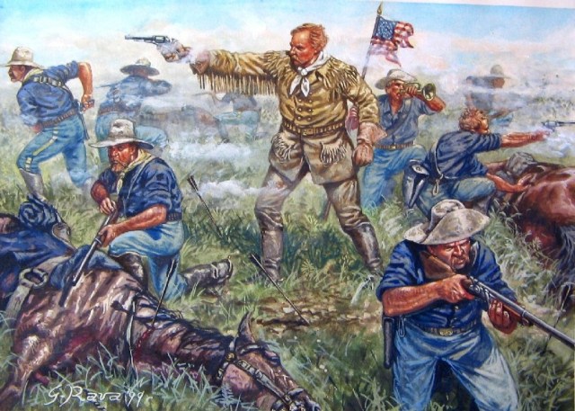
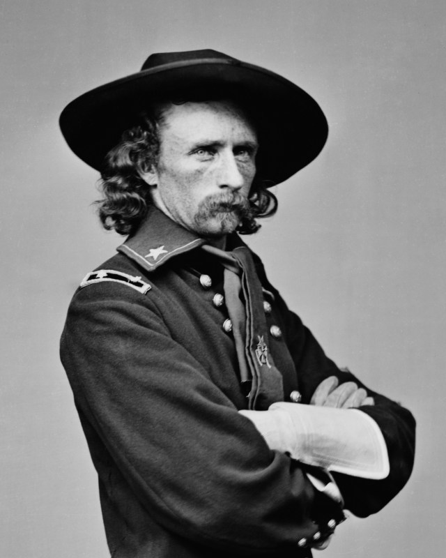
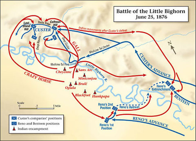
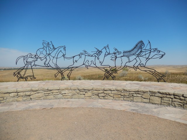
Much has been written about the Battle of the Little Bighorn, and a lot of it is not very accurate.  However, it is obvious that Custer led his Seventh Cavalry into a battle where they were totally outnumbered and out fought by the combined Lakota and Cheyenne force.  For the Indians this was a case of winning the battle and losing the war.  The Lakota and Cheyenne won the battle, but it was the last battle they ever won.  They fled north into Canada, but ended up returning to the United States and onto various Indian reservations.

For a good book that seems to be more accurate than most, I suggest you read “The Last Stand: Custer, Sitting Bull, and the Battle of the Little Bighorn” by Nathaniel Philbrick.

Posted in Fulltime RV, Michigan Traveler, Military RV Parks, Montana | Tagged , , , , , , , | 2 Comments

River Rafting with Wine, Smoke Jumpers, and Montana History – August 2016

We left the Tacoma area on August 28th and headed east over the Snoqualmie Pass.  As we drove east I was struck by the difference in terrain.  We had just left the deep forest of the Cascade Mountain range and now we were driving through desert.  The mountains force the clouds to give up their rain on the western side, so there is nothing left to fall on the east, hence the desert conditions.

We were on our way to Superior, MT.  My wife, Pat, had arranged for us to raft the scenic portion of the Clark Fork River and do a wine tasting at the same time – what a great way to celebrate our 43rd wedding anniversary!  We camped at nearby Quartz Flat National Forest Campground.  This was an unique place to spend the night.  The entrance is through a rest area and there is a tunnel under the highway to connect to the rest area (and another loop of the campground) on the westbound side.  Someone in state government was thinking outside the box when they designed this setup.  We arrived around lunch time and drove to Pangaea River Rafting later in the afternoon.DSCN0989

DSCN0990Pangaea River Rafting has a unique program where they take you down the river on a raft and treat you to wine, snacks, and a light dinner in the raft!  Our guide, Meagan, was terrific!  She told us about the river, pointed out osprey and turkeys, and kept our wine glasses full as we drifted with the current.  We rafted the scenic portion, downstream from a series of Class II and III rapids, so the river was gentle and relaxing.  We chatted and enjoyed the late afternoon sun shining through the trees on the western bank as we floated downstream.  There were a few spots where the water formed rapids and Meagan took us through them to provide a few thrills.  It was a great time and a lot of fun!DSCN0996

The next morning we drove to Jim & Mary’s RV Park in Missoula, MT.  Our primary reason for stopping here was to visit the Forest Service Smoke Jumpers CenterDSCN1003
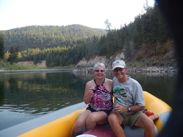
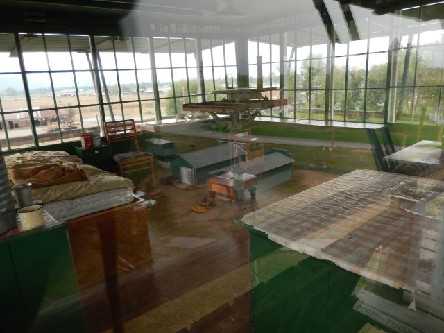
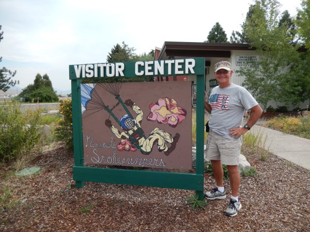
As a former Army paratrooper, I was interested in seeing how the Forest Service paratroopers worked and were trained.  I have been fascinated by the Smoke Jumpers ever since I saw a Walt Disney program about them when I was a kid.  We were led on a tour of the Smoke Jumpers Center by a veteran Smoke Jumper who began his service in 1961 at the age of 21.  The first thing that struck me was that the Smoke Jumpers make much of their own equipment.  While they purchase the parachutes, all of the packs, harnesses, and other equipment are sewn by the Smoke Jumpers themselves.  A big difference between Smoke Jumpers and military paratroopers is that Smoke Jumpers often land in trees on purpose because they can get closer to the fire.  We saw the rough terrain suits Smoke Jumpers wear.  I thought they were made of heavy canvas and discovered they are now made of Kevlar! DSCN1006 
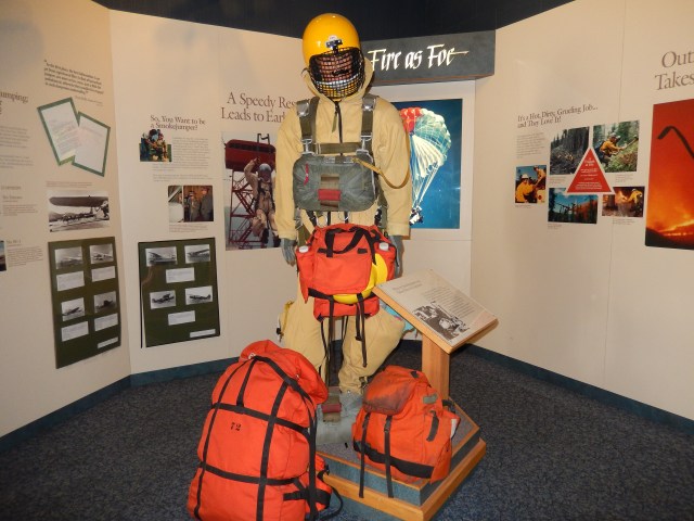
I never knew that Kevlar could be sewn like any other cloth.  Like most fire fighters, the Smoke Jumpers are paid to wait (for a fire).  Once the alarm is sounded they drop whatever they are doing and suit up.  They have two minutes from the alarm to boarding the jump aircraft, no time to make mistakes.  That kind of response is the result of training and repeated practice.  Just like Airborne Infantry, the parachute is only a means of transportation to get to where they have to fight.  They are fire fighters first, and parachutists second.  All-in-all, this is a great tour that takes you into the actual work spaces of the Smoke Jumpers and gives you a very clear idea of what these brave men and women are called on to do.

The next day we drove into Missoula and rode our bikes on the Riverfront Trail System.  As we rode the trail we stopped at the Carousal for Missoula.  In 1991 local cabinet maker Chuck Kaparich told the city, “If you give it a home, and promise never to take it apart, I will build a carousal for Missoula.”  The city fathers agreed and Chuck, with a crew of hundreds of volunteers, assembled an antique frame and constructed more than 40 ponies, two chariots, 14 gargoyles, mirror frames, and the largest band organ in continuous use in the United States.  It is a popular attraction and there were several kids on the carousel while we were there.  Pat was able to take a ride for under a dollar.DSCN1026

Another unique stop on the Riverfront Trail was the Boone and Crockett Club.  It was founded in 1887 by Theodore Roosevelt and housed in the old Missoula Train Depot.  Its mission is to promote the conservation and management of wildlife, especially big game, and its habitat, to preserve and encourage hunting and to maintain the highest ethical standards of fair chase and sportsmanship in North America.  For over a century the Boone and Crockett Club has championed the passage of laws, the establishment of institutions, and the designation of wild lands which today make up our nation’s conservation system. The National Forest, the National Park, and the National Wildlife Refuge Systems exist today in large part because of the extensive efforts of the Club and its dedicated membership.DSCN1033

Our last stop of the day was Fort Missoula.  The fort was established in 1877 in response to local requests for protection in the event of conflict with the western Montana Indian tribes.  Fort Missoula was never a stereotypical walled fort, but an open fort that required the troops to perform offensive, active patrolling in the area.  The history of the fort included its use as a CCC camp during the depression, and an Alien Detention Center for German, Italian, and some Japanese internees during WWII. There is a great display of Missoula history in the Museum and several original buildings scattered throughout the facility, including an actual Forest Service Lookout Tower.  DSCN1046Today the fort is home to the Historical Museum at Fort Missoula.  Other government agencies such as the Forest Service, and non-profit organizations occupy many of the buildings on the property.

The icing on the cake was a performance at the RV park called “Montana Melodies.”  Two men who were Forest Service firefighters and still live in the area serenaded us with songs of the area, including some they had written themselves.  This was followed by a serving of huckleberry ice cream from the park staff.  What a great way to end our visit!

Posted in Fulltime RV, Michigan Traveler, Montana | Tagged , , , , , , , , | 2 Comments